
Good morning! Yesterday was the HOTTEST day so far, with an Airport Heat Index up to 114. Dangerous. Big Heat produces Big Storms. Yesterday the radar was on fire. Today and just about everyday this weekend will be similar. Scattered to numerous strong storms. Some will reach severe limits. Have a Plan B for your holiday outdoor gatherings. Our weather app will keep you on top of the action. The active thunderstorm pattern will continue for several days, most numerous in the afternoon and evening hours.
Here’s my brief forecast discussion.
CLIMATE DATA: Yesterday’s high was 98 again. (Morning low 73) Highest Heat Index of the summer so far: 114. Normal hi lo 93/71. Airport rainfall: .87”. East Montgomery: 1.50”
TODAY: Hot & Humid. High near 95. Heat index 101 to 106. Scattered to numerous showers and strong storms, especially in the afternoon and evening hours. Low tonight 75.
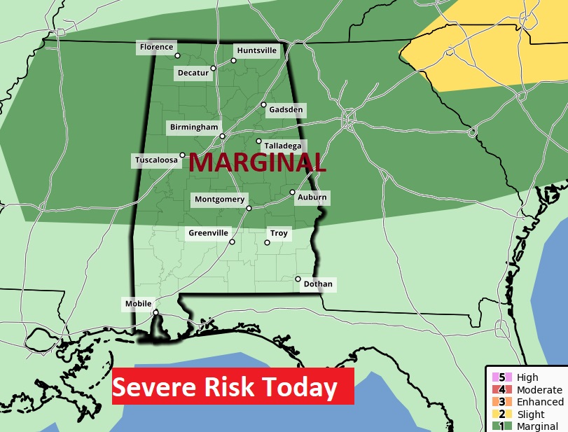
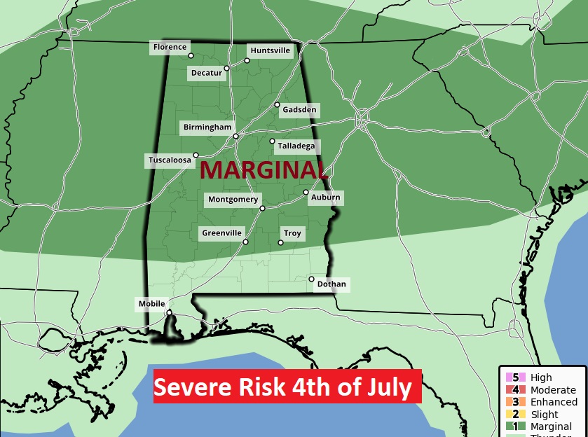
Again today, SPC has the Marginal Severe Risk as far south as a Greenville/Troy line. Tomorrow on the 4th of July, the risk area is almost identical. There will be several warnings like yesterday. Scattered strong storms with damaging wind gusts and intense lightning.
A couple of Future Radar examples from two different models. Scattered to numerous storms. Yesterday radar was on fire. Our weather app will keep you on top of the action.

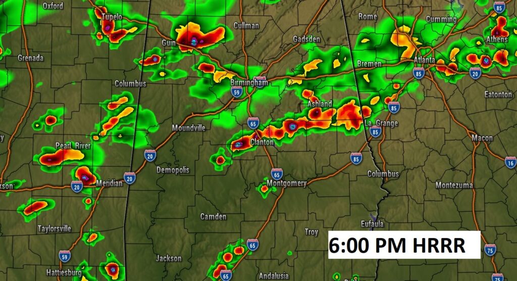
A couple of Future Radar examples from two different models. Scattered to numerous storms. Yesterday radar was on fire. Our weather app will keep you on top of the action.
4th of July: Very similar to todayHot & Humid. High near 95. Heat index 101 to 106. Scattered to numerous showers and strong storms, especially in the afternoon and evening hours. Low at night 74.
Watch for intense lightning. The number of lightning death, statistically, spikes the highest on the 4th of July.
NEXT FEW DAYS: Scattered to numerous strong storms. Some will reach severe limits. Have a Plan B for your holiday outdoor gatherings. Our weather app will keep you on top of the action. The active thunderstorm pattern will continue for several days, most numerous in the afternoon and evening hours.

BEACH FORECAST: Quite a stormy week down at the beach at times. Be flexible. Watch the radar. If you hear thunder, get in side. Lightning is a big killer on the beach. Scattered to numerous storms each day. Hot and Humid. Moderate rip current risk.

TROPICAL UPDATE: Good news. There’s nothing in the tropics. The Atlantic Caribbean and Gulf of Mexico are quiet for now.
Thanks for reading this Blog this morning! I’ll have another update for you in the morning. Have a nice 4th of July holiday! Everything is back to normal Wednesday.
–Rich