
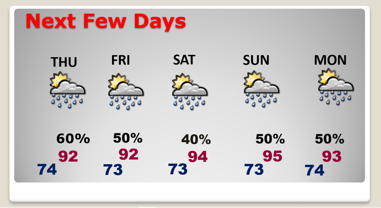
Good Morning! There were of storms roaming around on the 4th of July, and we should see a repeat performance today. Some storms will be strong. We are in a Marginal Severe Risk from SPC. Yesterday downburst thunderstorm winds caused damage in spots. Storms will be most numerous in the afternoon and evening. Storms will be in ample supply again on Thursday & Friday. By the weekend, the number of random storms will thin out a little bit. Here’s my brief forecast discussion.
TODAY: Partial sunshine.Hot & Humid, again. High near 93. Heat index 101+. Scattered to numerous showers and strong storms, especially in the afternoon and evening hours. Low tonight 74.
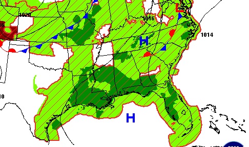
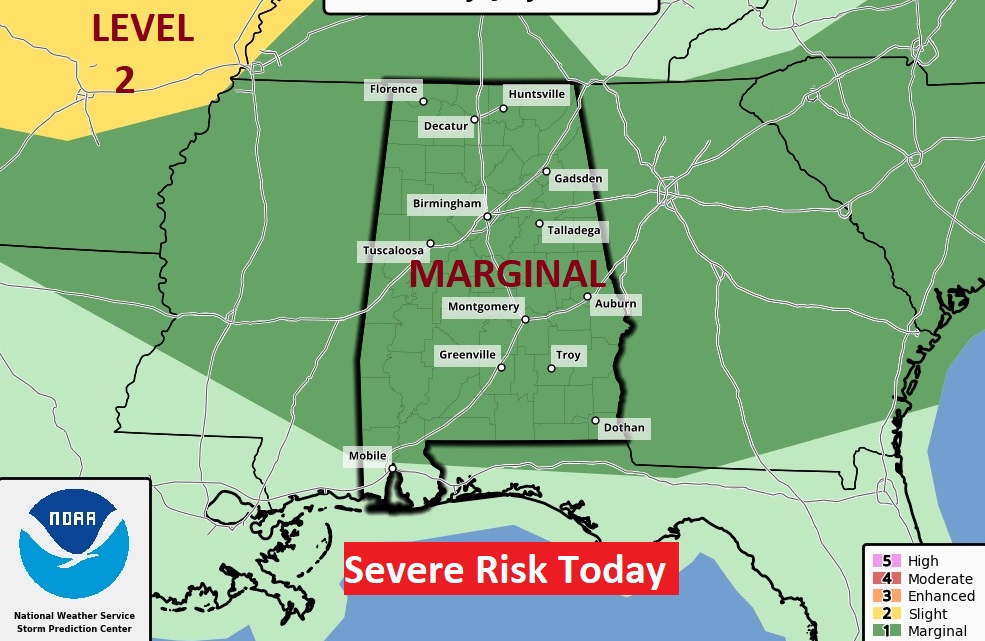
SPC has has much of the state in a Marginal Severe Risk again today . There will be some warnings again. Scattered strong storms with damaging wind gusts and intense lightning.
NEXT FEW DAYS: No surprises. Scattered to numerous strong storms will be rather numerous through Friday. Storms will be most numerous in the afternoon and evening hours. By the weekend, the number of random storms will thin out a little bit. Highs in the low to mid 90’s through the week and into the weekend. Lows at night in the 70’s.
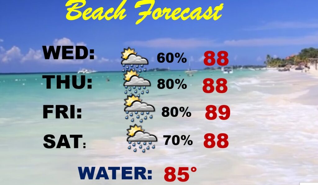
BEACH FORECAST: Quite stormy at times. Scattered to numerous storms each day. Hot and Humid. Highs in the upper 80’s, Moderate rip current risk.
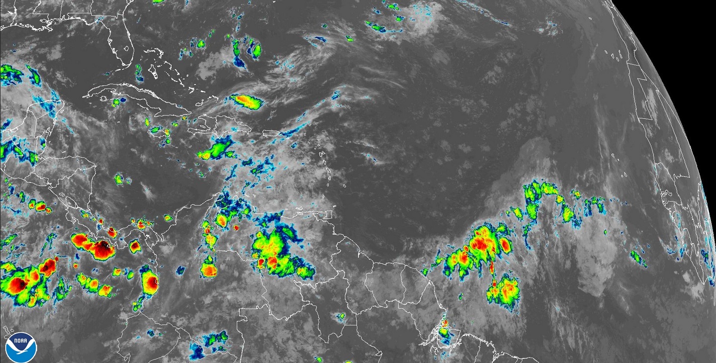
TROPICAL UPDATE: There’s nothing in the tropics. The Atlantic Caribbean and Gulf of Mexico are quiet for now.
Thanks for reading this Blog this morning! I’ll have another update for you in the morning. Have a nice 4th of July holiday! Everything is back to normal Wednesday.
–Rich