
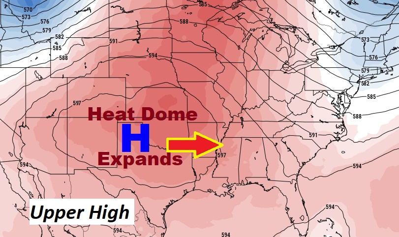
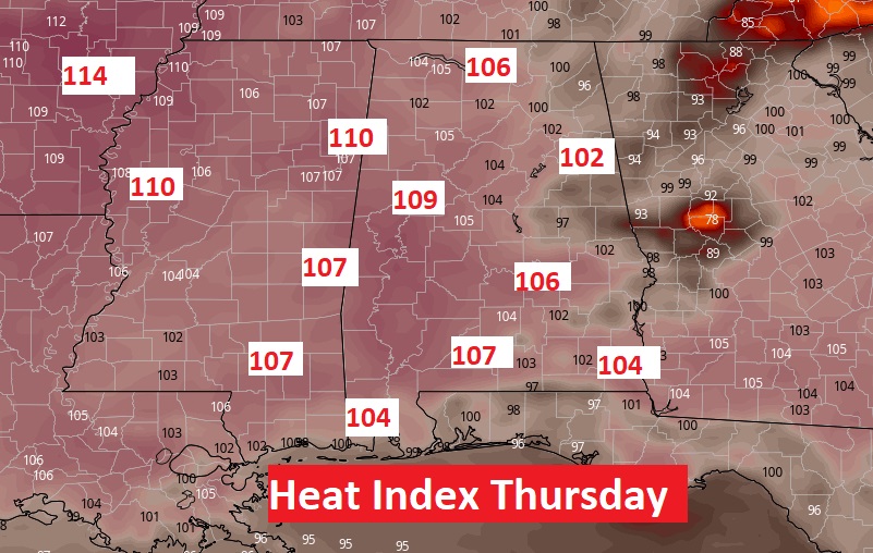
Good Morning! Are you ready? We’re heating up again. Expect more sun, hotter days, fewer storms. The big upper Heat Dome in the plains is expanding eastward. The best chance for storms today is down on the coast. Scattered random storms will return Thursday through Sunday. Triple digit heat indices will rise to the danger range by Thursday & Friday. Air conditioners will be working overtime. The tropics are quiet for now. Here’s my brief forecast discussion.
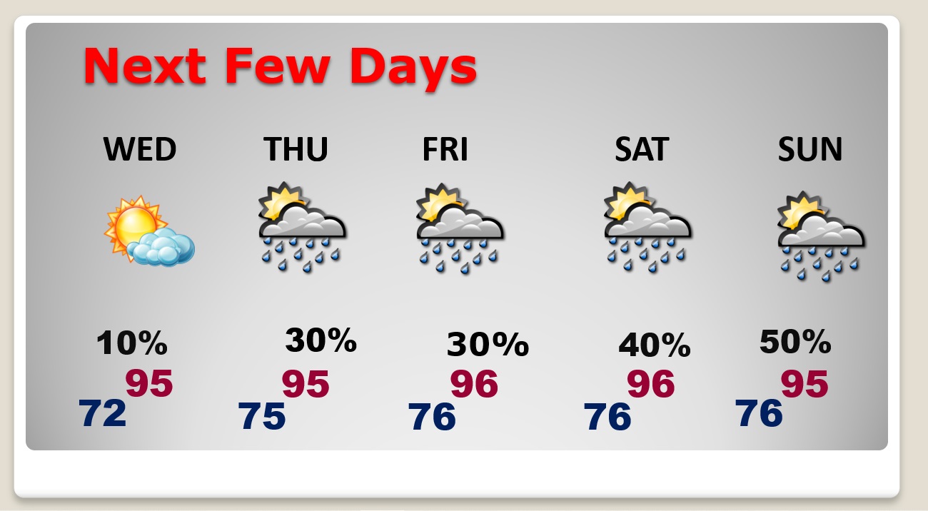
TODAY: Mostly Sunny. Risk of storms down near the coast. But, for most of us, rain chance 10% or less. Hot. High 92. Heat index near 100. Low tonight 72.
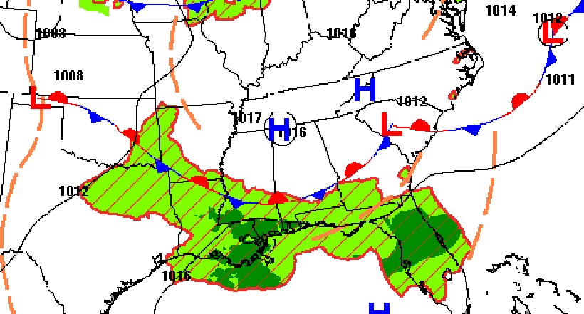
Most of the active weather will be down near the coast near that stalled front.
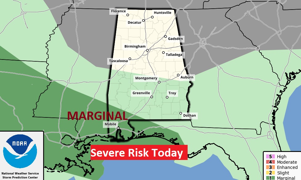
SPC has extreme coastal Alabama in a Level 1 Marginal severe weather risk.
NEXT FEW DAYS: Storms will be scarce through Wednesday. Spotty random storms will return Thursday through Sunday. Scattered showers and storms will be most numerous in the afternoon and evening hours. Temperatures to the mid 90’s with triple digit heat indices in mid to late week, and into the weekend.
The big player this week. The big upper heat dome in the Plains will spread eastward.
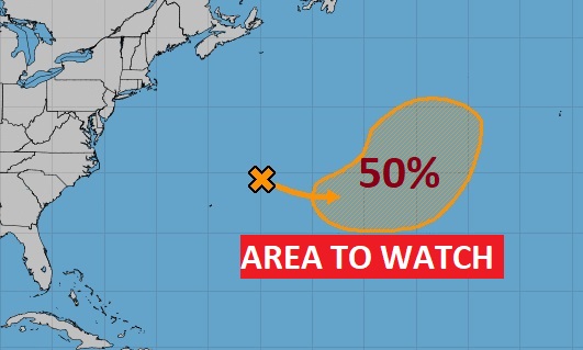
TROPICAL UPDATE: There is one Area to Watch in the central Atlantic, but the rest of the tropics are quiet.
Thanks for reading this Blog this morning! This morning we are LIVE on the radio from 6 to 9 on NewsTalk 93.1. Watch us on TV on CBS 8 and ABC 32. I’ll have another update for you in the morning. Have a nice day!
–Rich