
Good Morning! The hot & steamy pattern continues. Yesterday’s high was 93 with a Heat Index 104. Today will be similar. The radar will be more active today and tomorrow. Highs will be in the low to mid 90’s through Saturday, and lower 90’s on Sunday. Heat Index in the 100-105 range. Scattered to numerous random PM storms. Expect little day to day change. Here’s my brief forecast discussion.
TODAY: Partial sunshine. There will be scattered Hit or miss storms, Storms will be more numerous than yesterday. Hot & humid again. High 93. Heat index near 100-105. Low tonight 76.
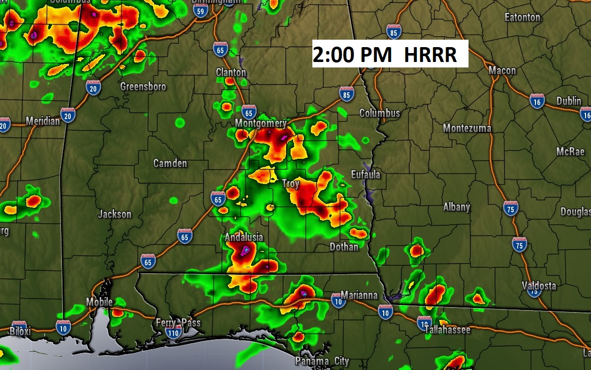
Here’s some Future Radar “examples”. Storms will be scattered to numerous, but random this afternoon.

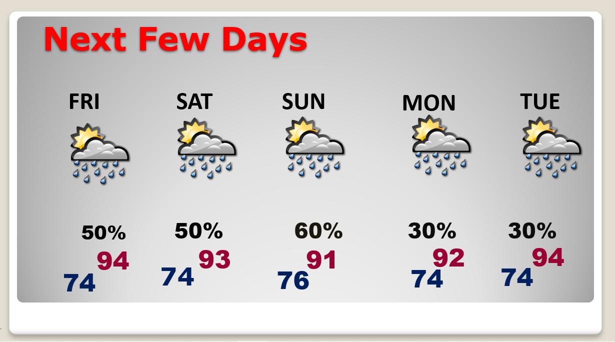
NEXT FEW DAYS: The hot & steamy pattern will continue. Highs will reach the low to mid 90’s just about daily through Saturday. The Heat Index will be in the 100 to 105, Afternoon and evening storms will be in somewhat better supply. Scattered Random storms, mostly in the afternoon and evening.
BEACH OUTLOOK: The Beach has certainly had it’s share of storms over the last few days. Be flexible. The better than normal chances will continue each day. Highs in the upper 80’s. Moderate Rip Current Risk. Gulf water: 86.
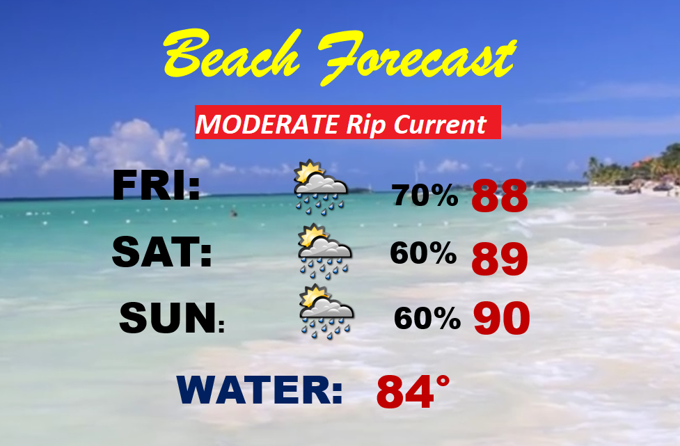
Unfortunately, the Beaches have been quite stormy at times for the last few days. Sorry to say that pattern rolls on today and tomorrow and probably through the weekend. Since I’m here at the beach, I am not thrilled. My dad would say, “It never rains in the restaurant.”
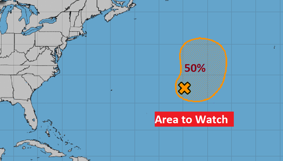
TROPICAL UPDATE: There continues to be one Area to Watch in the central Atlantic, but the rest of the tropics are quiet.
Thanks for reading this Blog this morning! I’ll have another update inn the morning from here in
Orange Beach. Have a great day.
–Rich