
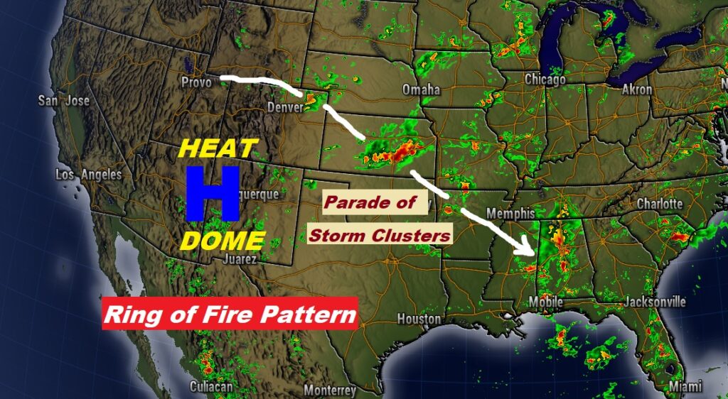
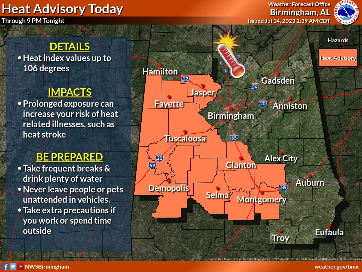
Good Morning! Yesterday featured some scattered “gully-washers”. The Montgomery Airport had 2.01”. You could have had more. Today, tomorrow and Sunday, the better than normal chance of storms continues. We are in what’s called a Ring of Fire Pattern. A high pressure Heat Dome is centered in the Southwest US. Around the edge of the Heat Dome, an endless series of storm clusters (MCS) continue to rotate into Alabama, one after another. This pattern may slowly begin to relax early next week. In the meantime, it’s still Hot and Steamy. Much of central and west Alabama are under a Heat Advisory until 9PM tonight. Here’s my brief forecast discussion from the Gulf Coast.
TODAY: Partial sunshine. There will be a generous supply of random storms. Locally heavy downpours. Hot & humid. HEAT ADVISORY in effect. High 93. Heat index as high as 106 . Low tonight 76.
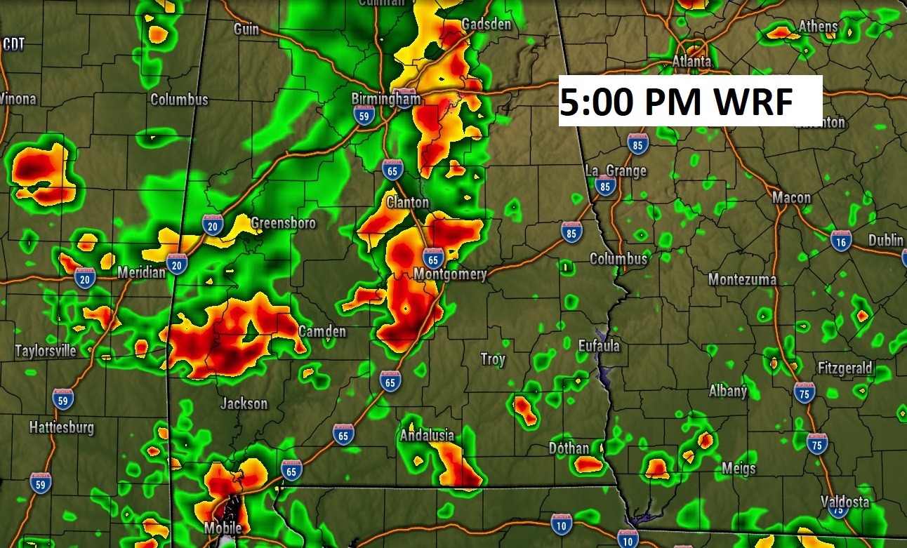
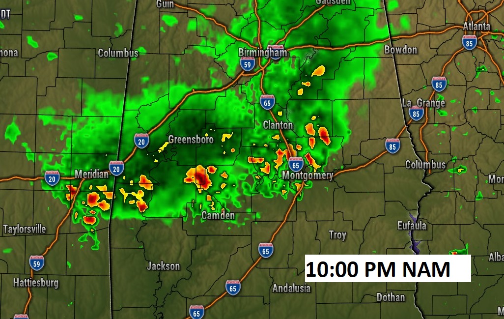
Here’s some Future Radar “examples”. We’ll be dealing with more of those storm clusters. Perhaps one this afternoon, and another one tonight.
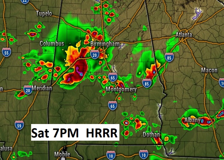
And more clusters on Saturday…
No surprise. SPC says some storms could be strong to severe, especially from us 80/ I-85 northward today.

HEAT ADVISORY for many of us today.
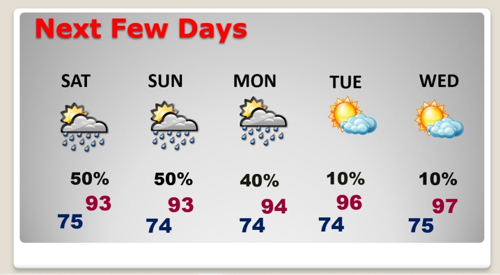
NEXT FEW DAYS: The hot & steamy pattern will continue. Highs will reach the low to mid 90’s just about daily through Saturday. The Heat Index will be in the 100 to 105, Afternoon and evening storms will be in generous supply through the weekend. Scattered to numerous Random storms, mostly in the afternoon and evening. Notice next week, this pattern may start to finally fade, as the temperature gets hotter.
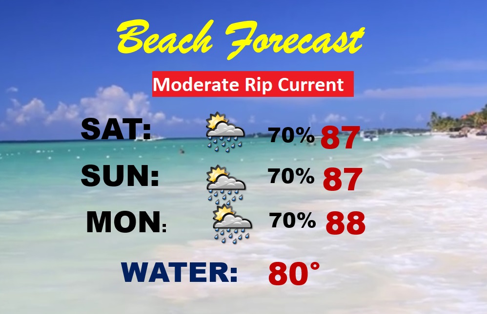
BEACH OUTLOOK: The Beaches will be turbulent at times with occasional storm clusters. The better than normal chances will continue each day. Highs in the upper 80’s. Moderate Rip Current Risk. Gulf water has cooled off a bit due to recent heavy rain. Now at 80 degrees.
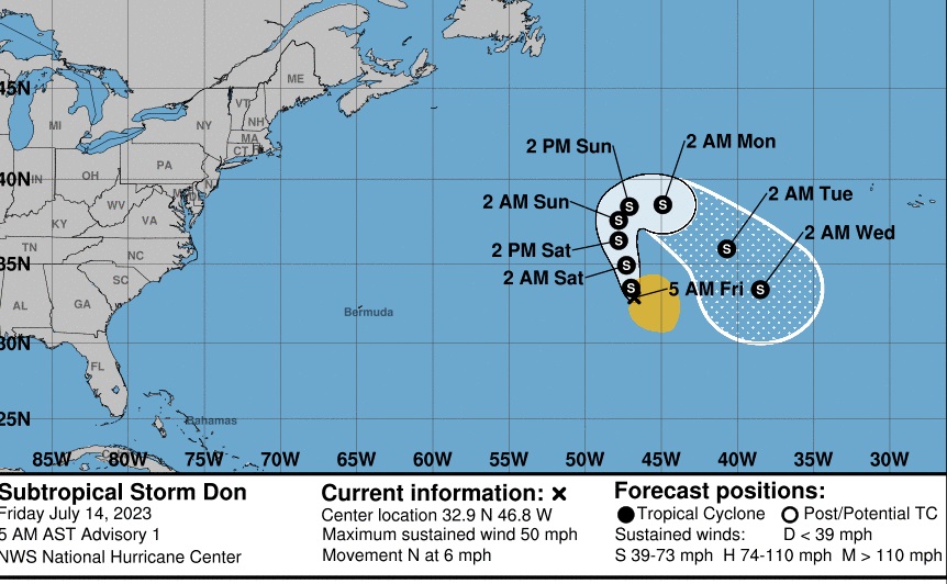
TROPICAL UPDATE: Invest 94-L in the central Atlantic has been promoted to Sub-tropical Storm Don. Maximum winds of 50 mph. It’s what we call of “fish storm.” Not threatening any land areas. The rest of the tropics are quiet for now.
Thanks for reading this Blog this morning! I’ll have another update inn the morning from here in
Orange Beach. Have a great day.
–Rich