
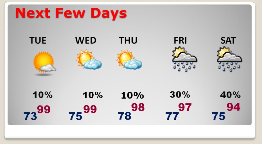
Good Morning! It’s been hot, but it’s going to get hotter this week. Today , sunshine will be abundant. Any storms will be few and far between. We’re headed for at least the mid 90’s today, and probably the upper 90’s Tuesday & Wednesday. Looks like a dry forecast Tuesday & Wednesday. Widely scattered storms return Thursday. Here’s my brief forecast discussion.
TODAY: Abundant sunshine. Any storms will be few and far between. Isolated at best. High 96. Heat index 100 to 105. Low tonight 76.
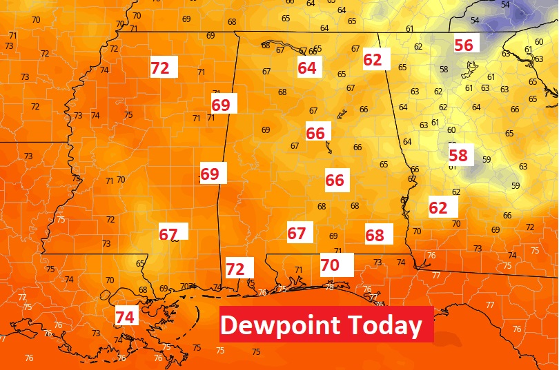
Today the humidity will be a little better than over the weekend. On Saturday with dewpoint was close to 80 on Saturday afternoon. That’s crazy humid. Dewpoints this afternoon will be in the 60’s. Not wonderful but much better.
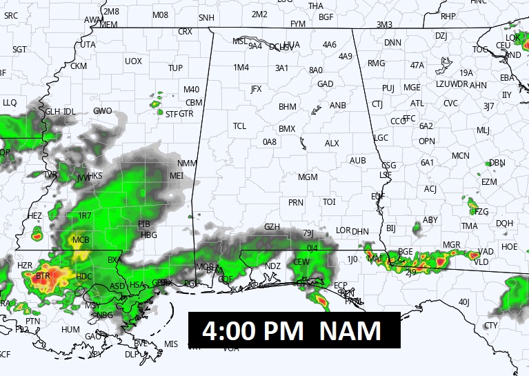
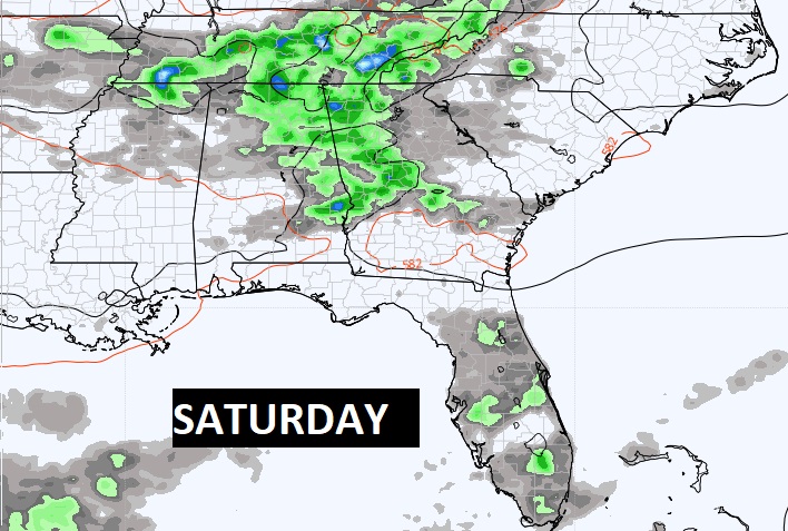
Today the better rain chance shift to the coast.
NEXT FEW DAYS: Expect some very hot days especially Tuesday through Thursday. Highs in the upper 90’s. Should be dry Tuesday & Wednesday. Widely scattered to scattered storms return on Friday & Saturday.
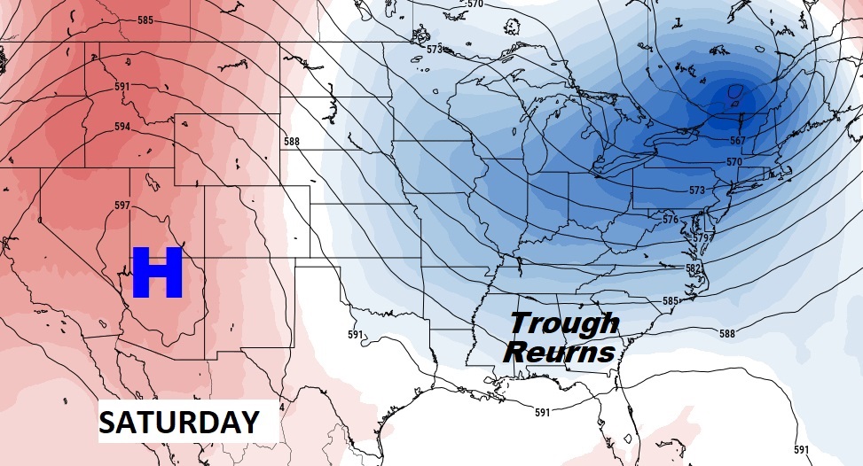
The big upper Heat Dome high in the southwest will expand eastward by mid week. Our hottest days will be Tuesday through Thursday.
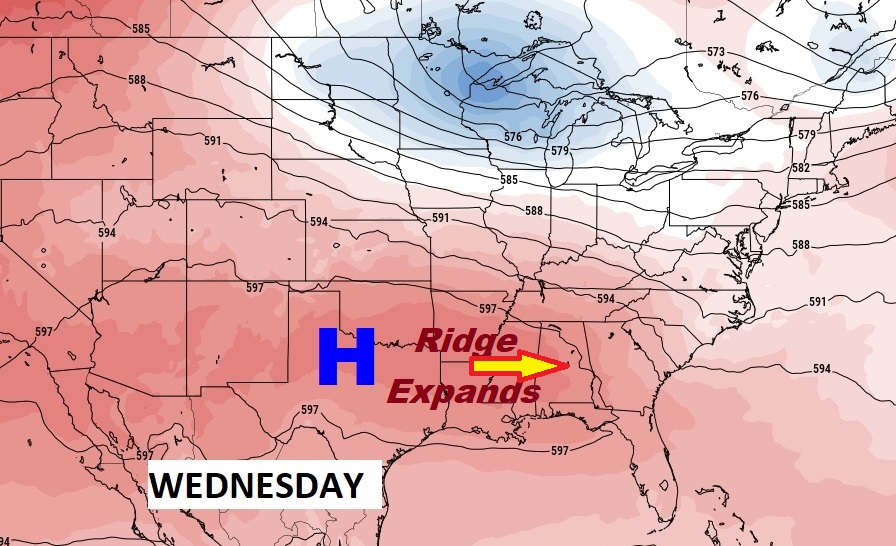
By Friday/Saturday, the Upper High will retreat again. The trough returns and the risk of showers & storms will return to our forecast.
TROPICAL UPDATE: Tropical Depression Don, in the central Atlantic is weak and making a loop. It may hang on for a few more days and could even become a Tropical storm again. The rest of the tropics are quiet.
Today is normal. We’ll be LIVE on the radio from 6 to 9 on NewsTalk WACV, 93.1. Watch us on TV on CBS 8 and ABC 32. There will be another Blog Update in the morning. Have a great day!
–Rich