
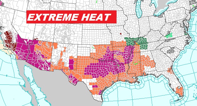
Good Morning! The Big Heat Dome has expanded eastward. There are various heat alerts from California to Florida. We are under a Heat Advisory through Thursday. Heat Index as high as 108, if not higher in a couple of spots. Rain chances, while not zero, are very low today and Thursday. By Friday, the upper high starts to break down a bit. Scattered random storms will return. Storms become much more numerous over the weekend, as high temperatures come down to the lower 90’s. Close to normal. Here’s my brief Forecast discussion.
TODAY: HEAT ADVISORY through Thursday. Hazy Sunshine. Very hot and humid. High 98. Heat index near 108. Rain chance is not zero, but generally 20% or less. Low tonight 76.
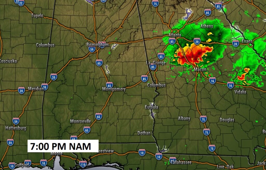
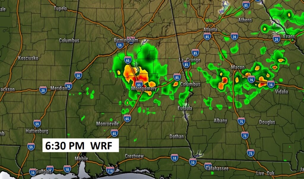
To rain or not to rain. The models disagree. The NAM brings a cluster of storms to Georgia…missing us. The WRF model has a different opinion.
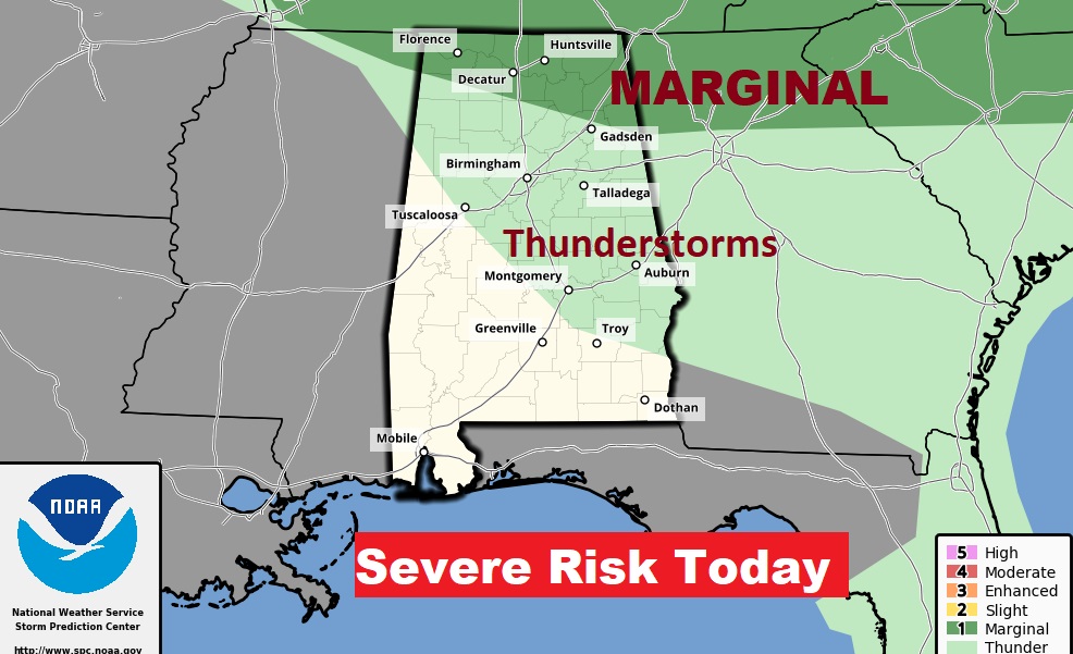
Here’s today’s Severe Weather and thunderstorm outlook from SPC.
NEXT FEW DAYS: Extremely hot Wednesday and Thursday. We’ll be teasing 100 Thursday . The heat index will be near 108 again. For now, our forecast is dry. Rain chance under 20%. Scattered storms will return to the forecast Friday. Storms become much more numerous over the weekend, as high temperatures come down to the lower 90’s.
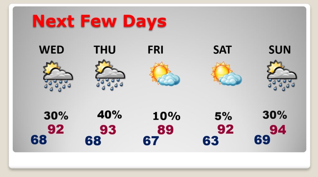
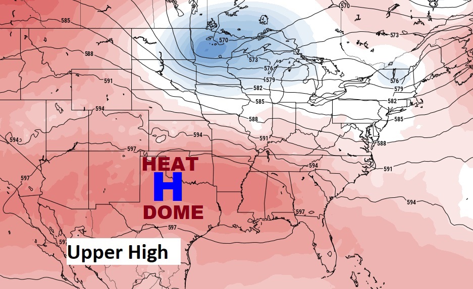
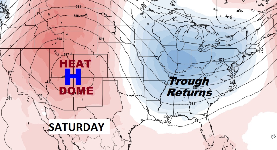
The big upper Heat Dome has expanded into our area, at least briefly. The hottest days will be today & Thursday. By the weekend, the heat dome retreats. A trough will develop in the east. The weekend will be more typical for July, with lower 90’s and scattered to numerous random storms.
There are various heat alerts from California to Florida.
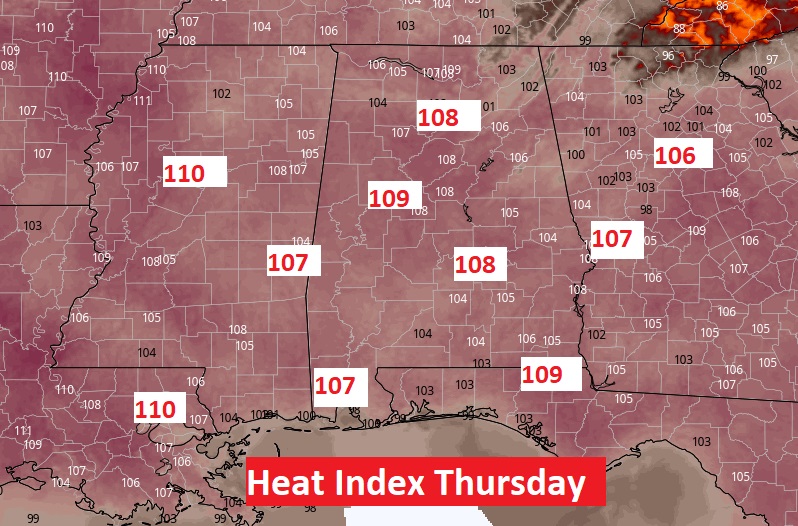
A sample of some Heat Indices on Thursday afternoon. Today and tomorrow will be similar. Brutal heat. Dangerous.
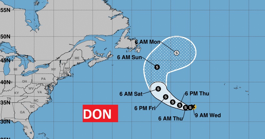
TROPICAL UPDATE: Tropical Storm Don is still spinning around in the central Atlantic. Maximum winds are now 40 mph. Not threatening any land areas. The rest of the tropics are quiet for now.
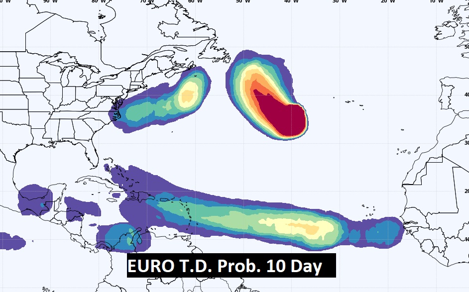
The Euro model shows the potential for tropical development is growing over the next 10 days. We’ll see.
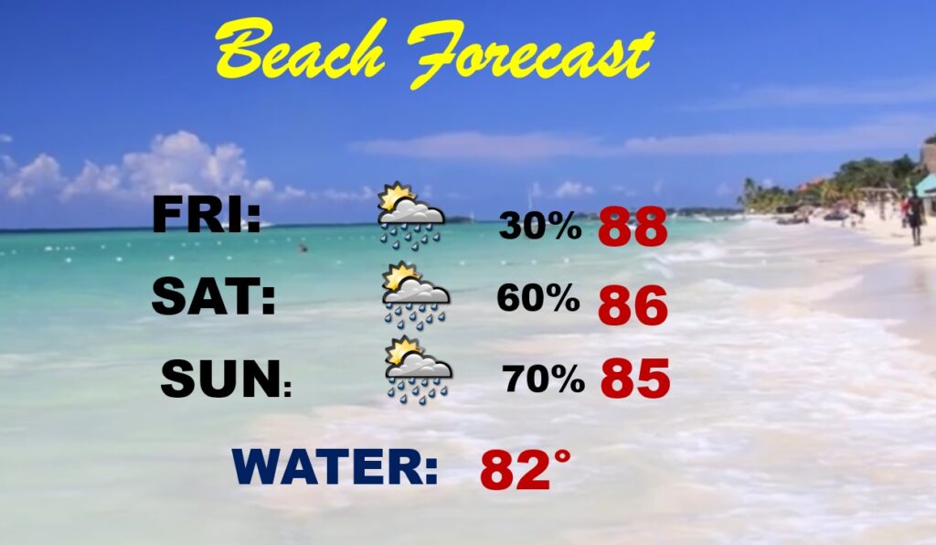
BEACH FORECAST: Storms will become more numerous over the weekend.
Thanks for reading this Blog this morning! This morning we are LIVE on the radio from 6 to 9 on NewsTalk 93.1. Watch us on TV on CBS 8 and ABC 32. I’ll have another update for you in the morning. Stay cool. Stay hydrated. Have a nice day!
–Rich