
Good Morning! The Heat Advisory has been upgraded to an Excessive Heat Warning today. Yesterday’s Heat Index at MGM reached 111. We could easily be close to 110-112 today. Dangerous Heat. The big upper Heat Dome will start to erode on its eastern side and start to retreat. Random thunderstorms will return to radar today. SPC says some storms could be severe. Storms will be even more numerous Saturday, as a southward moving front sparks more strong storms. The weekend temperatures will be much more reasonable. Highs will recede to the lower 90’s. Here’s my brief Forecast discussion.
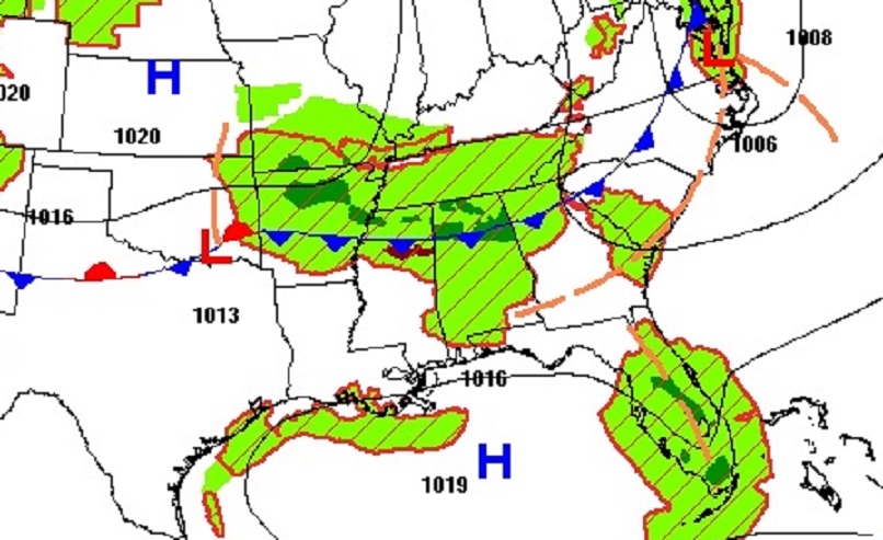
TODAY: Excessive Heat Warning. Mostly Sunny. Very hot and humid. High 99. Heat index 110 to 112 Scattered random storms will return. Some storms could be strong/severe. Damaging wind gusts are possible. Low tonight 77.
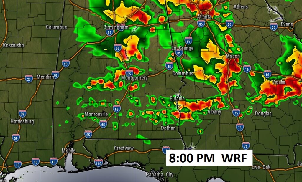
Future Radar suggests today’s Storm Cluster (MCS) will slide into Alabama and southeastward into central and east central Alabama by this evening. We’ll see. It’s possible.
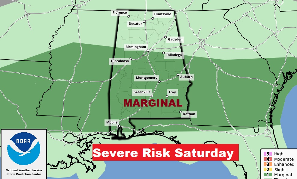
NEXT FEW DAYS: Showers and storms will likely become quite numerous Saturday, along a southward moving front. Some storms could be strong/severe. Expect more scattered storms Sunday. The better rain chance will shift south of the front in extreme south Alabama and down on the coast. High temperatures come down to the lower 90’s over the weekend. Highs will return to the mid 90’s Monday through Wednesday.
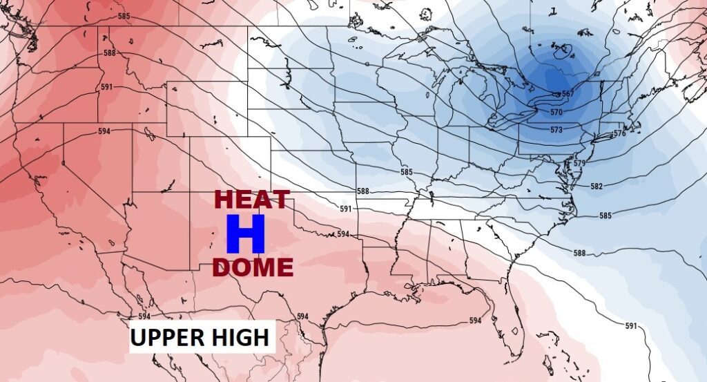
The big upper heat dome is starting to break down on it’s eastern edge. The High will retreat to the 4 corners area as a trough develops in the east.
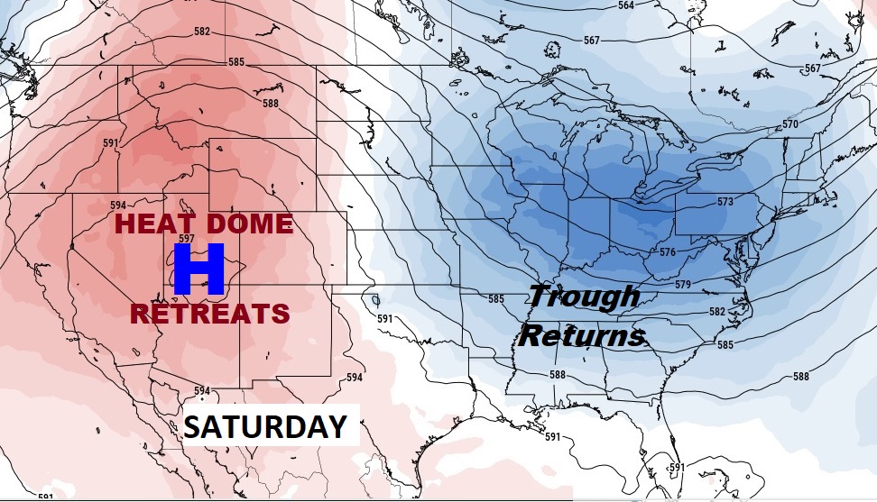
This will allow a frontal system slide southward through the state over the weekend.
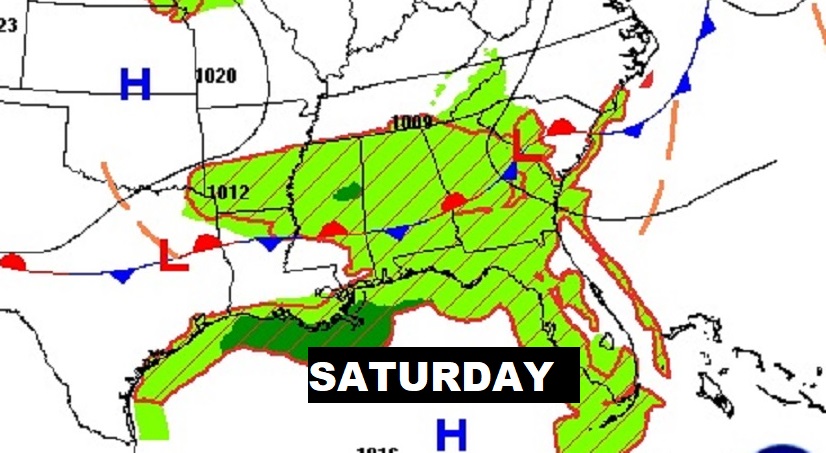
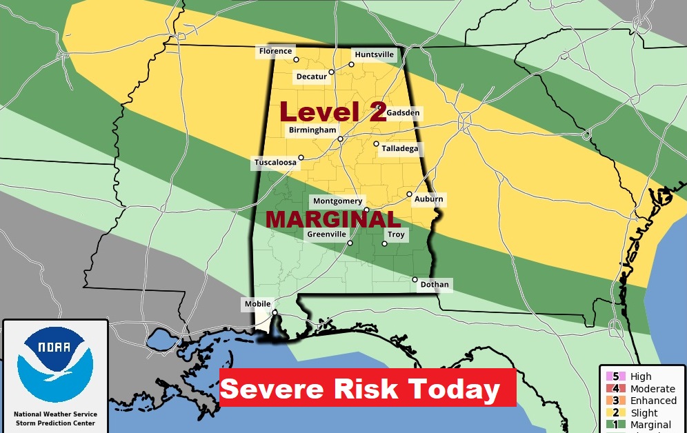
Some storms could be severe Saturday.
TROPICAL UPDATE: Tropical Storm Don is still spinning around in the east central Atlantic. NHC is continues tracking a Tropical Wave in the Tropical Atlantic is tracking westward. So far, a low 30% chance of development in the next 7 days.
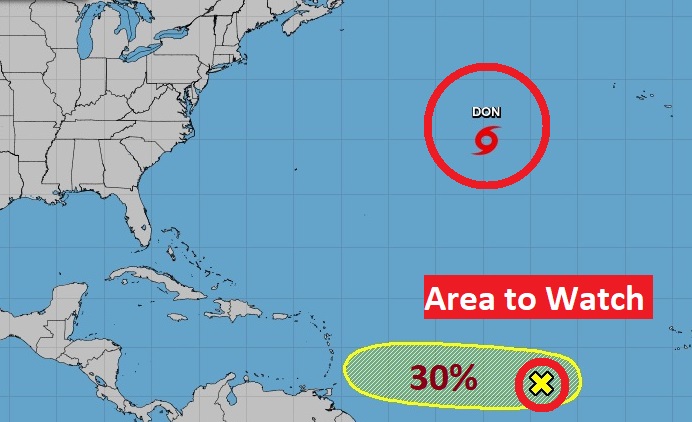
The Euro model shows the potential for tropical development in the Caribbean is growing over the next 10 days.
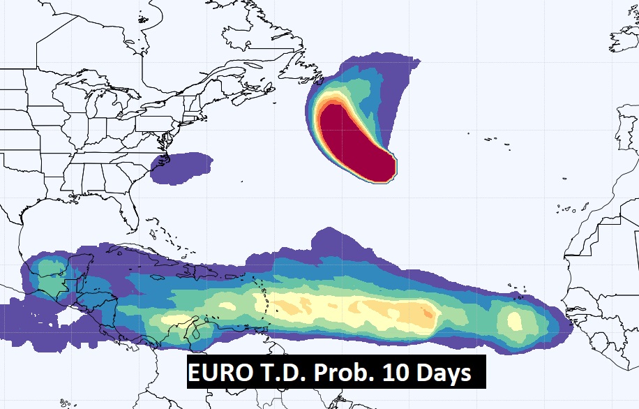
The GFS also hints at this system will persist westward to the Florida keys and into the Gulf in the next 11 days. We’ll see.
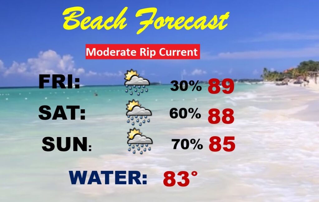
BEACH FORECAST: Rain chances will increase over the weekend as that southward moving front approached the coast. Highs in the 80’s. Moderate Rip Current risk.
Thanks for reading this Blog this morning! This morning we are LIVE on the radio from 6 to 9 on NewsTalk 93.1. Watch us on TV on CBS 8 and ABC 32. I’ll have another update for you in the morning. Stay cool. Stay hydrated. Have a nice day!
–Rich