
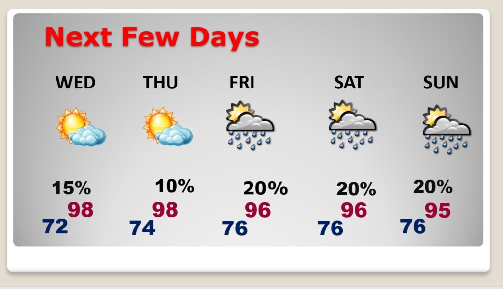
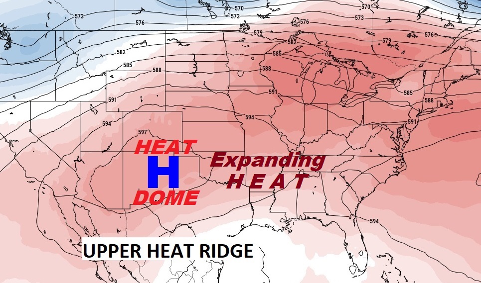
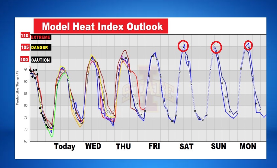
Good Morning! The Upper High Pressure Heat Dome continues to expand eastward…again. Sunshine dominates today. Best chance of showers remain near the coast. Each day will get a little hotter. Mid 90’s today. Upper 90’s Thursday through Sunday. The heat index has not been too bad compared to last week. It will surpass 100 starting tomorrow and be closer to the 105 danger range. We’ll put in a tiny chance of random PM storms by Friday and the weekend. Widely scattered. Meanwhile, the Upper Heat Ridge will continue to dominate the forecast for several days. In fact, there’s clues it may be stronger next week, on the first week of August. NHC is monitoring a couple of features in the tropics. Here’s my brief forecast discussion.
TODAY: Sunny & hot. Dry. High 96. Low tonight near 70.
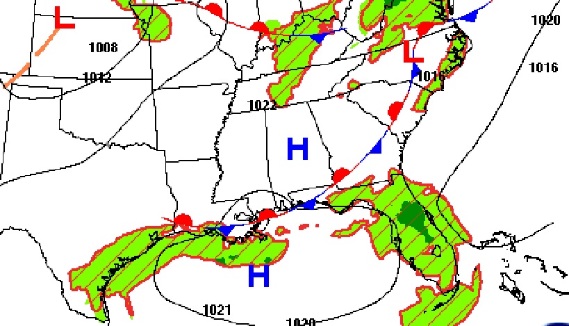
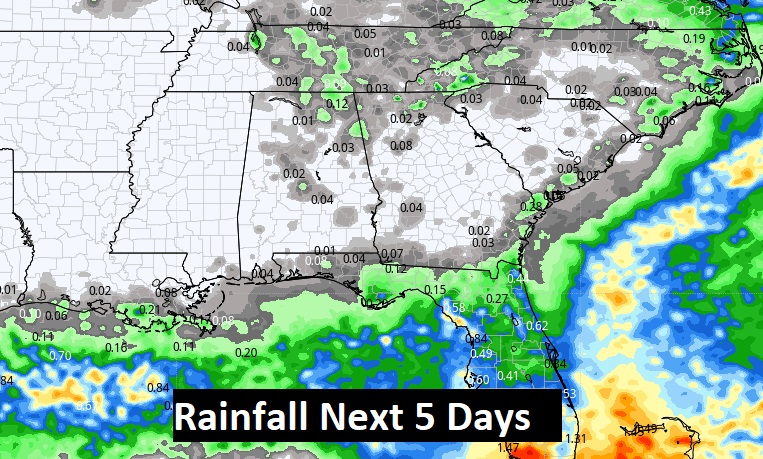
The BEST chance of rain for the next several days will be down close to the coast near that stalled front
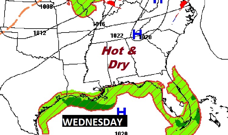
NEXT FEW DAYS: Still, High and Dry. Lots of sunshine. Middle 90’s Wednesday. Upper 90’s Thursday through Sunday. Rain chance is rather remote through Thursday. Widely scattered storms return Friday and over the weekend. But, they will be few and far between.
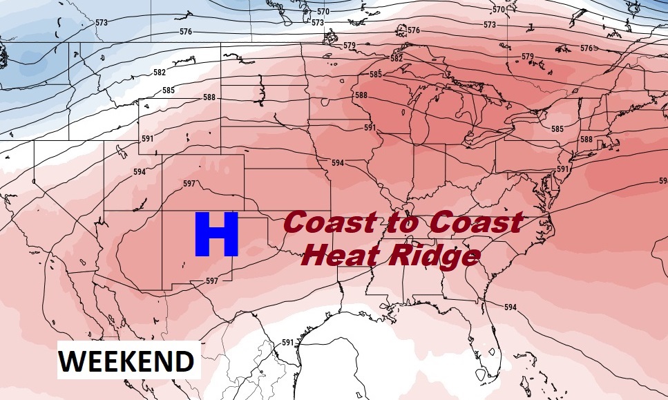
The massive Upper High Ridge, which has been the story of the summer here in the United states continues to expand. It will continue to be the big story for several more days,
Rain prospects for the next five days will continue to be rather scant, except closer to the coast where storms will continue.
The Heat Index is not be as bad as last week. Last week we had Heat Indices in the 110-115 range. This week, looks like close to 100 Wednesday, Thursday and Friday. Possibly higher this weekend.
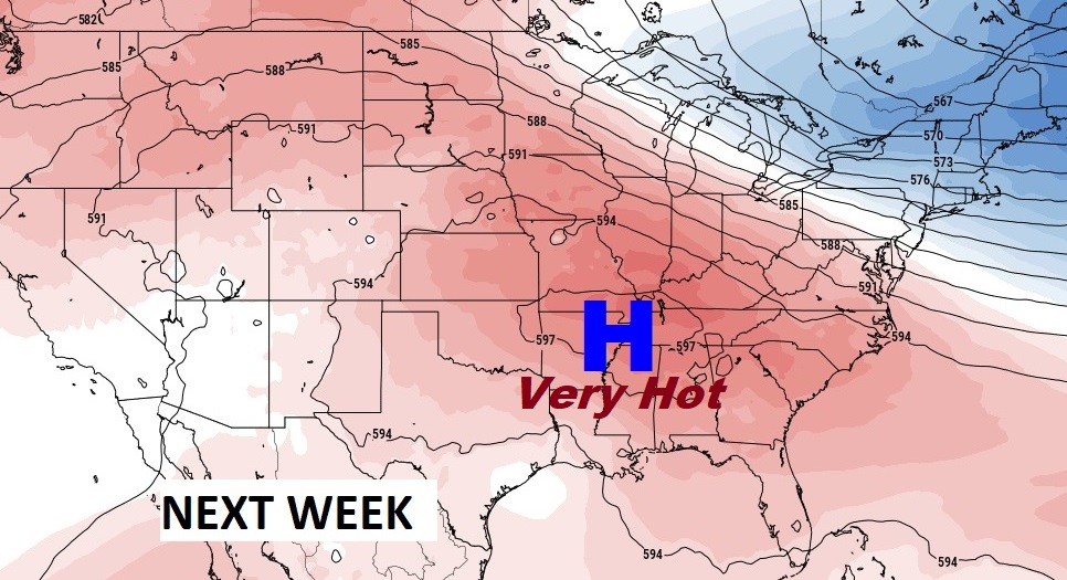
Next week, the upper high could even be stronger across the south, on the first week of August.
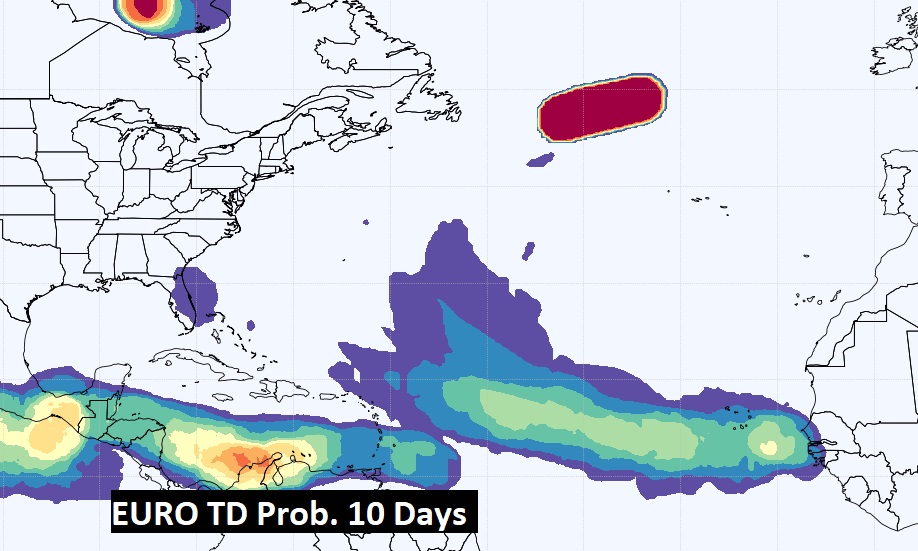
TROPICAL UPDATE: NHC is monitoring Invest 95-L in the Tropical Atlantic. It’s potential for development is decreasing due to hostile upper wind shear. Meanwhile there is a new Area to Watch approaching the Bahamas.

The Euro model shows the areas where tropical potential are possible in the next 10 days.
Thanks for reading this Blog this morning! This morning we are LIVE on the radio from 6 to 9 on NewsTalk 93.1. Watch us on TV on CBS 8 and ABC 32. I’ll have another update for you in the morning. Have a nice day!
–Rich