
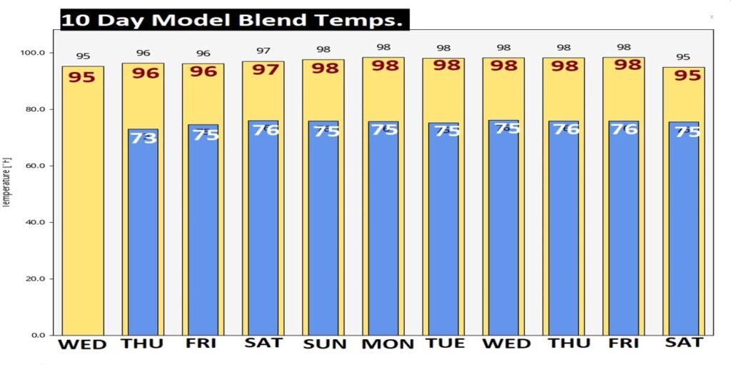
Good Morning! What can I tell you? The Massive Heat Dome in the middle of the nation continues to expand. Best chance of showers remain closer to the coast. Today the rain chance is not zero, but 20% or less. Each day is getting a little hotter. Expect upper 90’s each day through the weekend and beyond. Yesterday the heat index was 99.. It will surpass 100 starting today and be closer to the 105 danger range over the weekend. We’ll put in a tiny chance of random PM storms on Friday and over the weekend. Widely scattered. Meanwhile, the Upper Heat Ridge will continue to dominate the forecast for several days. I have included the 10 day temperature trend forecast on this blog update. NHC is monitoring a couple of features in the tropics. Here’s my brief forecast discussion.
TODAY: Sunny & hot. Rain chance not zero, but only 20% or less. High 97. Heat Index 102 Low tonight 74. Calm wind.
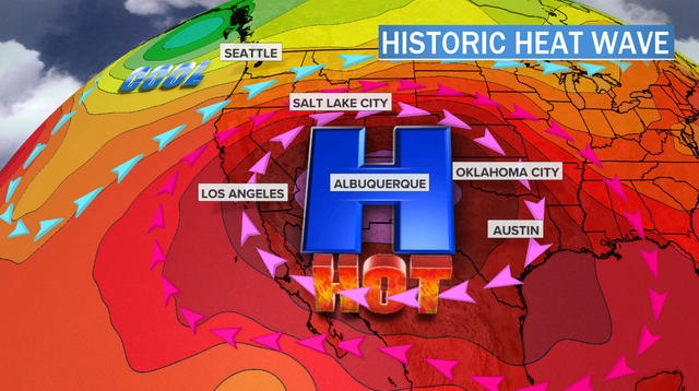
The relentless, historic heatwave dominates much of America.
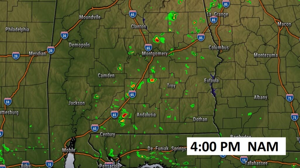
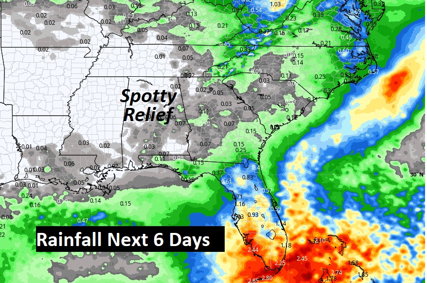
Future radar offers SOME hope that one or two communities will see a shower today, but chances area remote.
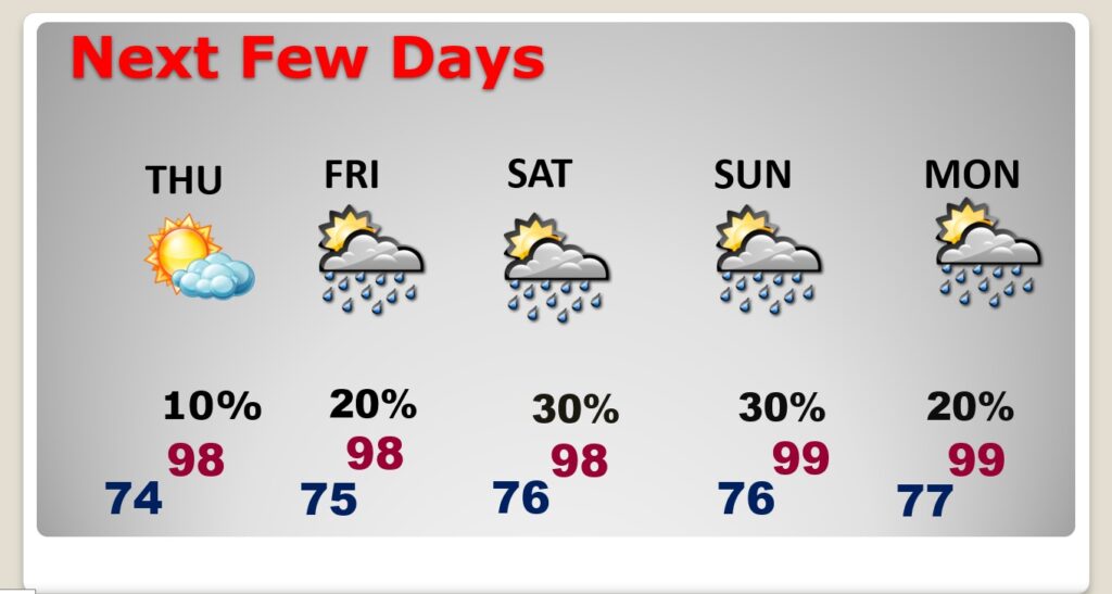
NEXT FEW DAYS: Still, High and Dry. Lots of sunshine. Upper 90’s Thursday through Monday. Daily heat index 100 to 105. (Perhaps a little higher over the weekend) Widely scattered storms return Friday and over the weekend. But, they will be few and far between.
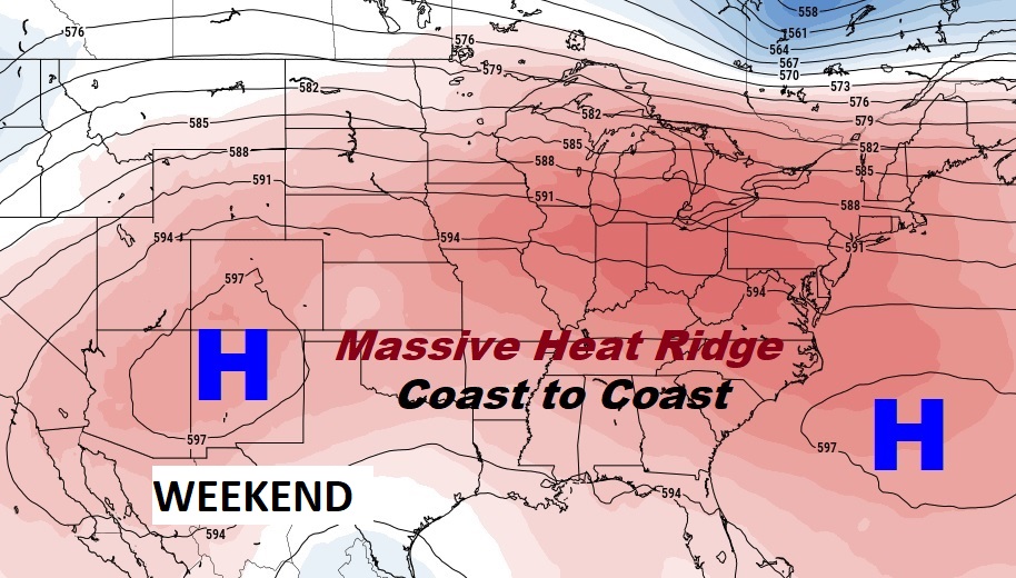
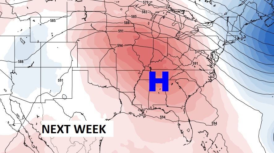
The massive Upper High Ridge, which has been the story of the summer here in the United states continues to expand. It will continue to be the big story for several more days. Look at the extent of the heatwave over the weekend.
Rain prospects for the next five days will continue to be rather scant, except closer to the coast where storms will continue.
Here’s the temperature trend over the next 10 days. Little or no day to day change.
Next week, the upper high could even be stronger across the south, on the first week of August.
TROPICAL UPDATE: NHC is monitoring two Areas to Watch in the Atlantic. The probability for development appears low due to upper level wind shear.

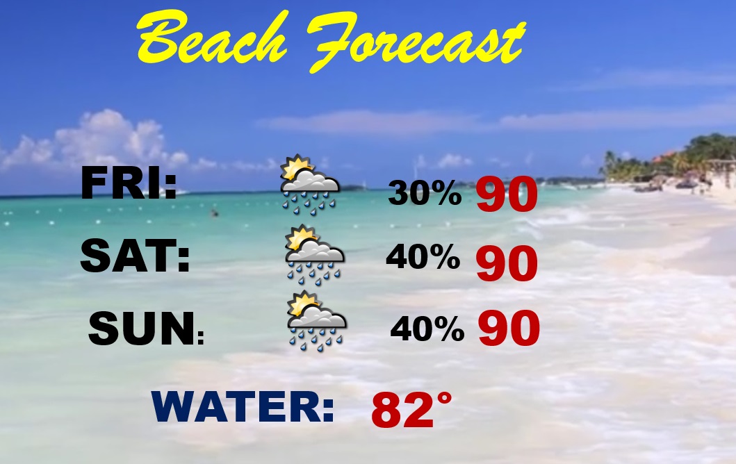
BEACH FORECAST: Fairly routine. Scattered spotty storms each day. Highs near 90.
Thanks for reading this Blog this morning! This morning we are LIVE on the radio from 6 to 9 on NewsTalk 93.1. Watch us on TV on CBS 8 and ABC 32. I’ll have another update for you in the morning. Have a nice day!
–Rich