
Good Morning! Today the Big Heat Dome edges just a little closer. The Heat Index will head into the Dangerous Range 105 to 110. Around the edge of the Heat Dome clusters of storm will affect the state, especially northern and NE Alabama. But the so called “outflow boundary from those storms, combined with the heat will bump up the rain chance for all of us, particularly today and tomorrow. Some storms could be strong to severe with damaging wind gusts and prolific lightning. Then, get ready for a steamy weekend with more Dangerous Heat indices and scattered, random strong storms. August in Alabama. Here’s my brief forecast discussion.
TODAY: Lots of sun, leading to a sun/cloud mix. Hot and Humid. High 96. Dangerous Heat Index over 105. Widely Scattered random storms possible. Some could be strong to severe with damaging wind gusts. Low tonight 76
Future radar tells quite a story. Another one of those storms clusters called MCS will affect the state today. It will track southeastward across north and east central Alabama. But the “outflow boundary from those storms, combined with the heat will bump up the rain chance for some of us, particularly today and tomorrow. Some storms could be strong to severe with damaging wind gusts and prolific lightning. Big heat produces bug storms.
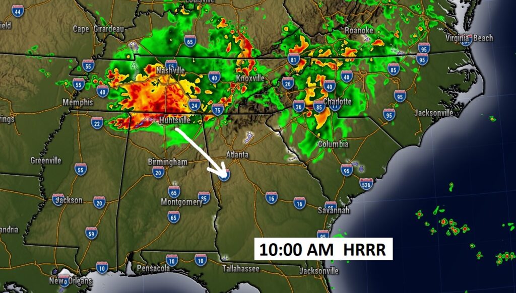
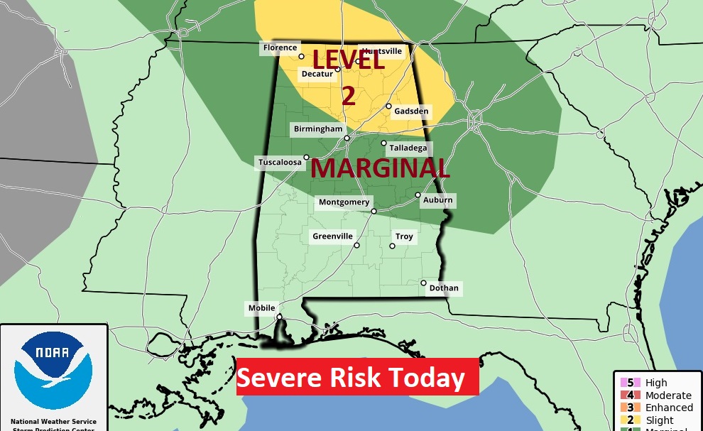
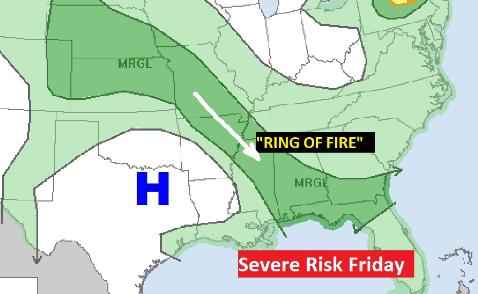
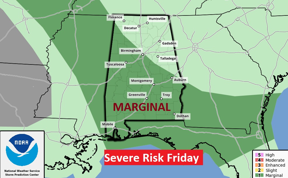
SPC has a large chunk of the state in a severe weather risk, for the US 80/I-85 corridor northward.
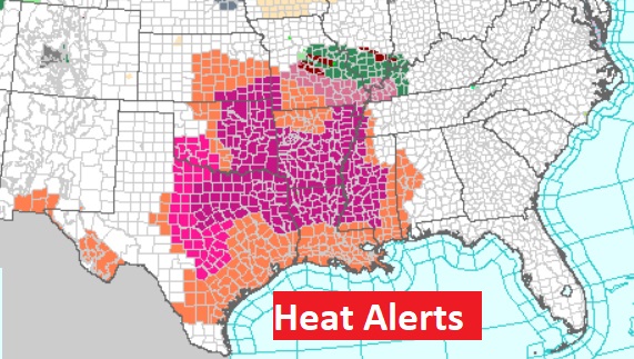
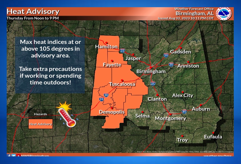
The Big Heat Dome is still in control. Heat Advisories and Excessive heat warnings cover several states.
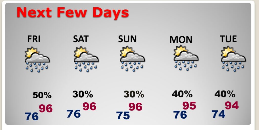
NEXT FEW DAYS: Dangerous Heat Indices Friday, perhaps approaching the 110 range. That will be the fuel for scattered strong storms. The Weekend looks steamy with more scattered random storms. Daily highs well into the 90’s. Lows at night mid 70’s.
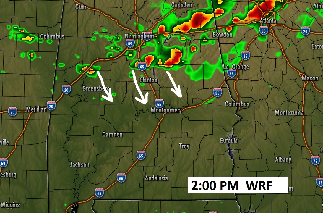
With the heat dome out to the west of us tomorrow, a corridor of strong storms will “ride” down into Alabama like a train track, round the edge of the high. The so called “Ring of Fire” pattern. Marginal Severe Risk
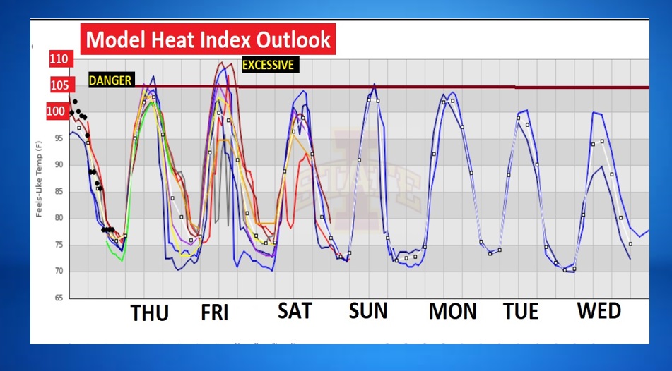
This graph speaks for itself. The dangerous heat indices will be making a comeback. The red line is the danger range. Friday and Saturday look fun.
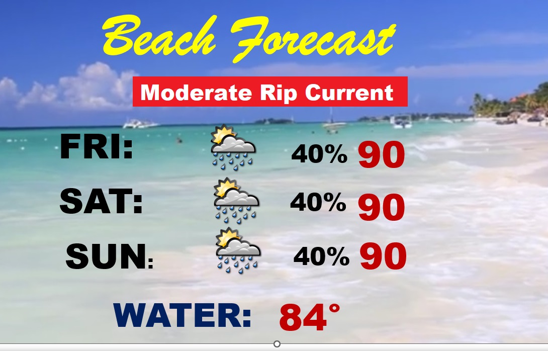
BEACH OUTLOOK: Hot and humid with dangerous heat indices. Highs near 90. Scattered random storms each days. Moderate Rip Current Risk.
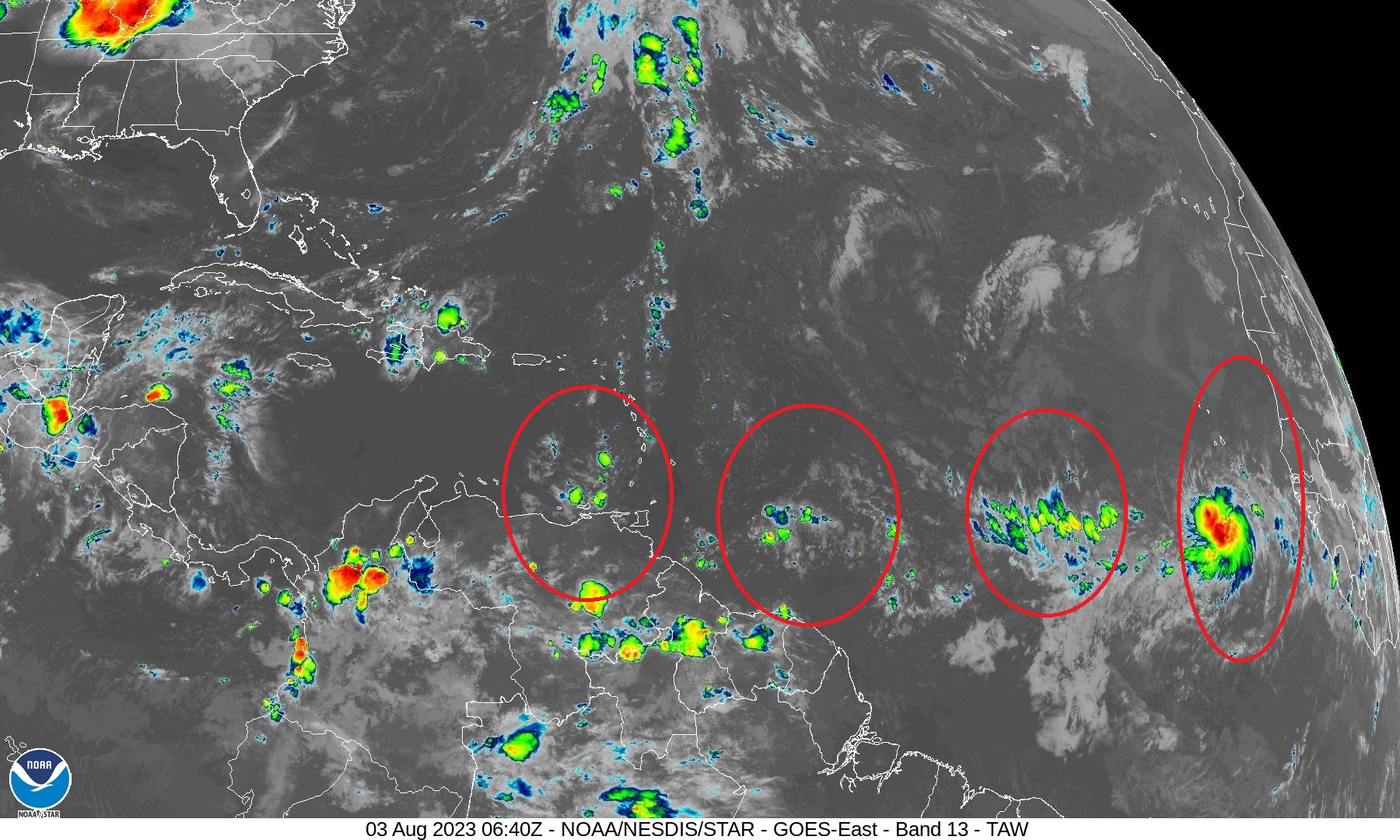
TROPICAL UPDATE: The tropics are quiet for now. We’re watching a series of tropical waves come off Africa.
Thanks for reading this Blog this morning! This morning we are LIVE on the radio from 6 to 9 on NewsTalk 93.1. Watch us on TV on CBS 8 and ABC 32. I’ll have another update for you in the morning. Have a nice day!
–Rich