
Good Morning! Today’s update is routine. This first weekend of August will be rather typical. Here we go again with another Heat Advisory. Today’s Heat Index will likely exceed the 105 Danger Range. In fact, heat & humidity will headline the weekend forecast. The Heat Index could tease the 109 range on Sunday. Big heat can produce big storms. Marginal Severe Risk again today. Scattered Random Storms will dot the radar screen today and Sunday. No big changes are in the cards over the next few days. Highs will reach the upper 90’s Monday & Tuesday. Dangerous heat indices will continue.
TODAY: A lot of sun. Hot and Humid. High 95. Dangerous Heat Index near 106. Scattered random storms. Some could be strong to severe with damaging wind gusts. Low tonight 76
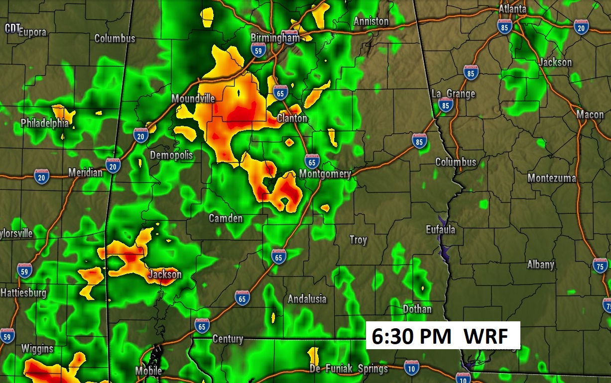
Future radar suggests another stormy late afternoon and evening.
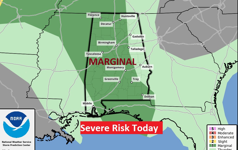
SPC has a large chunk of the state in a severe Marginal severe weather risk. Damaging wind gusts are the main risk.
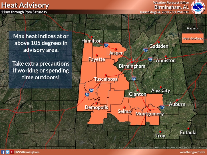
Heat Advisory for a lot of us again today. I expect the Heat Advisory will be extended through Sunday.
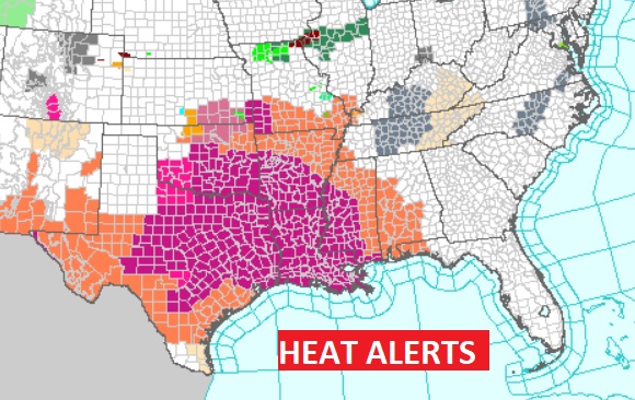
Various Heat Alerts cover at least 10 states.
NEXT FEW DAYS: Dangerous Heat Indices again Sunday, perhaps approaching the 110 range. That will be the fuel for more scattered strong storms. Scattered random storms will be around each day. Daily highs well into the 90’s. Lows at night mid 70’s.
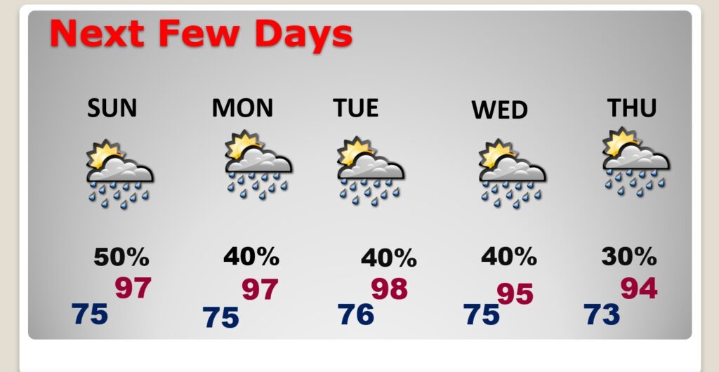
BEACH OUTLOOK: About what you’d expect for the 1st weekend of August. Hot and humid with dangerous heat indices. Highs near 90. Scattered random storms each days. Moderate Rip Current Risk.

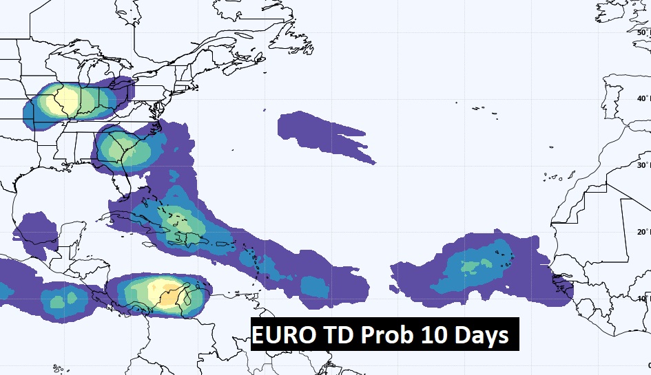
TROPICAL UPDATE: The tropics are quiet for now. We’re watching a series of tropical waves in the Tropical Atlantic.
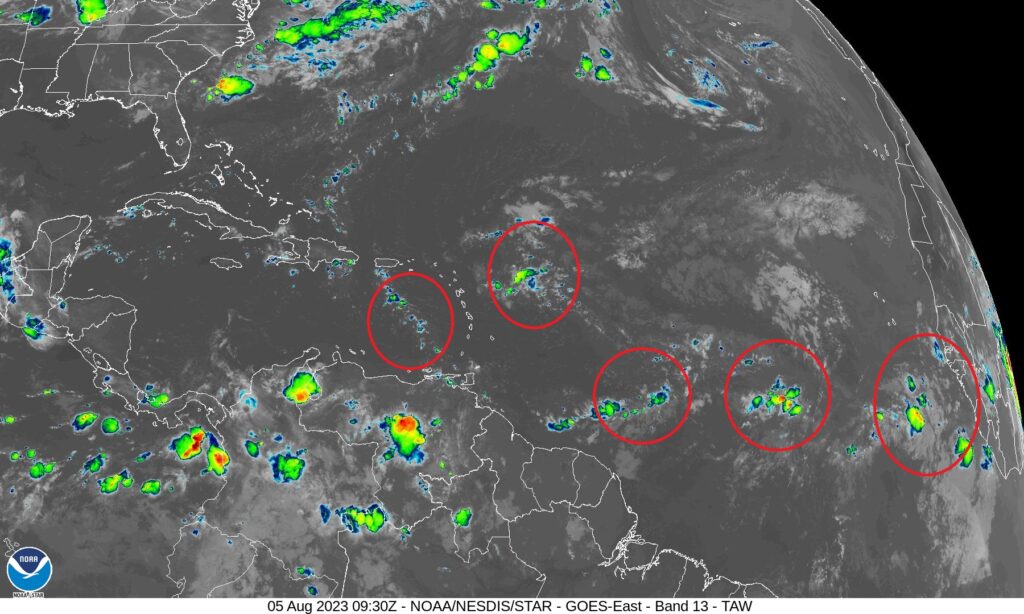
The Euro and GFS continue to highlight a corridor of Tropical Activity from the coast of Africa to the Bahamas.
Thanks for reading this Blog this morning! I’ll have another update for you in the morning. Have a nice weekend!
–Rich