
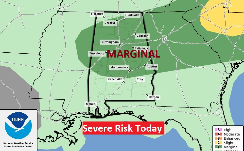
Good Morning! Our extended intense summer heatwave continues. Yesterday, the Heat Index, once again, soared well into the Danger/Excessive range with 111 at MGM. Today, the Heat Advisory continues. In fact, we’ll probably reach the upper 90’s each day through Sunday at least. Dangerous heat indices will continue each day. This will be fuel for the fire for potentially strong to severe storms. SPC has much of the state in a Severe Risk today and tomorrow. I wish I could say there is relief on the horizon. Unfortunately, we are stuck in this situation for several days. Here’s my brief forecast discussion.
TODAY: Heat Advisory continues. High near 97. Dangerous Heat Index as high as 108. Random scattered PM Storms. Some could be strong to severe with damaging wind gusts. Low tonight 78
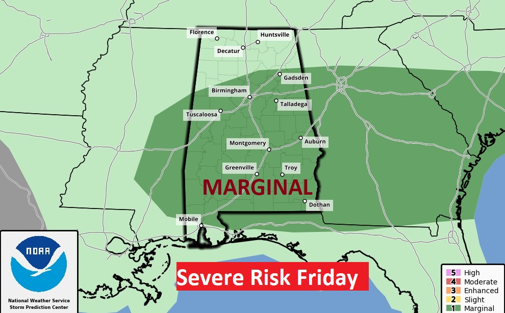
It’s getting to be a daily occurrence. Once again today and tomorrow, a big chunk of the state is in a severe weather risk. Damaging wind gusts are the main threat.
NEXT FEW DAYS: Intense Heat with triple digit heart indices will continue. There will be Random hit or miss storms each day, especially in the afternoon and evening. Very little day to day change. Over the weekend, the heat will be intense.
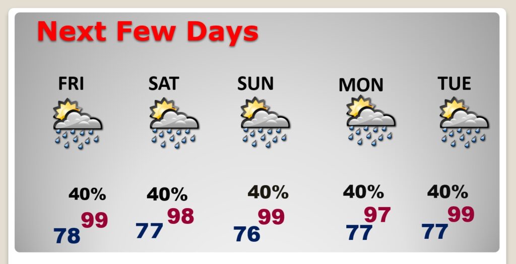
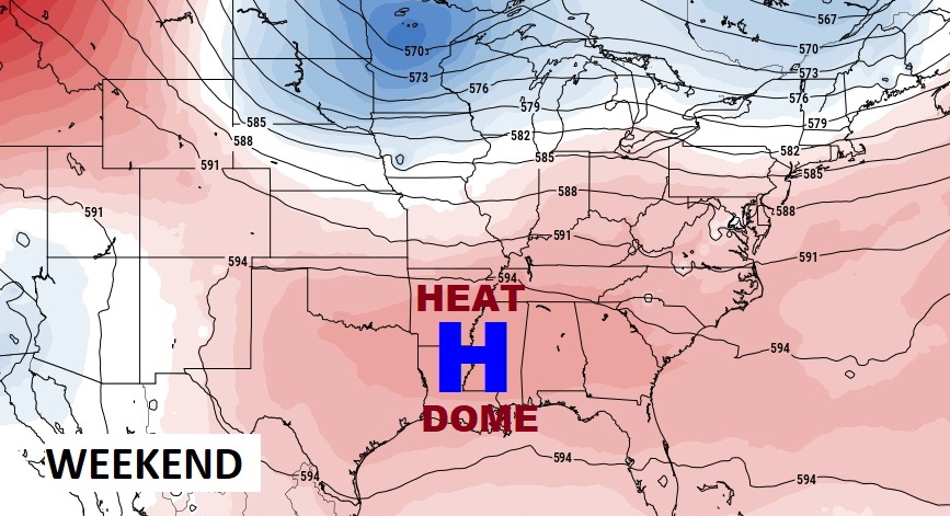
Over the weekend, with the Upper Heat Dome expanding again, highs will be in the upper 90’s with dangerous Heat Indices.
BEACH OUTLOOK: Dangerous Heat Indices Friday through Sunday. Scattered Random storms. Highs upper 80’s to near 90. Gulf Water: 87.

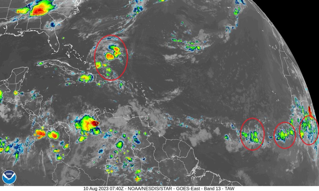
TROPICAL UPDATE: The tropics are quiet for now. Next week, the models are hinting an an uptick in the level of activity in the MDR (Main Development Region)
Thanks for reading this Blog this morning! This morning we are LIVE on the radio from 6 to 9 on NewsTalk 93.1. Watch us on TV on CBS 8 and ABC 32. I’ll have another update for you in the morning. Have a nice day!
–Rich