
Good Morning! Early this morning, hours before dawn, there’s a cluster of strong storms moving southeastward from North Alabama. Some of us could see a morning round of storms, with redevelopment later in the day. Marginal Severe Weather Risk. Damaging wind gusts are possible in the stronger storms. Otherwise, are you ready for another very hot August weekend? Expect highs in the upper 90’s, with dangerous heat indices of 105 to 110. Random storms will be few and far between over the weekend. Widely scattered. There’s no end in sight to the heat. Here’s my brief forecast discussion.
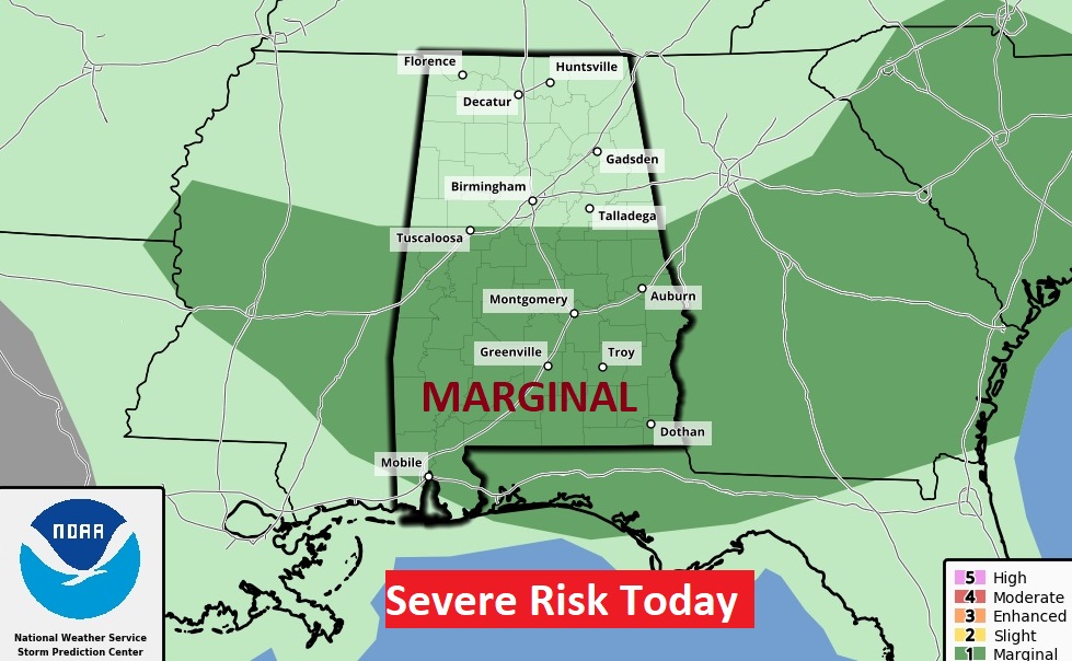
TODAY: Risk of a morning round of storms, with possible redevelopment later in the day. Some could be strong to severe with damaging wind gusts. Marginal Severe Risk. Hot and Humid again. High 96. Heat index as high as 105. Low tonight 76.
Here’s one of the Hi Res models (WRF) suggesting storms could redevelop again.
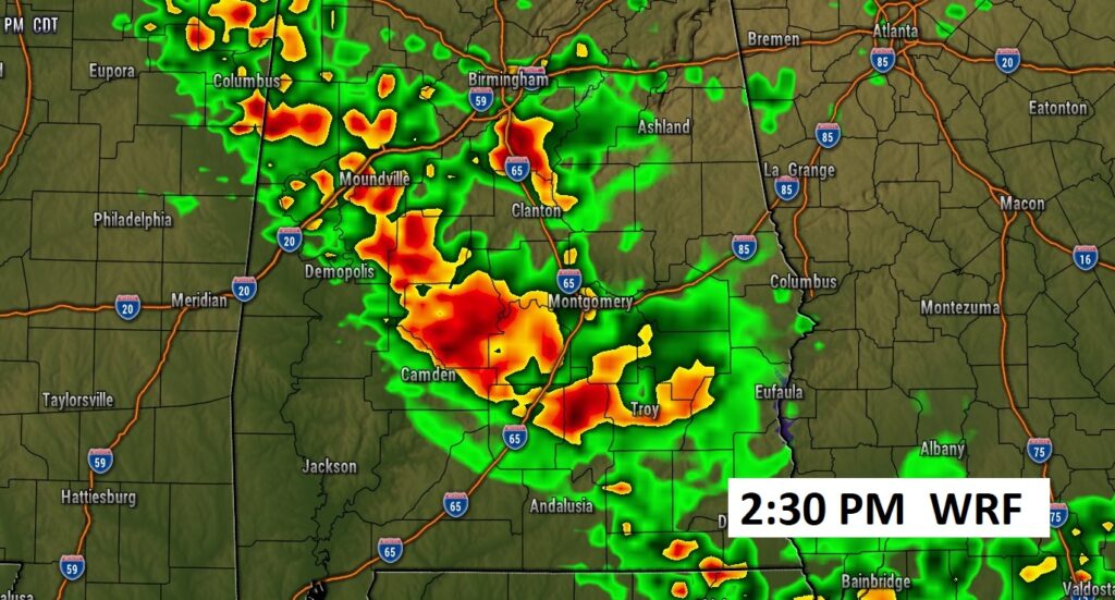
Some could be quite strong. SPC has us in a Marginal Severe Risk again today.
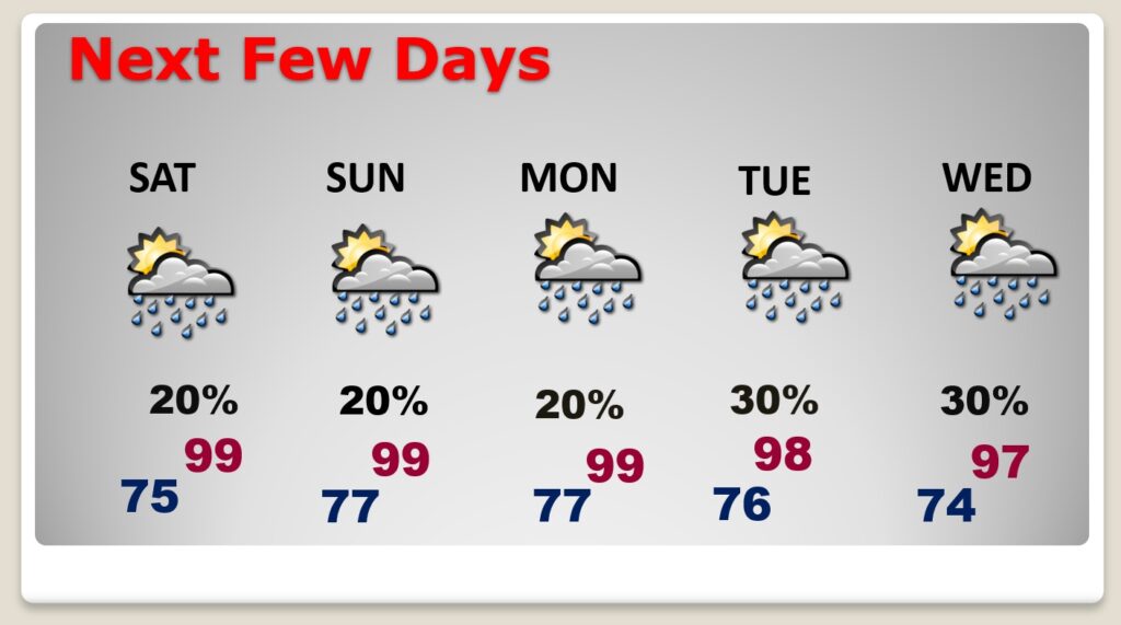
NEXT FEW DAYS: Intense Heat with triple digit heart indices will continue. Expect highs in the upper 90’s, with dangerous heat indices of 105 to 110. Random storms will be few and far between over the weekend. Widely scattered. Not much day to day change Monday through Wednesday.
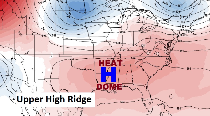
That migrating Heat Dome will be centered right over the Gulf South this weekend.
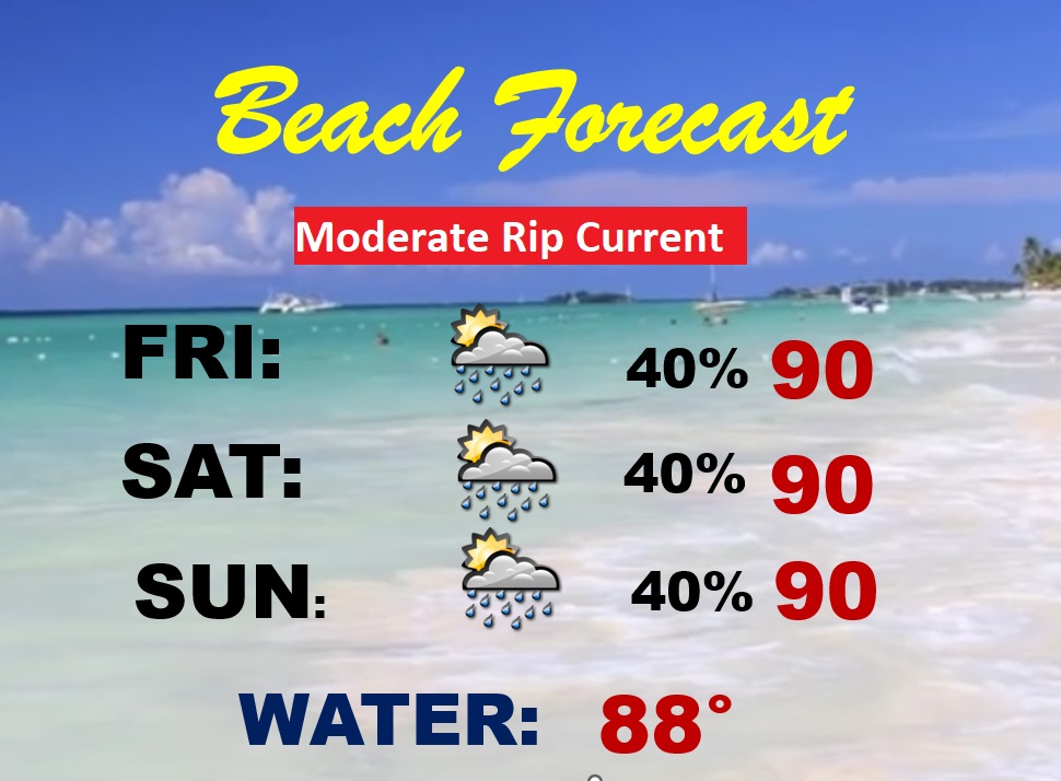
BEACH OUTLOOK: Dangerous Heat Indices Friday through Sunday. Scattered Random storms. Highs upper 80’s to near 90. Gulf Water: 87.
TROPICAL UPDATE: The tropics are still quiet for now.
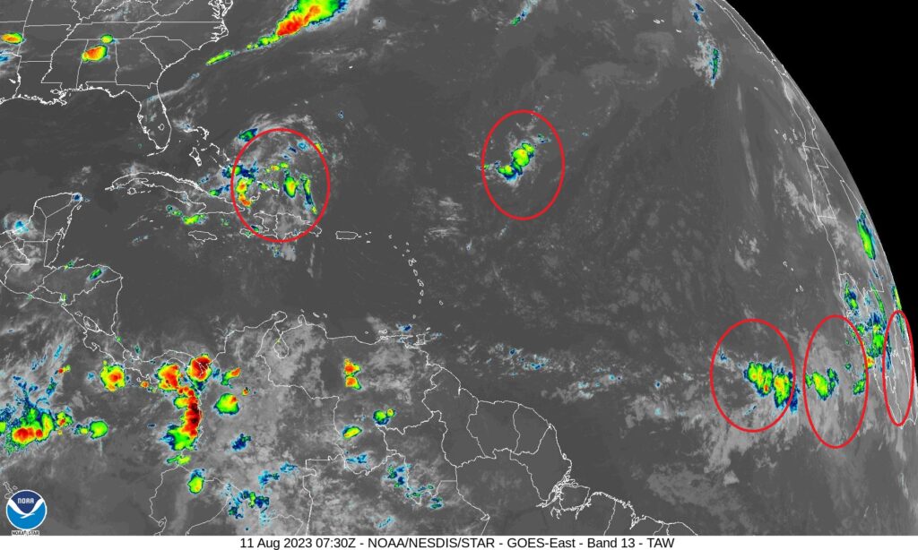
However, The EURO model is advertising an uptick in tropical potential from the African coast to the southeastern US.

Thanks for reading this Blog this morning! This morning we are LIVE on the radio from 6 to 9 on NewsTalk 93.1. Watch us on TV on CBS 8 and ABC 32. I’ll have another update for you in the morning. Have a nice day!
–Rich