
Good Morning! It’s been a hot summer. Our current Heatwave has been around for weeks. But, get ready for what could be, perhaps, the hottest weekend of the summer so far. The Heat Advisory has been upgraded to an Excessive Heat Warning through Sunday. Heat Indices could easily reach the 112-118 range today and Sunday. There will be random storms on the radar, but today and Sunday, the storms will be few and far between. And, guess what? The excessive heat will continue well into next week. Even Monday and Tuesday, actual highs will be near 100. Storms will be widely scattered through Wednesday. I don’t see any end in sight, yet. Stay hydrated.
CLIMATE DATA: Friday was an interesting day. Hot and humid. High 96 (morning low 75). Heat index 112. Big heat can produce big storms. There were LOTS of severe thunderstorm warnings and even a Severe Thunderstorm Watch. The Airport had .89”. My house in East Montgomery had 1.27”. Some of you, in some towns had more than 3”!
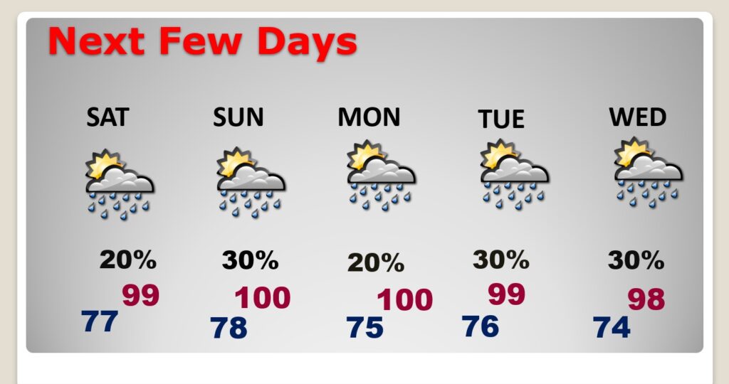
SATURDAY & SUNDAY: Excessive Heat Warning. Hot and Humid again. Highs upper 90’s to near 100 . Potential Heat Index 111-118. Low tonight 78.
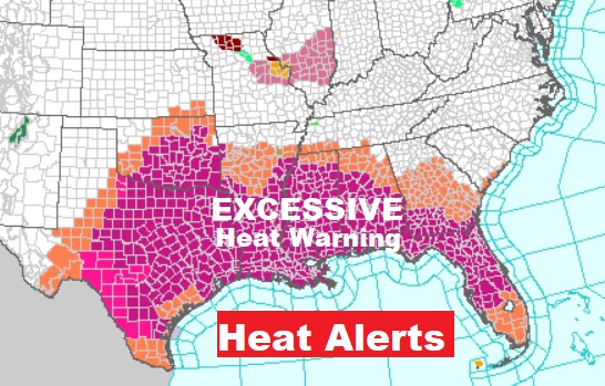
Look at this. Excessive Heat Warning extends from Texas to the Atlantic coast. Crazy, dangerous heat.
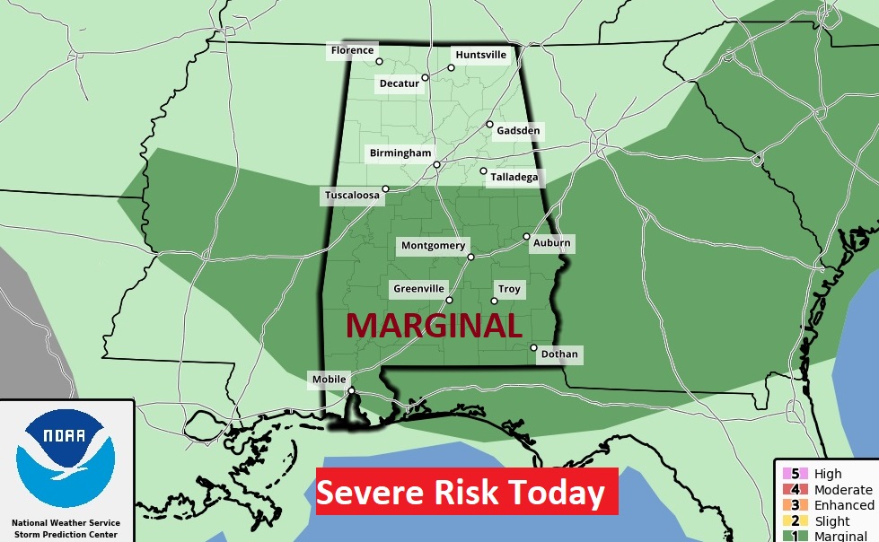
Seems like everyday there’s a Severe Risk in the state. Today it covers all the state from I-85 northward. Big heat…Big Storms.
NEXT FEW DAYS: Intense Heat with triple digit heart indices will continue. Expect highs in the upper 90’s to near 100. Dangerous heat indices of 105 to 110. Random storms will be few and far between through Wednesday. Widely scattered. Not much day to day change.
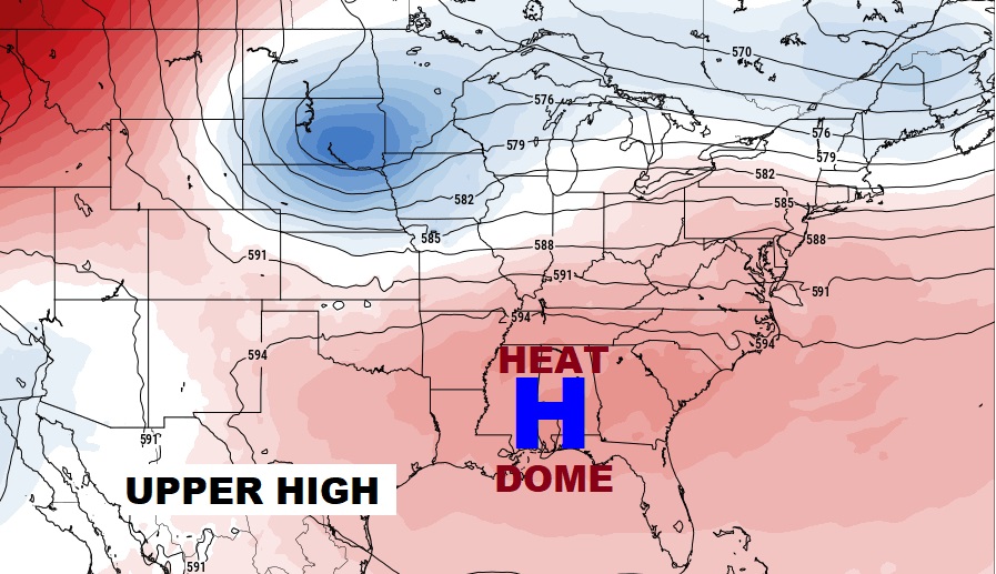
That migrating Heat Dome will be centered right over the Gulf South this weekend.
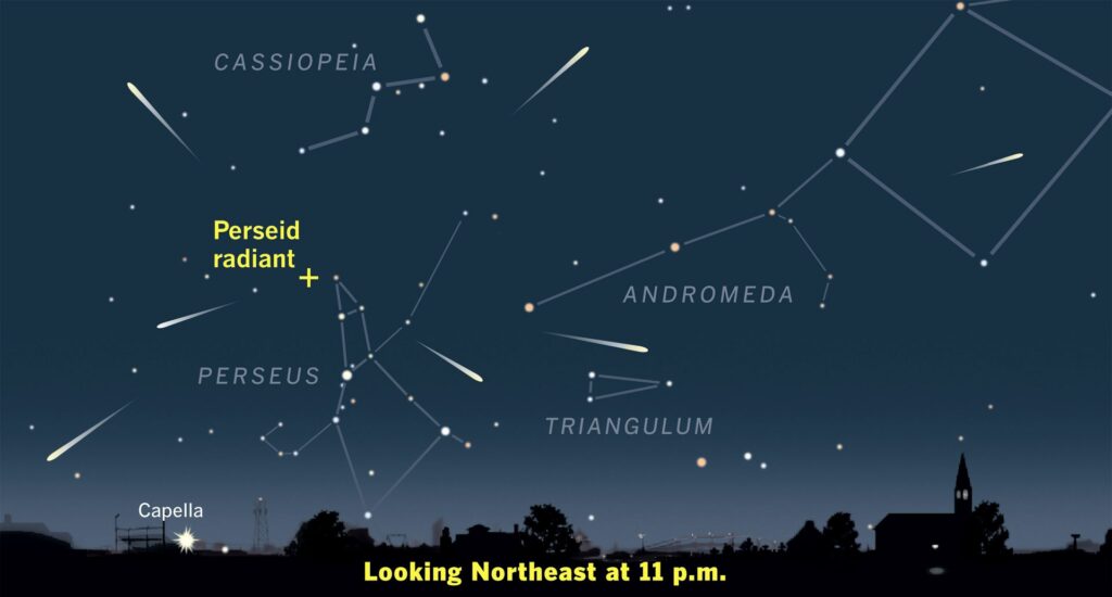
PERSEID METEOR SHOWER: The Perceid Meteor Shower is considered, perhaps the BEST meteor shower of the year. Good luck meteor watching.
https://www.space.com/perseid-meteor-shower-storm-2028
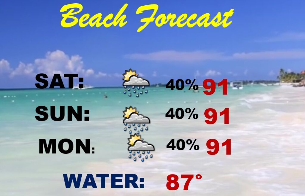
BEACH OUTLOOK: Dangerous Heat Indices through the weekend. Scattered Random storms. Highs near 90. Gulf Water: 87. Moderate rip current risk.
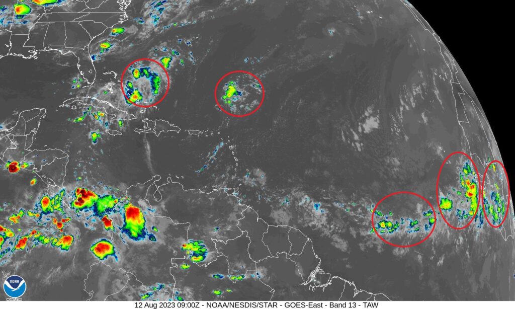
TROPICAL UPDATE: The tropics are spooky quiet for now.
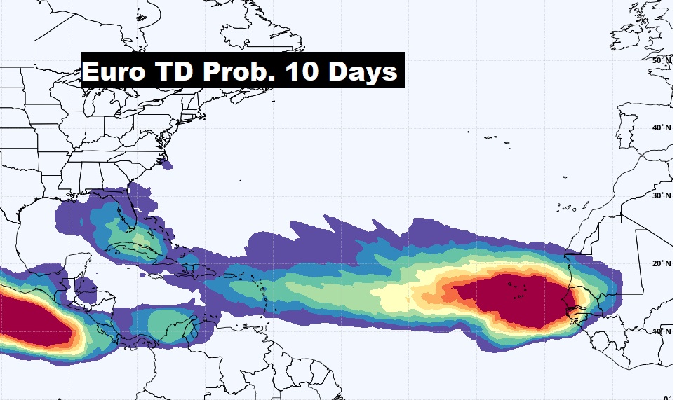
However, The EURO model continues to advertise an uptick in tropical potential from the African coast to the southeastern US over the next 10 days.
Thanks for reading this Blog this morning! There will NOT be a Blog Update on Sunday morning. I’ll have another update for you on MONDAY morning. Have a nice day!
–Rich