
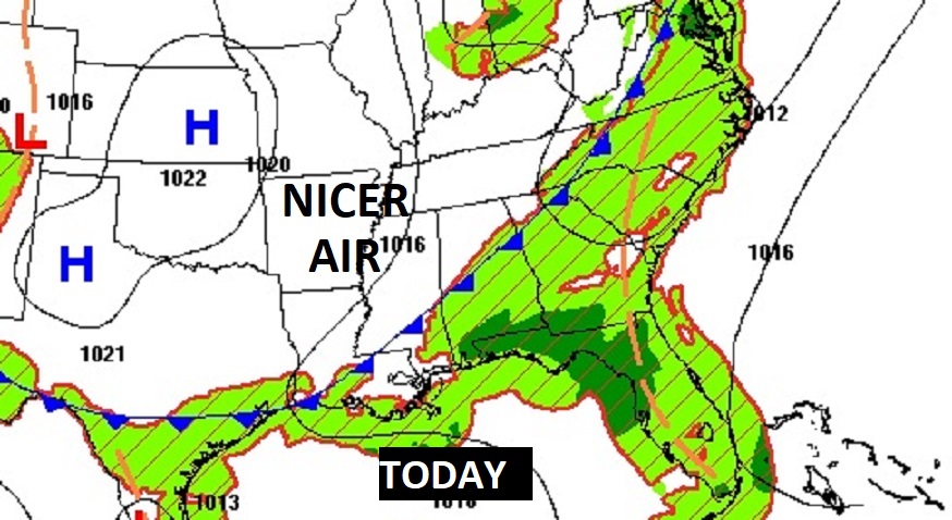
Good Morning! Brutal Heat continues today, but stand by. The front we’ve been waiting for is about to arrive. This front will bring some much nicer air by tomorrow. Get ready for big improvements. A Heat Advisory continues today. The heat index may reach 108. Thunderstorms will develop ahead of a southward moving front. The front will reach south Alabama by this evening. Behind the front, there will be significant relief. You’ll notice a huge difference in the humidity level, with lower temperatures. Nights will be much more bearable…in the upper 60’s. Sunshine will dominate Wednesday through Sunday. No storms. A dry forecast. Here’s my brief forecast discussion
CLIMATE DATA: Monday was another day of terrible excessive heat High was 99 (morning low 75). (Normal 94/72) Heat index reached 117. The Airport had just a TRACE of rain. My house in East Montgomery had 1.66”, with a Max Heat index 121.
TODAY: Heat Advisory for one more day. Hot and Humid again. Highs near 97. Potential Heat Index 108. Scattered thunderstorms, along a southward moving front. Some could be strong. Low tonight near 70.
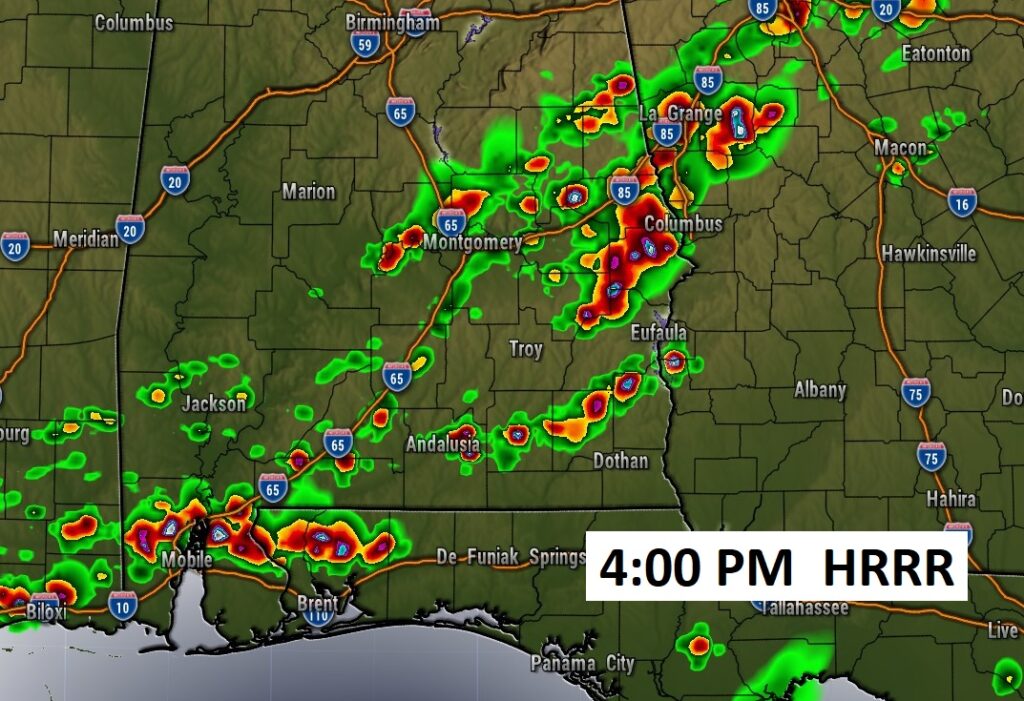
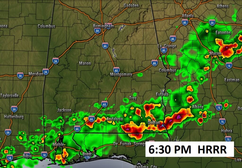
SPC has music of SE Alabama in a Marginal Severe Risk.

Future Radar. This is the HRRR model. Strong storms by mid to late afternoon along the southward moving frontal system.
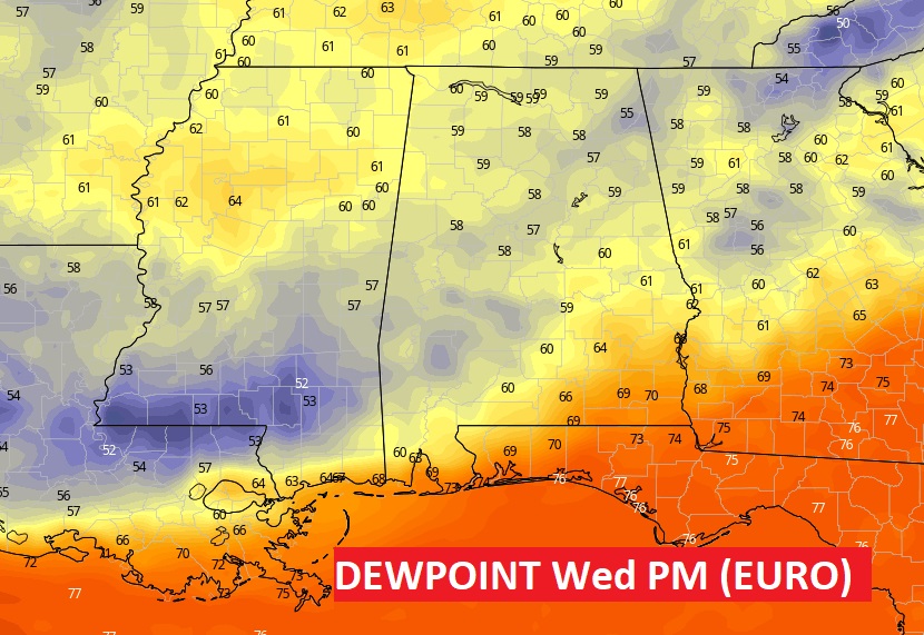
FRONT BRINGS RELIEF!: A frontal system will move through the state today will bring the relief we’ve been wanting. Tomorrow, you’ll feel a BIG DIFFERENCE. Highs will be much lower. Low 90’s. But, it’s the lower humidity will make such a big difference. Dewpoints will fall to the low 60’s. Get ready. This is the news we’ve been waiting for.
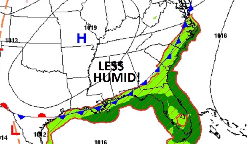
How NICE is the air behind the front? Look at projected Dewpoint numbers off the Euro model Wed afternoon. WOW. Just wow.
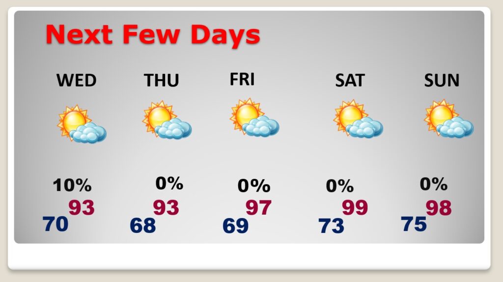
NEXT FEW DAYS: It’s gonna be hot with highs in the 90’s …BUT, the humidity will be much more bearable mid to late week. DRY. No storms. Much higher humidity creeps back by Monday.
Are we done with stupid-heat? Apparently not. Here’s the 10 day model temp. blend.

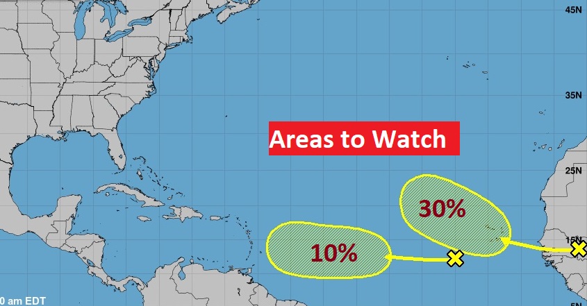
TROPICAL UPDATE: NHC is now mentoring two new Areas to Watch in the far eastern Tropical Atlantic. The one closer to Africa has a 30% chance of development.
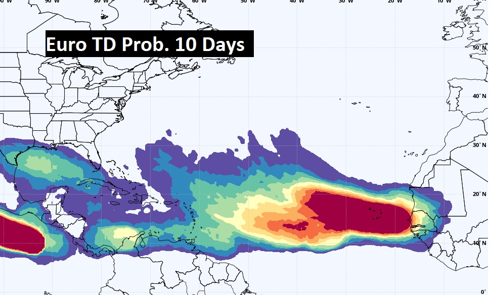
The EURO model continues to advertise an huge uptick in tropical potential from the African coast to the southeastern US and the Gulf of Mexico over the next 10 days.
Thanks for reading this Blog this morning! This morning we are LIVE on the radio from 6 to 9 on NewsTalk 93.1. I’ll have another update for you in the morning. Have a nice day!
–Rich