
Good Morning! The “niceness” we enjoyed earlier this week is over. Alabama is heating up again. We returned to triple digits on the Heat Index Friday with 102. That number will continue to creep higher every day through mid-week. The actual highs will reach the upper 90’s Sunday, near 100 Monday & Tuesday, and the low 100’s mid to late week. It will continue to be storm-free/dry for several days. Meanwhile, the tropics continue to wake up in a big way. But, nothing for us to worry about for now.
CLIMATE DATA: Friday’s high at MGM was 94. Morning low 68. Highest Heat index 102. No rain. Normal hi/lo: 94/71.
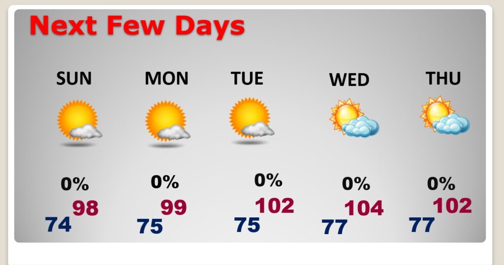
TODAY (Saturday): Sunshine. Hotter. High 97. Max Heat index to 103. Clear, not as cool tonight. Low 72. Light wind.
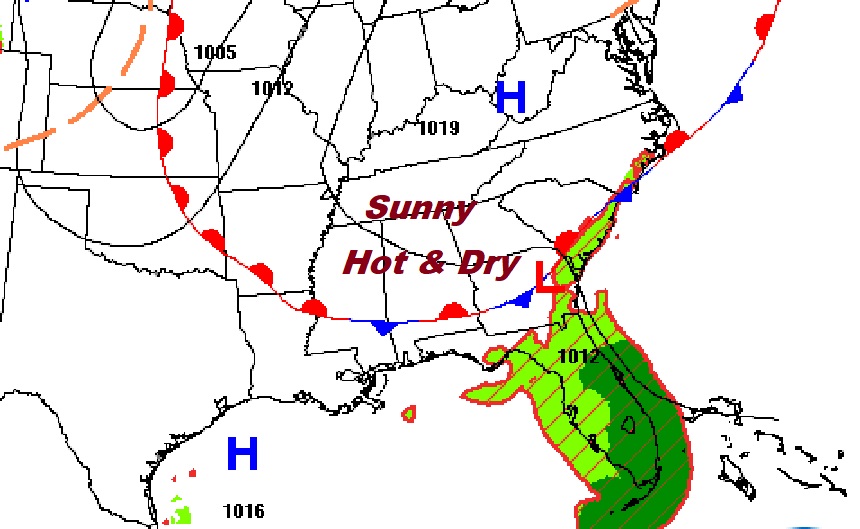
A weak front has delivered a fresh supply of drier air to the area. Many storm-free days.
SUNDAY: High 98. Heat index near 104-105. Sunshine. Still dry. Low Sunday night 75.
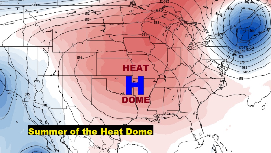
The big upper high is still in control. The Heat Dome has dominated this summer.
NEXT FEW DAYS: Storm-free for several days. Sunny days. Mostly clear nights. Upper 90’s Sunday. Near 100 by Monday and Tuesday. Low 100’2 Wednesday & Thursday. Heat index near 105 Sunday. Heat index 105-110 Monday through Thursday. Nights are getting warmer. Mid 70’s at night Sunday night through Tuesday. Upper 70’s Mid to late Week.
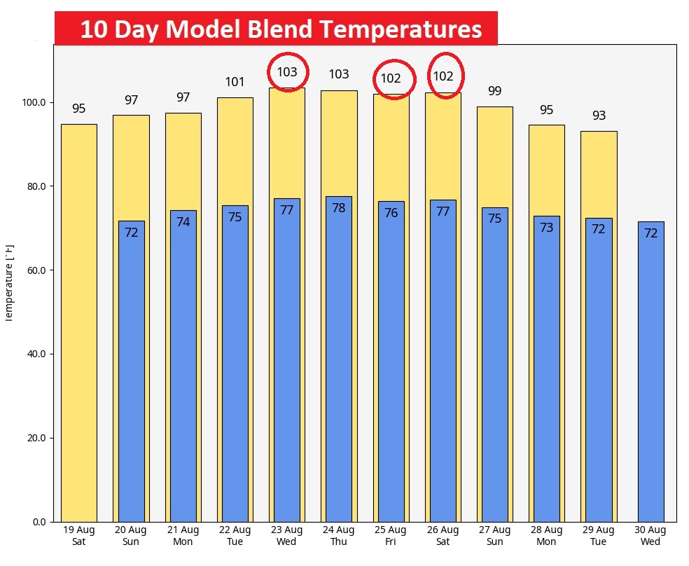
Potential RECORD HIGHS this week. We’ll be close to or exceeding records Tuesday through Saturday. The records most in jeopardy are Wednesday, Friday and Saturday. Highs in the lower 100s. Hottest week of the summer so far? Perhaps. #alwx #mgmwx
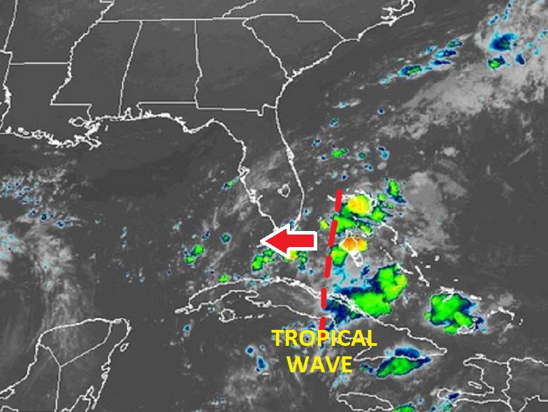
TROPICAL UPDATE: All of a sudden, it’s busy in the tropics. The National Hurricane Center is now monitoring four features in the tropics, including two Invests and a Area to Watch in the Gulf of Mexico. A Tropical Wave moving into the Gulf, has a decent chance of becoming depression by mid-week as it heads toward the western Gulf coast.
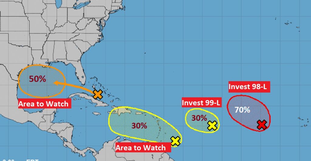
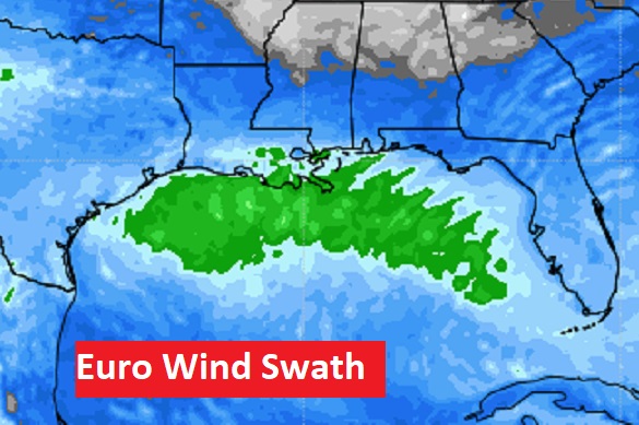
The prospects for potential development in the Gulf is increasing. A Tropical Wave in the Bahamas is headed for the Gulf. NHC says a tropical depression could form early in the week and head towards the western Gulf coast. The Euro wind swath map is interesting. Watching.
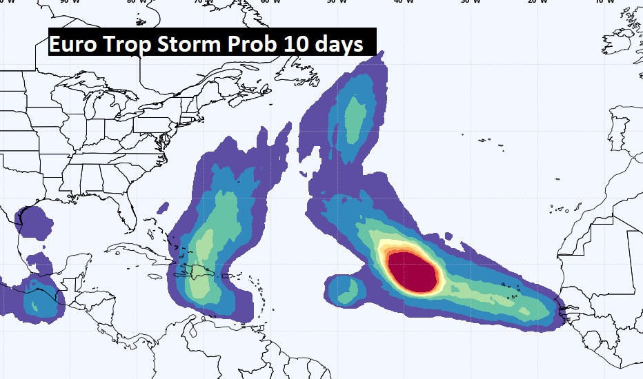
Here’s the EURO Tropical storm probability for the next 10 days. No doubt about it. The tropics are waking up.
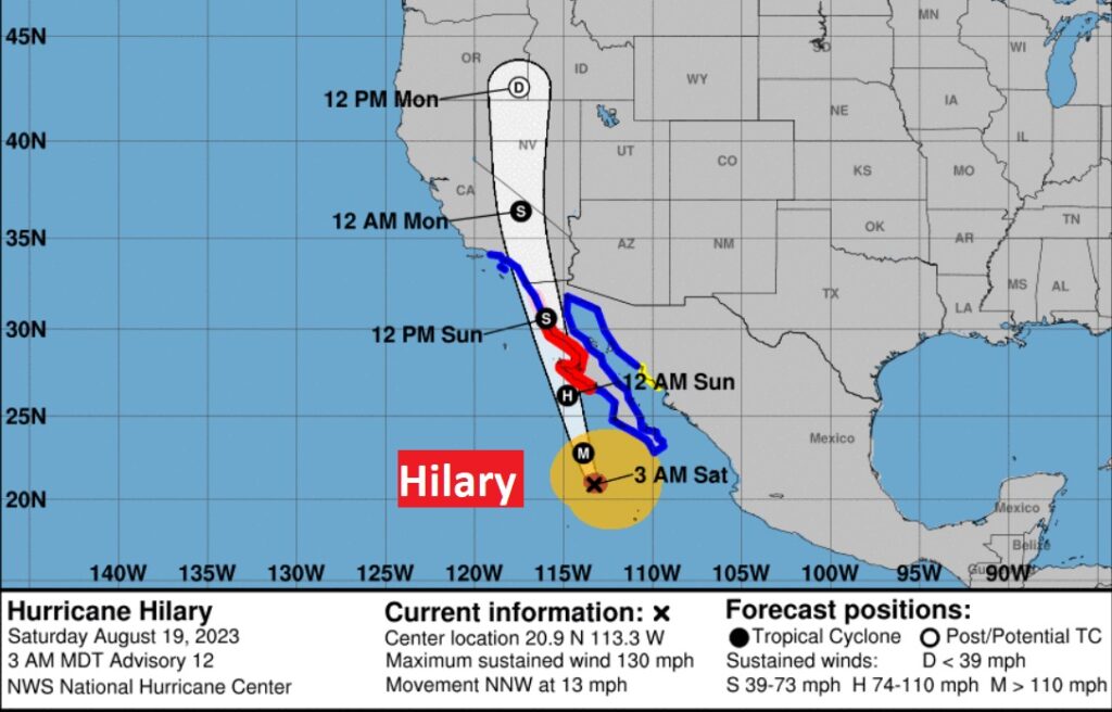
An extremely rare tropical threat on the West Coast. Hurricane Hilary currently has 130 mph winds. First Tropical storm warning EVER issued for southern California. Hilary could start impacting Southern California by tonight. Extremely heavy rain is expected as the storm moves northward. Crazy history.
Thanks for reading this Blog this morning! There will NOT be a Blog Update on Sunday morning. I’ll have another update for you on MONDAY morning. Have a nice day!
–Rich