
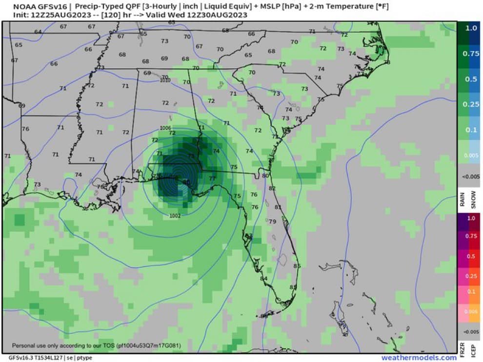
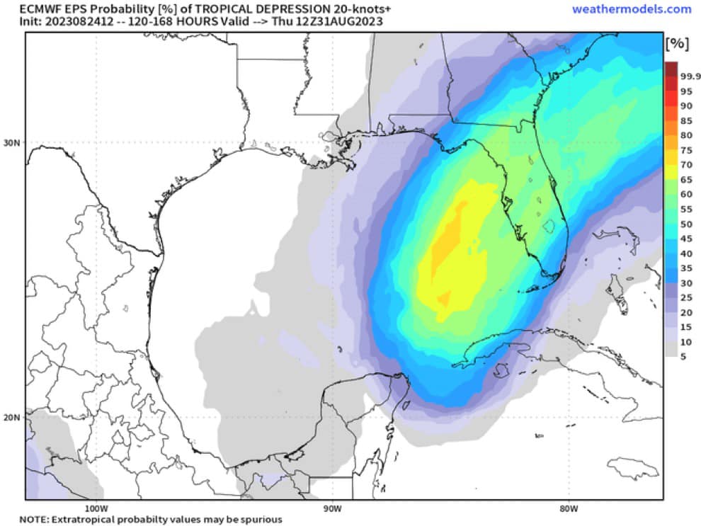
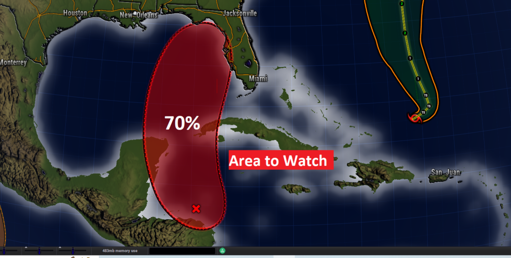
Concern continues to grow for Gulf tropical development in the next few days. Invest 93-L now has a 80% chance of development. Both the GFS and Euro are advertising drama along the north and northeast gulf coast by mid-week. AF Recon will investigate tomorrow .
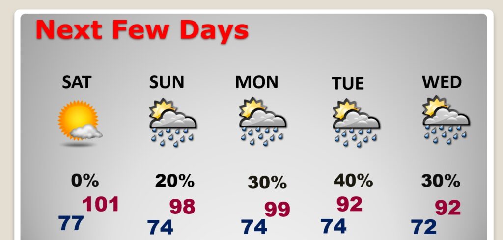
Good Morning! Rince and repeat. The extreme heat continues. The Heat Advisory has been extended and continues at least through Saturday. Dangerous heat indices can expected at least through Sunday. Rain chances are very small. Maybe 10% today and Saturday. Widely scattered storms Sunday. Better rain chances return next week as the upper High breaks down and retrogrades westward. Temperatures next week will be much more reasonable. Could we see a tropical storm in the Gulf over the next few days? Yes. Probably. Most likely in the eastern Gulf. With a dreaded “I” name. Probability is now 70%. Stay tuned. Here’s my brief forecast discussion.
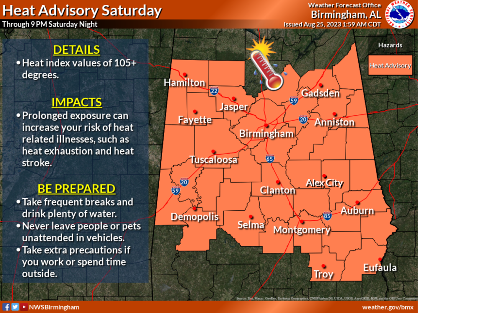
TODAY : Heat Advisory through Saturday. Sunshine. Very Hot. High near 100. Max Heat index to 108. Mostly clear tonight. Low 78. Light wind.
All of Alabama is under various Heat Alerts today & Friday. West Alabama is under an Excessive Heat Warning. Most of the rest of us continue under a Heat Advisory. The Heat Advisory continues on Saturday.
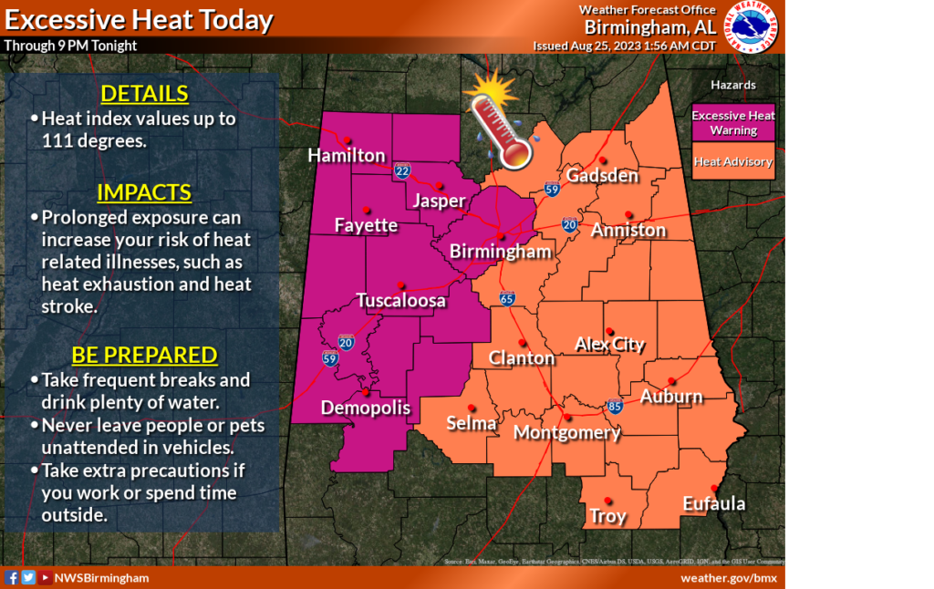
NEXT FEW DAYS: Intense Heat. Close to or exceeding record highs today through Sunday. Sunny days. Highs near or above 100 through Saturday. Heat index 106 to 112. Rain chance only about 10% through Saturday. Widely scattered storms Sunday. Beter rain chance next week. Also, high temperatures will be more reasonable.
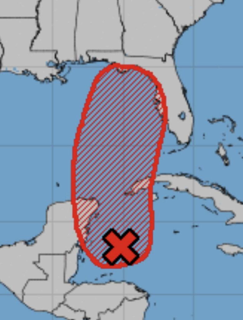
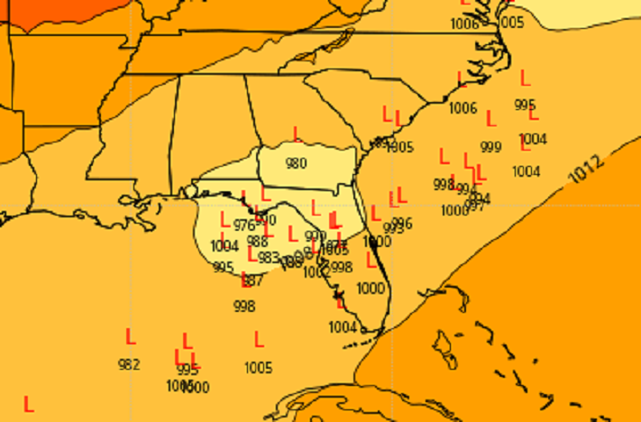
TROPICAL UPDATE: NHC is tracking four features. In the far east Atlantic there is the Remnants of Emily and Invest 92-L.
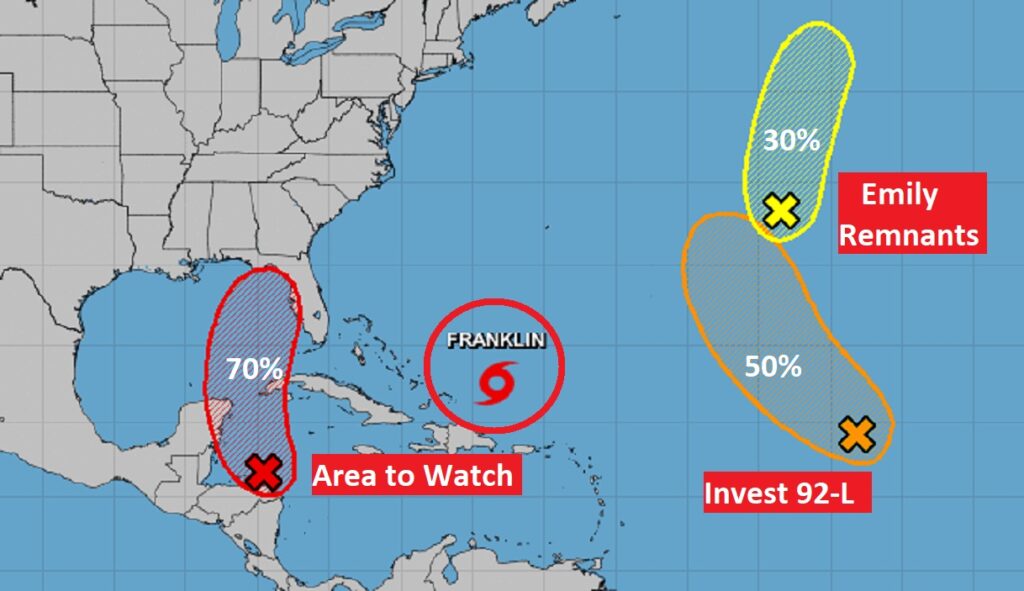
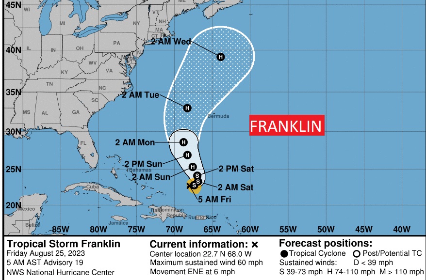
Tropical Storm Franklin is likely to become a Hurricane and perhaps a Major Hurricane in the Atlantic.
The Area to Watch in the west Caribbean continues to be very interesting for the Gulf. There’s a very good chance this system will become a named Tropical Storm next week in the eastern Gulf. This is something we’ll be watching very closely.
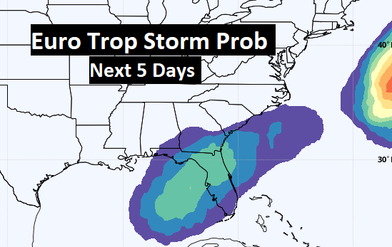
The EURO Ensembles show possible future LOW positions in the NE Gulf over the next 5+ Days.
Thanks for reading this Blog this morning! This morning we are LIVE on the radio from 6 to 9 on NewsTalk 93.1. I’ll have another update for you in the morning. Have a nice day!
–Rich