This is a special slimmed down Blog update to bring you up to update you on some important stuff. Heat Advisory today, and may have to be extended to Monday. Record tying 102 yesterday (1938) and Heat index 114. Today’s record of 101 from 1938. Big heat produces big storms. Severe thunderstorms are certainly possible today and Monday. Storms will be scattered to numerous Monday and Tuesday. Tropical Depression 10 will strengthen eventually to a Hurricane named Idialia. A hurricane likely to strike the United States by mid week. Most likely the northeast Gulf coastline. Perhaps near the Florida Big Bend area. Details below. Here’s a very very brief forecast discussion.
CLIMATE: Record tying high of 102 yesterday. (1938) Heat Index 114. Today’s Record high of 101 from 1938.
TODAY: Extreme heat continues. High near 101. Heat index 110+ possible. Scattered locally severe thunderstorms with this kind of heat. Low tonight 76.
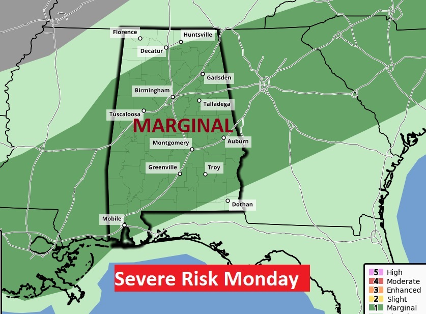
Marginal Severe Risk today and tomorrow.


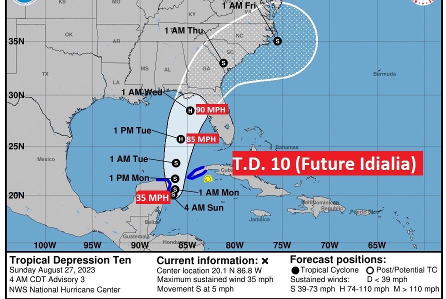
TROPICAL DEPRESSION 10 (Future Hurricane Idialia): Air Force RECON will investigate TD 10 today. Currently not far from the Yucatan, with 35 mph wind, expected to become a named Tropical Storm Idialia soon. Could become a Hurricane Tuesday. Expected to strike the northeast Gulf coast of the United States on Wednesday, at Cat 1, maybe Cat 2 hurricane. Let’s hope we don’t see a Rapid Intensification cycle.

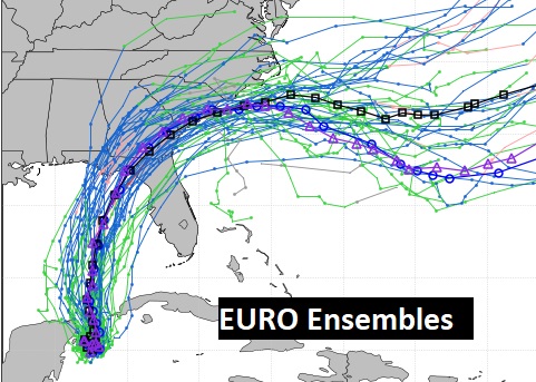
Here’s a sample of the Euro Model’s Tropical Storm Probability corridor. Looking at the Ensemble tracks, I feel pretty confident that Alabama will be bypassed. Let’s hope so. But we need to be very watchful, of course.


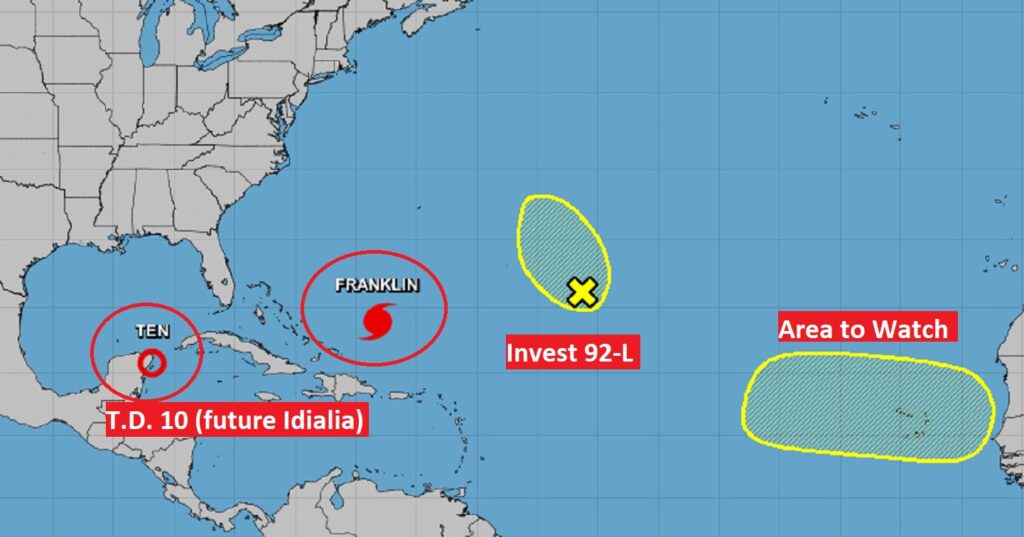
Here’s what’s happening in the rest of the tropics including Hurricane Franklin which will bypass the United States.

I’ll have a Complete Blog Update in the morning, and updates today as needed. Have a good day. Our Weather App will instantly alert you to Severe thunderstorm Warnings.
–Rich
