
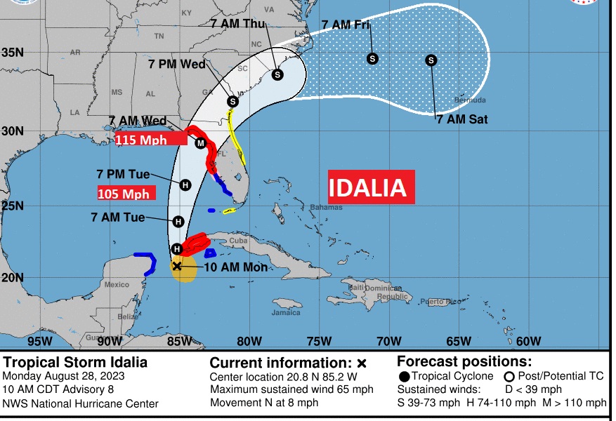
10AM IDALIA UPDATE: Upgrade to a Hurricane Warning and a Storm Surge Warning along the FL west coast including Tampa Bay. Still 65 mph winds, 80 mi S of the west tip of Cuba, moving north at 8.
https://www.nhc.noaa.gov/text/refresh/MIATCPAT5+shtml/DDHHMM.shtml?
Good Morning! All of us here in the Gulf South have our eyes on the growing threat from IDALIA, which has been getting more and more organize and already looks impressive. It appears likely that this storm is targeting the northeast Florida Gulf coast, however we take nothing for granted and any shift in this track could be a problem for Alabama or even an increasing problem for the Tampa Bay area. Complete details below on Idalia. Otherwise, get ready for another hot & humid day with the Heat Index in the damager range. The stage is set for widespread storms today, tomorrow and Wednesday. Some storms could be strong/severe. Damaging wind gusts are the main threat. Temperatures will be more reasonable by mid week with highs in the 80’s. Here’s my brief forecast discussion.
CLIMATE DATA: Sunday’s high was a record high of 102. (second record in a row) (Old record 101 from 1938 & 1954) Heat index 110. Normal 93/71. No rain at the airport.
TODAY: Very Hot and humid. High 77. Heat index 105 to 108 . Scattered to numerous storms, especially in the afternoon and evening. Some storms could, be strong to severe. Low Sunday night 74.
A frontal system parked over south Alabama will help be the focus for widespread storms today and Wednesday.
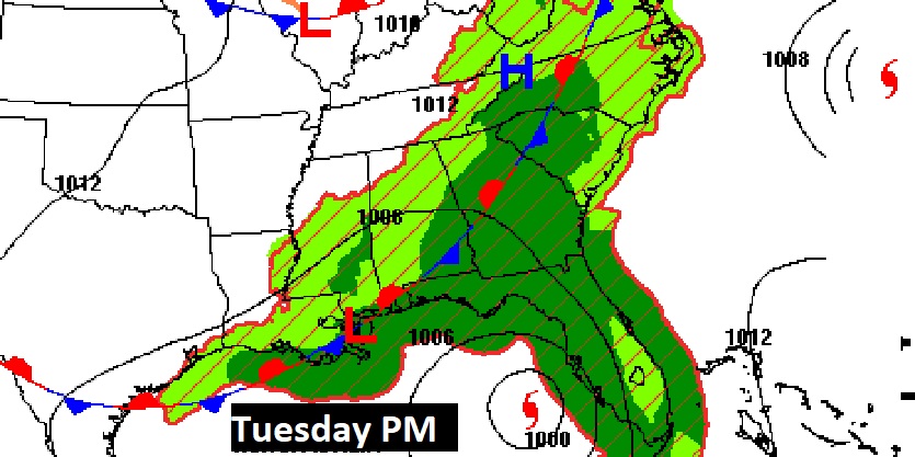
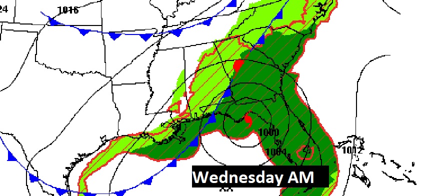
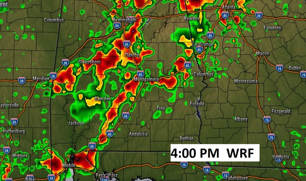
Here’s three Hi-res Model views, at various times. The point is , radar will be very very active.
Marginal Severe Risk. Damaging wind gusts are the main risk.


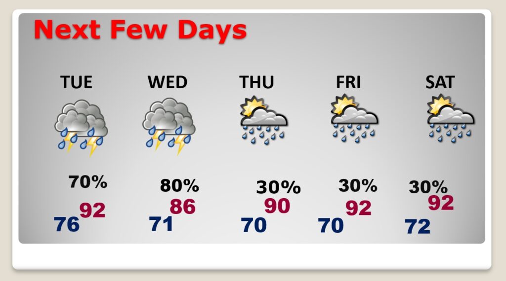
NEXT FEW DAYS: Showers and storms be much more numerous through Wednesday. Storms will be scattered and less numerous Thursday through Saturday. Highs in the 80’s Wednesday. Lower 90’s return late week.
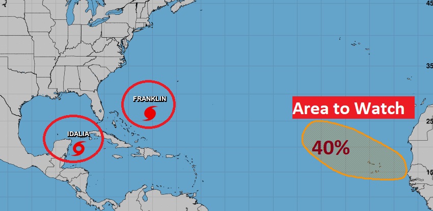
TROPICAL UPDATE: Obviously, the big story is IDALIA. Complete details below. Here’s a the wideshot of the Tropics. Hurricane Franklin is now a MAJOR hurricane with 115 MPH wind. There’s an area to watch in the far east Atlantic.
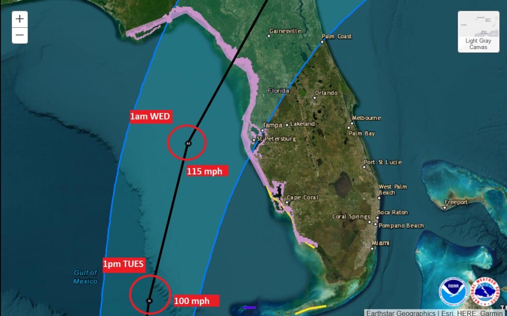
Idalia’s winds have reached 65 mph. It will become a hurricane today. It may undergo rapid intensification in the warm Gulf waters. It’s now forecast to become a Major Cat 3 hurricane late Tuesday night before likely landfall somewhere along the NE Florida Gulf coast Wednesday morning. There is a fear that the strength of Idalia may even be stronger if Rapid Indemnification takes place. Any wobble to the east would be very bad news for the greater Tampa bay area.
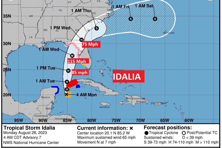
A hurricane watch covers lot of the Florida coast from roughly near Apalachicola down to near Fort Myers.
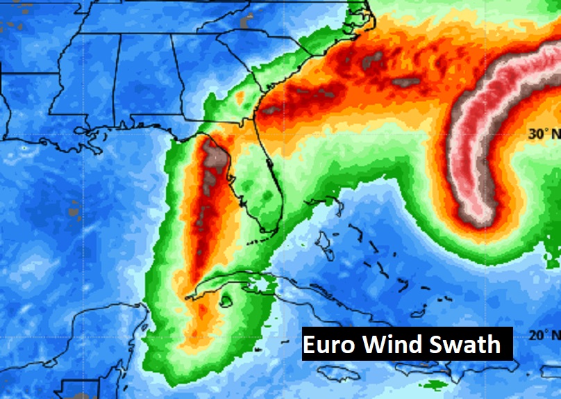
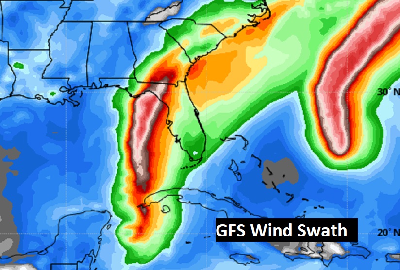
Here’s the projected wind swath from the Euro and GFS models.
Projected rainfall swath.

Thanks for reading this Blog this morning! This morning we are LIVE on the radio from 6 to 9 on NewsTalk 93.1. I’ll have another update for you in the morning. Have a nice day!
–Rich