
Good Morning! As we continue to closely monitor Hurricane Idalia in the Gulf, today’s stormy weather in Alabama is not associated with Idalia. Yesterday radar was very active. There were multiple warnings. Today storms will be scattered to numerous again. Some could be quite strong, along a stalled front draped across south Alabama. The number of storms will start to thin out starting Wednesday evening, and late week. Idalia will have little direct impact on our weather, except to rob some of the available moisture for storms from our area by late week, in it’s wake. This will be a day of rapid intensification in the Gulf, and Idalia is expected to be a major hurricane by landfall Wednesday morning, somewhere along the northeast Gulf coast of Florida. Catastrophic storm surge is the greatest fear, besides the intense winds. Another potential “I” storm disaster. Here’s my brief forecast discussion.
TODAY: Today’s high temperature will be held down some by clouds and showers. Heat index 100-106. Scattered to numerous storms, especially in the afternoon and evening. Some storms could be strong. Low tonight 73.
A frontal system parked over south Alabama will help be the focus for widespread storms today and Wednesday.
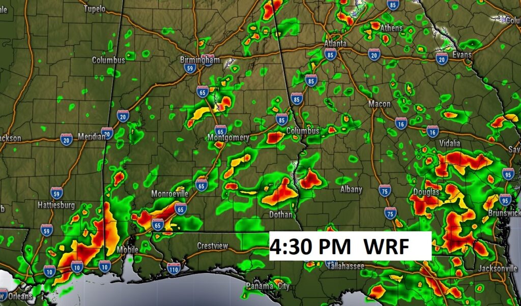
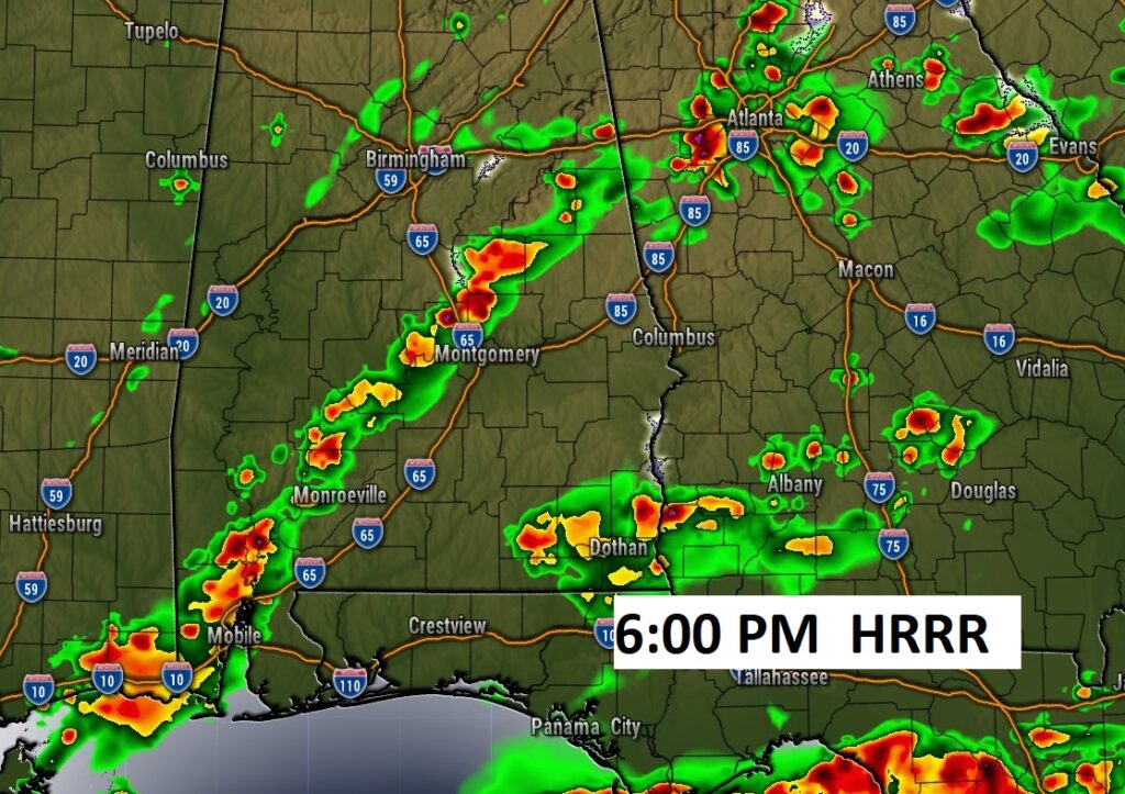
Here’s a couple of Future Radar snapshots late this afternoon and early this evening. Again today, some storms will be quite strong with gusty winds, prolific intense lightning and torrential downpours.
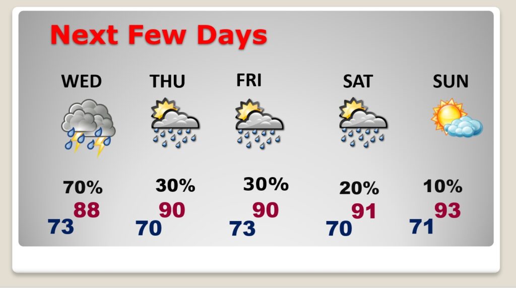
NEXT FEW DAYS: Scattered to numerous storms Wednesday, especially south of the front in south Alabama. Storms will be less numerous Thursday through Saturday. Highs in the upper 80’s Wednesday. Lower 90’s return late week.
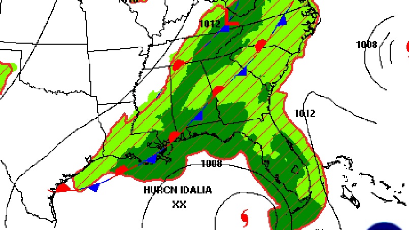
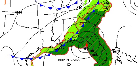
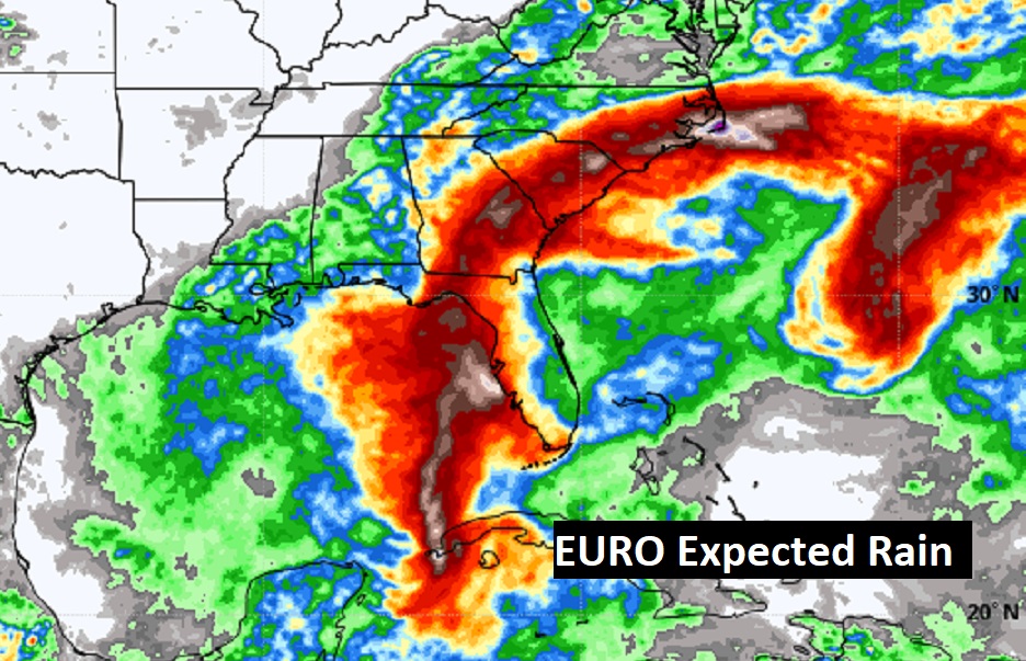
Notice the heavy rain associated with Idalia will bypass Alabama.
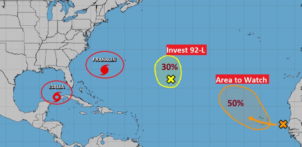
TROPICAL UPDATE: Obviously, the big story is IDALIA. Complete details below. Here’s a the wide shot of the Tropics. Cat 4 Hurricane Franklin is a monster in the Atlantic. Huge ocean swells are assaulting the beaches along the US East Coast. Also in the Atlantic is Invest 92-L and an Area to Watch in the far east Atlantic.
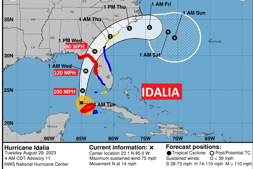
4:00AM CDT BREAKING NEWS: Idalia is now officially a HURRICANE with 75 MPH winds, located 85 miles north of the western tip of Cuba, moving north at 14. Expected to undergo Rapid Intensification today, and become a major Hurricane. Catastrophic Storm Surge up to 12 feet is possible at landfall. Here’s the complete NHC 4AM Public advisory.
https://www.nhc.noaa.gov/text/refresh/MIATCPAT5+shtml/290856.shtml?
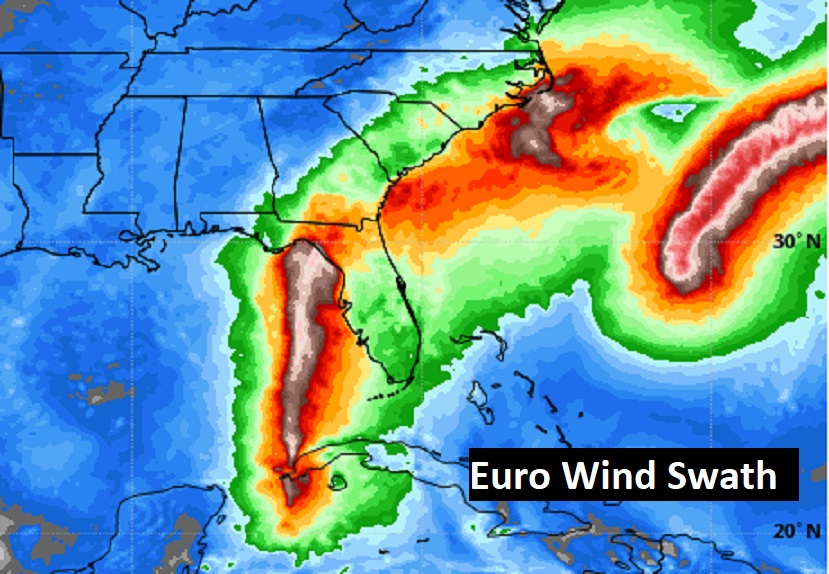
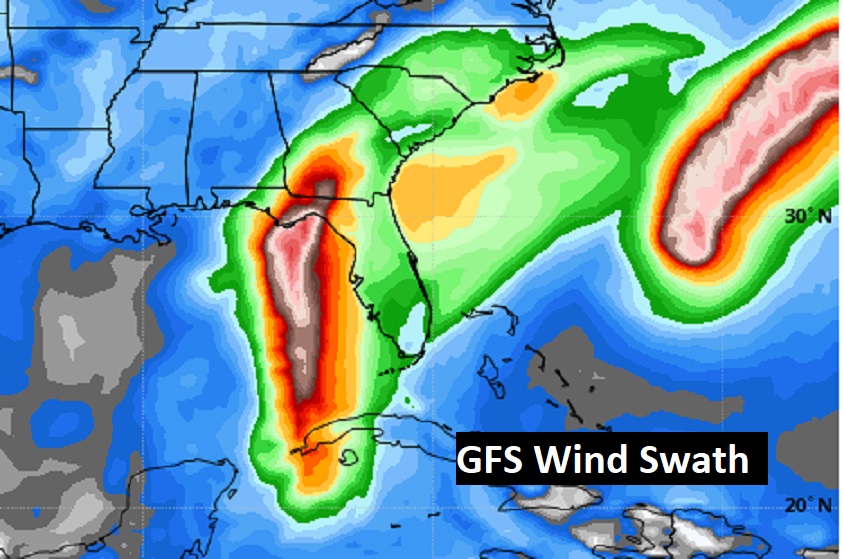
Here’s the projected wind swath from the Euro and GFS models.
Thanks for reading this Blog this morning! This morning we are LIVE on the radio from 6 to 9 on NewsTalk 93.1. I’ll have another update for you in the morning. Have a nice day!
–Rich