
Good Morning! Drama builds as Monster Historic Cat 4, 130 mph, Idalia grows stronger and approaches landfall along the northeast Florida Gulf coast this morning. Perhaps the center will cross the coast close to Cedar Key, but Idalia’s effects will be wide ranging across the Southeast US. Outer clouds from the hurricane will circulate into the area today. But, in general, the Hurricane will tend to rob moisture from our area. So, the rain chance today is lower. Scattered storms perhaps. Isolated storms at best Thursday. The Labor Day weekend for us will be rather routine. In fact, Sunday and Labor Day Monday look dry at the moment. Here’s my brief forecast discussion.
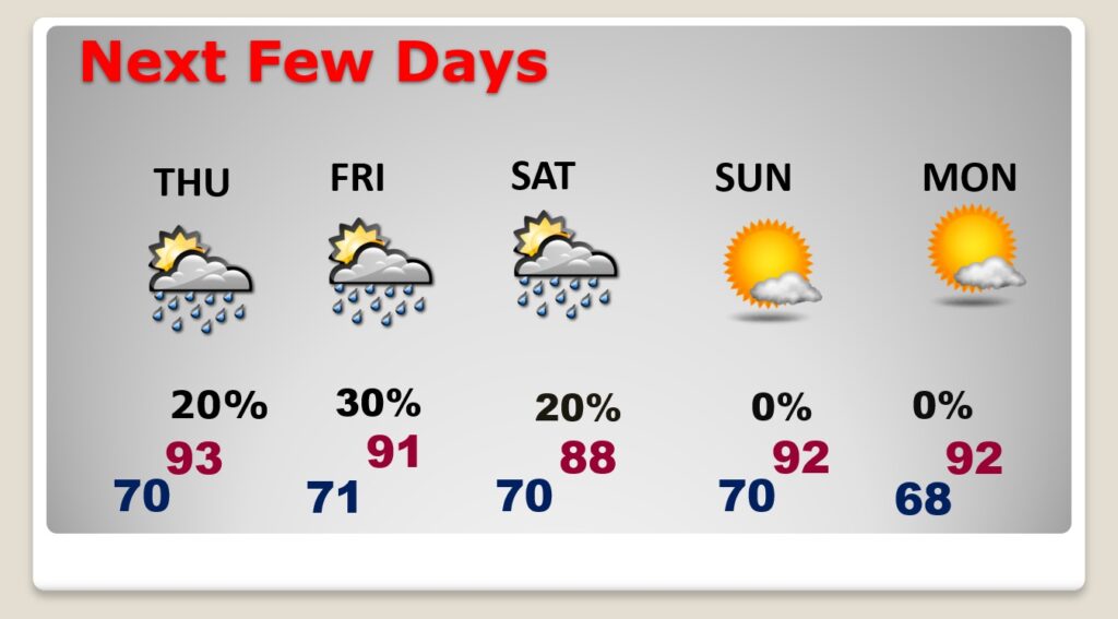
TODAY: Outer clouds from the hurricane will circulate into the area. But, in general, the Hurricane will tend to rob moisture from our area. So, the rain chance today is lower. Scattered storms perhaps. You could argue that it’s the extreme western outer bands of Idalia. High today 88. Low tonight near 70.
A frontal system parked over central Alabama this morning. That front, along with a dip in the Jetstream, is the mechanism that is protecting us, and helping to steer the hurricane toward the northeast.
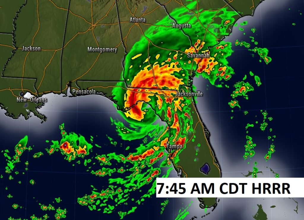
Here’s Future radar, showing a potential Landfall on Idalia at about 7:45 AM CDT/8:45 AM EDT. Wow.
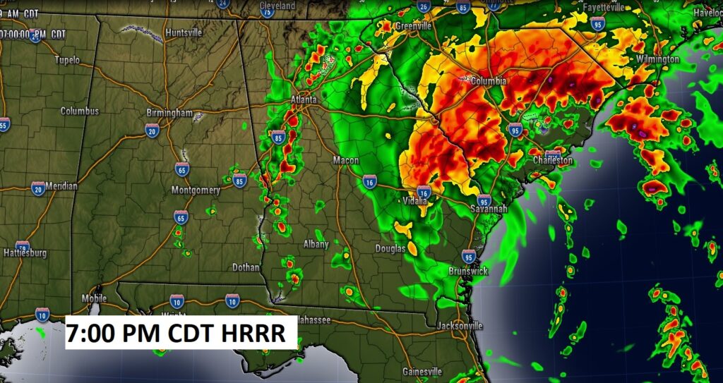
Here’s 7:00 PM tonight (CDT), with the center of the storm south of Savannah. Notice some extreme western moisture from the storm circulating into our area.
NEXT FEW DAYS: The subsistence around the hurricane will rob moisture from us. Storms will be less numerous Thursday through Saturday. Highs mostly in the low 90’s. We should be mostly dry Sunday and Labor Day Monday.
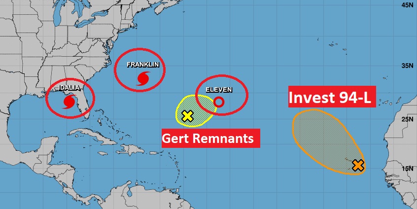
TROPICAL UPDATE: Obviously, the big story is IDALIA. Complete details below. Here’s a the wide shot of the Tropics. Cat 4 Hurricane Franklin is a monster in the Atlantic. Huge ocean swells are assaulting the beaches along the US East Coast. Also in the Atlantic, NHC is tracking Tropical Depression 11. Plus, there is Invest 94-L and an Area to Watch
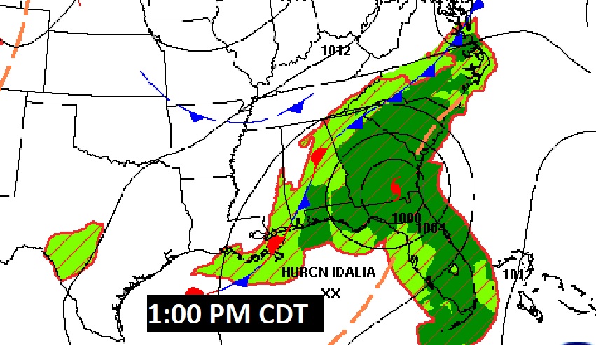
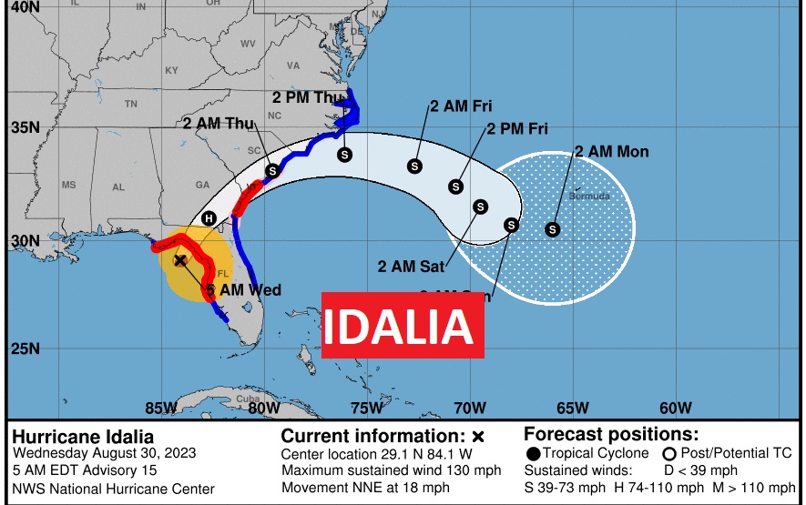
HISTORIC MONSTER IDALIA: This will be OLD news when you read this. Everything I’m about to tell you is true as of 4:00AM CDT. Monster Historic Powerful Idalia continues to intensify, to historic proportions. This will be the all-time most powerful storm to affect the northeast Florida Gulf coast, as far as intensity and especially storm surge. Also, this Hurricane is having a major impact on the Tampa Bay area. It will be significant in places like Tallahassee, south Georgia and the Carolinas.
At 4:00 AM: Idalia has reached Cat 4 status with 130 mph wind…now perhaps 4 hours from landfall.
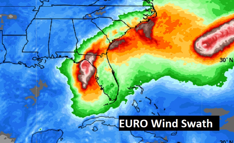
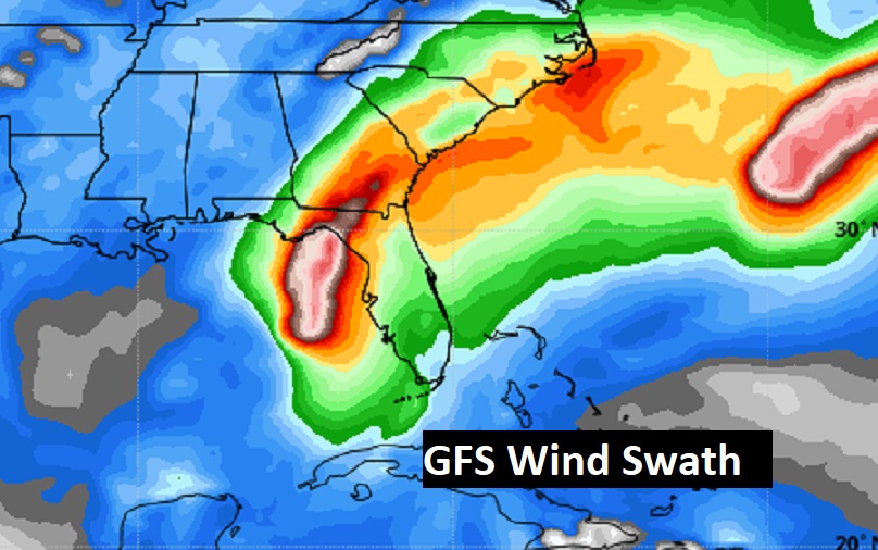
The GFS and EURO wind swaths.
Thanks for reading this Blog this morning. This morning we are LIVE on the radio from 6 to 9 on NewsTalk 93.1. I’ll have another update for you in the morning.
–Rich