
Good Morning! On Friday much of Alabama was drenched. Many towns had 1”+. Some spots had as much as 6”! Today, Saturday will be a different story on this first big tailgating day of the Football year. Showers & storms will be widely scattered, with highs in the 80’s. Sunday and Labor Day Monday look Sunny and Dry. Much of next week looks dry and hotter. Unfortunately, down on the coast – torrential downpours are a good bet through Sunday. Storms will thin out a bit on Labor Day. The Tropics are very but there’s nothing to worry about through the holiday weekend. Have a nice holiday weekend!
TODAY (Sunday): Welcome to Football season. Thousands will be tailgating today. Showers and storms will be widely scattered in nature. Few and far between. Highs held down to the mid 80’s. Low tonight 70.
Here’s a couple of Future Radar snapshots. Vastly different than yesterday. Widely scattered showers.

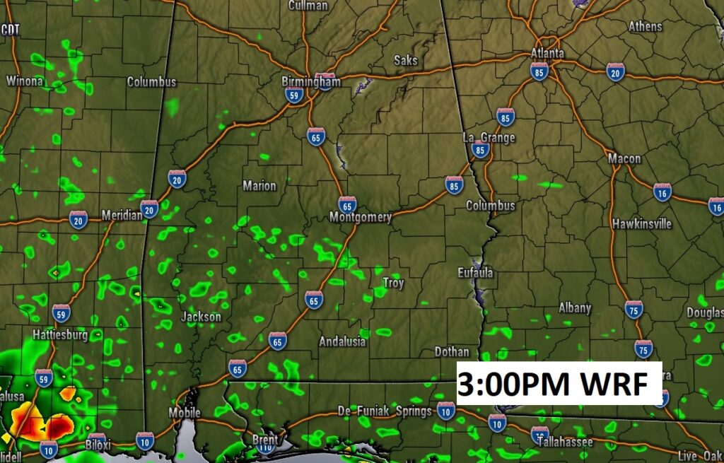
However, the Beach will get drenched. Low pressure moving along a stalled front will keep the coast very wet through Sunday.

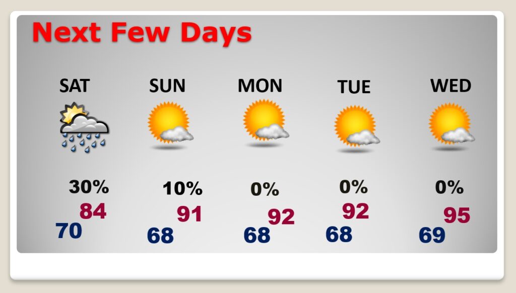
NEXT FEW DAYS: It’s a rather routine Holiday weekend forecast. Widely scattered storms Today. Mainly dry Sunday, Labor Day Monday and Tuesday. Near 90 to low 90’s Sunday through Tuesday. Mid 90’s by Mid-week.
BEACH FORECAST: Unfortunately, down on the coast – torrential downpours are a good bet through Sunday. Storms will thin out a bit on Labor Day. Moderate Rip Current Risk.

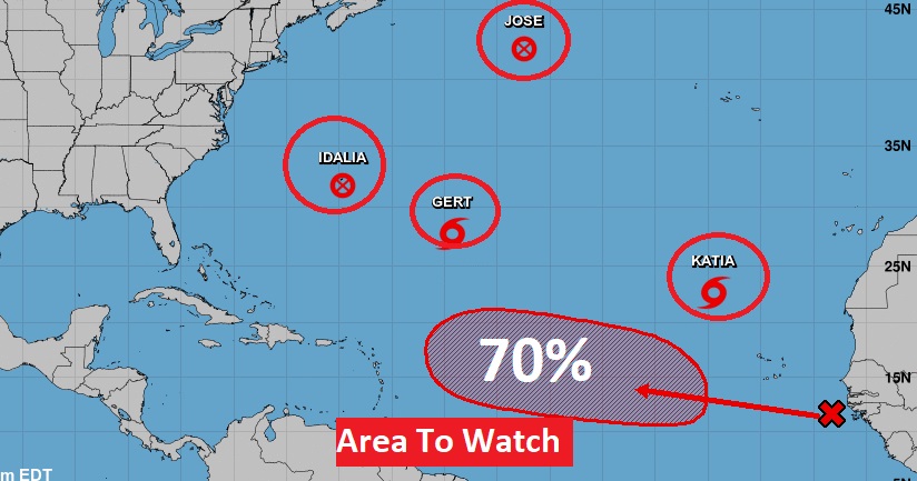
TROPICAL UPDATE: The tropics are busy. There are 4 named systems. I’m not going to say anything about them, because they are not going to impact land. That area to watch in the far east Atlantic is more interesting. Several days down the line, this could be something to watch for the Bahamas and the Southeast US. The next available name on the list is Lee.
Thanks for reading this Blog this morning. Have a nice holiday weekend.
–Rich