
Good Morning! …Kind of a slimmed-down, Holiday edition of the Blog on this Labor Day.. It’s a good forecast. We’ll be in the lower 90’s today. It’s another dry/storm-free forecast for today and the next few days. Great grill-out weather today. This week will gradually get hotter and hotter. Expect mid 90’s by mid week and perhaps upper 90’s by Thursday. Widely scattered storms will return Thursday through Saturday. There are several features in the Tropical Atlantic, but only one worth talking about. Invest 95-L is worth watching. Details below.
TODAY: A good Labor Day holiday forecast. Much like yesterday. A sun/cloud mix. Dry. High 93. Light wind. Partly cloudy tonight. Low near 70.
NEXT FEW DAYS: This week will gradually get hotter and hotter. Expect mid 90’s by mid week and perhaps upper 90’s by Thursday. Widely scattered storms will return Thursday through Saturday.
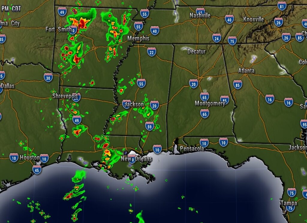
Today we’re dry. Best chance of showers/storms will be west of Alabama.
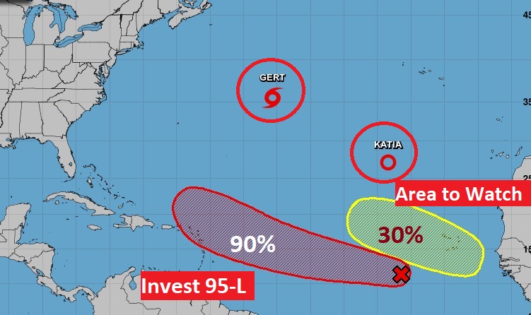
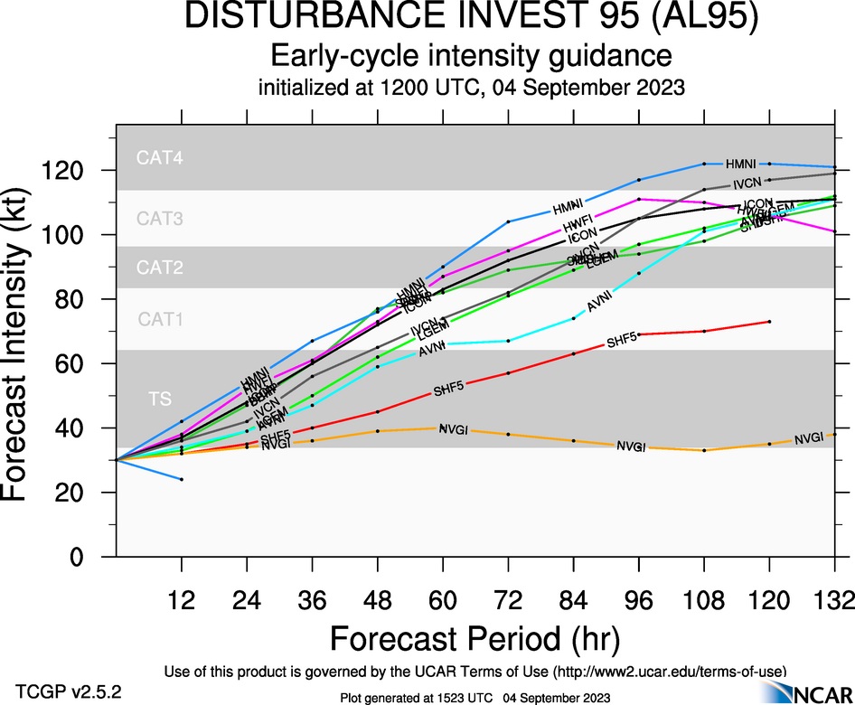
TROPICAL UPDATE: There’s two named systems in the Atlantic and one Area to Watch, But, it’s Invest 95-L which is most interesting, It’s worth watching. Very good chance it will be a future hurricane. Next available name is Lee. Could it threaten the Bahamas and/or the eastern US in several days? Too early to say.
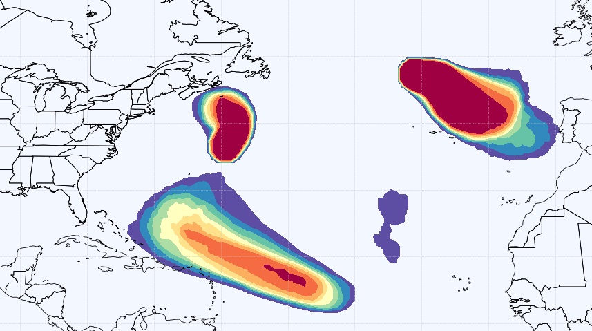
Here’s the EURO Tropical Storm Probability out 10 days.
Here’s the GFS Ensemble tracks on Invest 95-L.
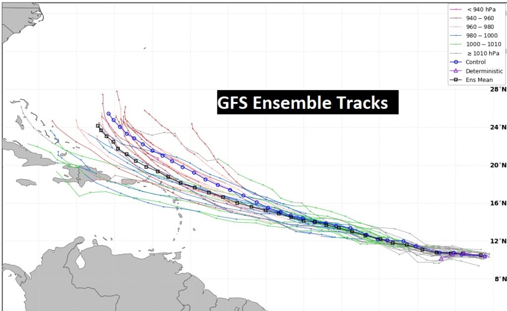
Not only is it’s future track interesting, take a look at future model intensity. The next available name is Lee.
Thanks for reading this Blog this morning. There will be a FULL update in the morning. Have A Nice Labor Day!
–Rich