
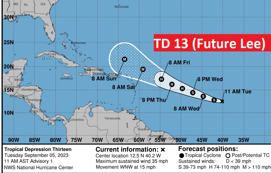
Not only do we have a new Tropical Depression 13, it is destined to become a Major Hurricane north of the islands by Saturday. Saw Hello to the future #LEE.
Good Morning! Labor Day has passed, but summer hangs on. This afternoon the heat index will tease 100. Mid 90’s are in the cards for Wednesday and Thursday. Most of the week ahead looks rather dry. But, there’s a small chance of showers Thursday as a weak frontal system approaches. Drier air will follow front by Friday & Saturday. Out in the Tropics there’s Invest 95-L. It’s likely to eventually become Hurricane Lee. It could become a major hurricane. Could Lee threaten land? I have the latest models trend in the blog below. Have a nice day! Here’s my brief forecast discussion.
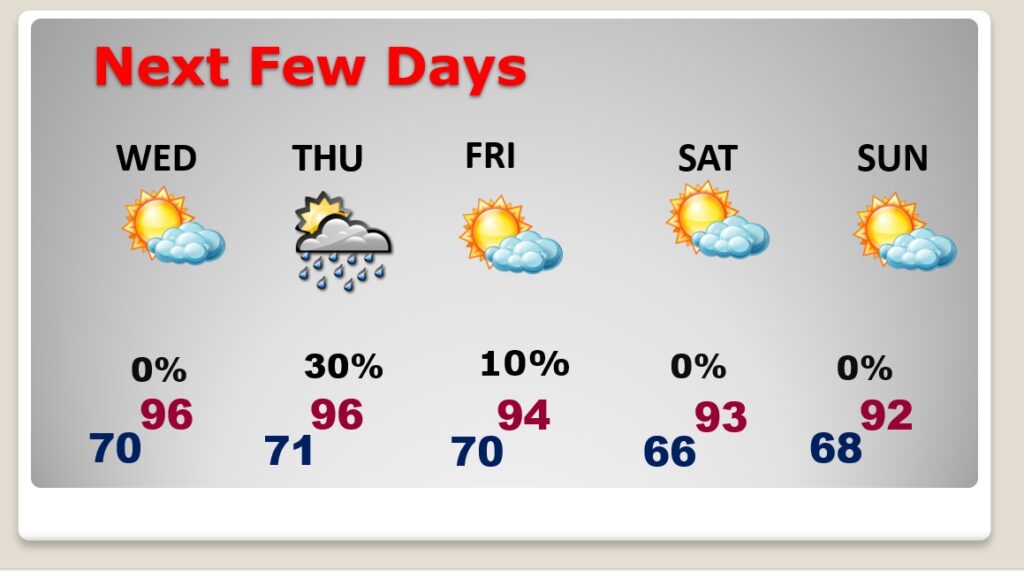
TODAY: Mostly sunny & Hot. High 94. Heat index will get close to 100. SE wind 5 to 10. Mainly clear tonight. Low near 70.
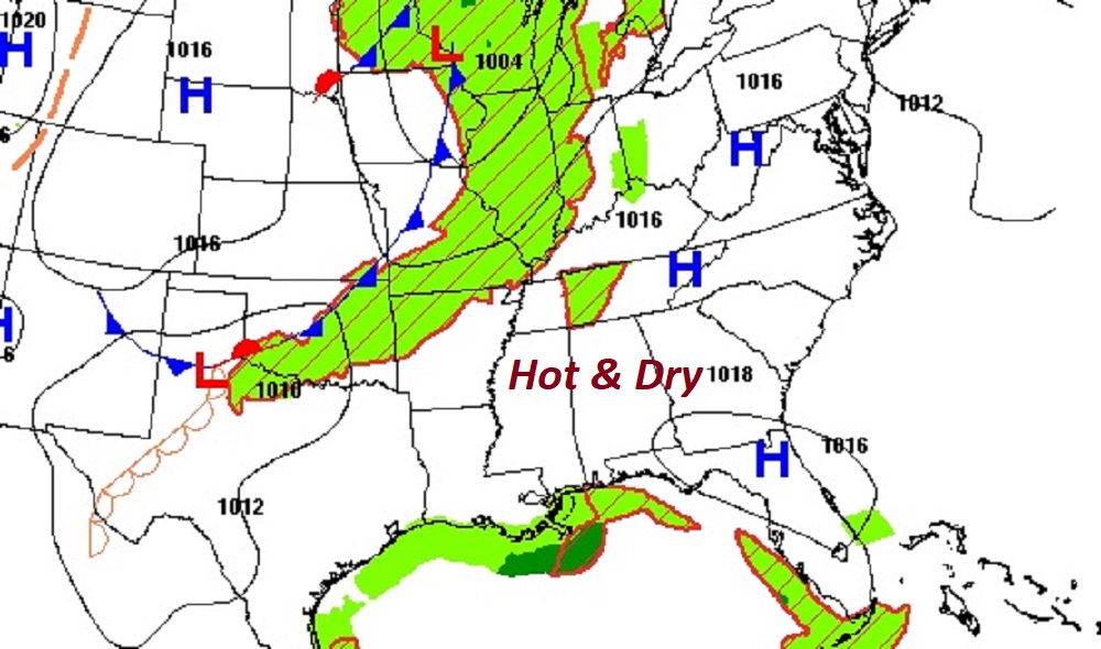
NEXT FEW DAYS: The Hottest days of the week are likely to be Wednesday and Thursday. Temperatures will be down just a notch Friday through Sunday behind a front. Widely scattered storms are possible Thursday. Otherwise, it’s a dry forecast.
An approaching front will bring a small rain chance Thursday.

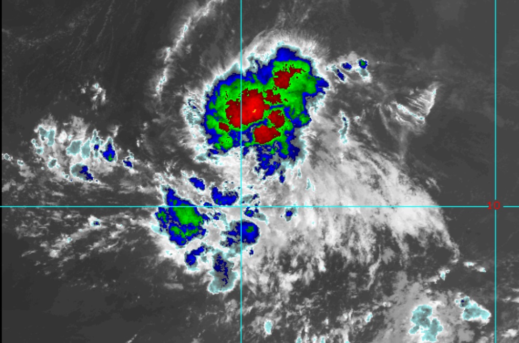
TROPICAL UPDATE: There are currently three features in the east Atlantic.
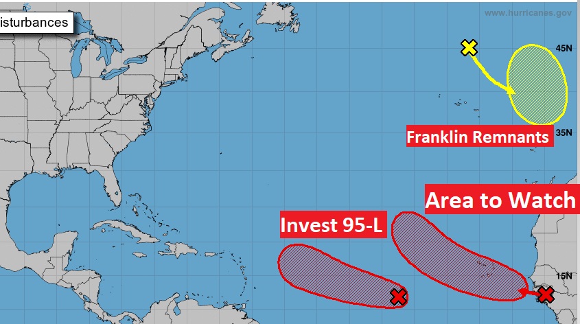
There’s only one we’re going to talk about. Invest 95-L. It’s likely to become a DEPRESSION soon. Eventually it will become a Hurricane. The next available name is LEE.
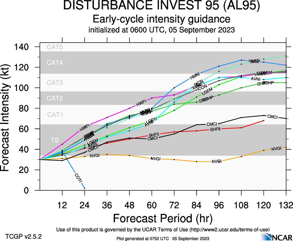
Some of the models take the Future Lee to Major Hurricane Status.
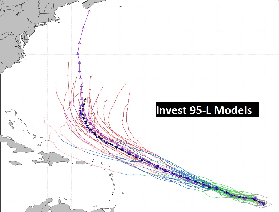
Yesterday there was some concern that this system could threaten the Bahamas and maybe even the Southeast US. Now, the major global models curve this system into the Atlantic. Here’s the GFS Ensemble member tracks.
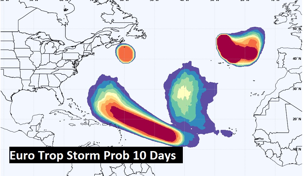
The Euro Tropical Storm Probability out 10 days.
Thanks for reading this Blog this morning! This morning we are LIVE on the radio from 6 to 9 on NewsTalk 93.1. I’ll have another update for you in the morning. Have a nice day!
–Rich