
Good Morning! Summer heat rolls on. Monday was hot, with 94 and a Heat Index 100. We will be in the same boat today. Random scattered storms will dot the radar screen today as Wednesday, with a southward moving front. Good luck. Not every town will get wet. Behind the front there will be a little heat relief on Thursday and Friday, as high temperatures roll back to the 80’s. The best news is, there’s no big ticket weather to worry about. There’s still a heap of Tropical trouble in the Atlantic. The jury is out on what direct impact Lee could have with the Northeast Unites States coastline later this week. But Lee could almost certainly wallop coastal Atlantic Canada. I have a complete tropical update below. Here’s a brief forecast discussion.
TODAY: Mostly sunny. Another hot day. High near 94. Rain chance a little better today, this evening and Wednesday, with that front acting as a focus. Light wind. Partly cloudy, risk of showers tonight. Low near 70.
An approaching weekend front could touch off a few isolated showers especially on Today and Wednesday as it moves southward.
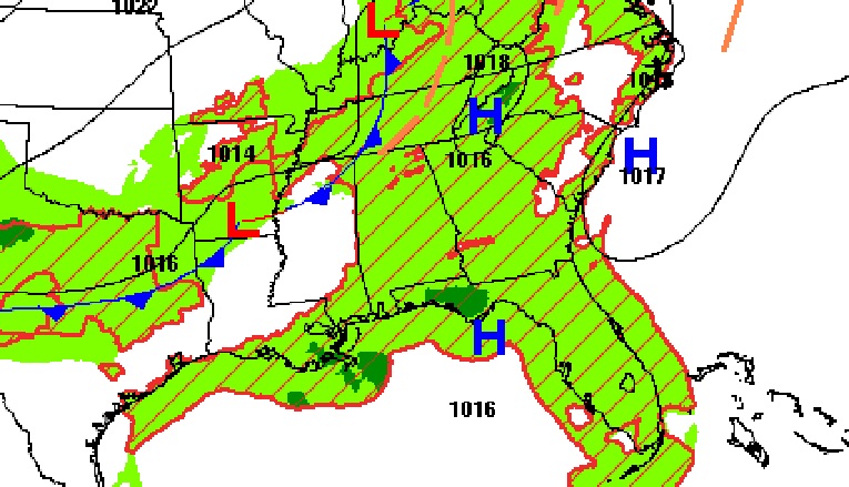
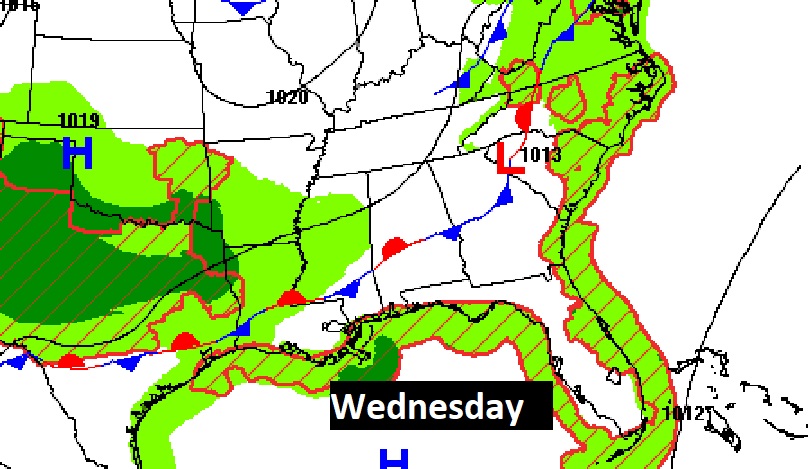
Future radar show extremely isolated storms could pop up this afternoon and this evening.
NEXT FEW DAYS: Lots of sunshine Tuesday. Small rain chance under 20%. Widely scattered storms Tuesday night into early Wednesday as a front moves through. Nicer air behind the front by Wednesday night and Thursday. Uneventful forecast. No tropical concerns for us.
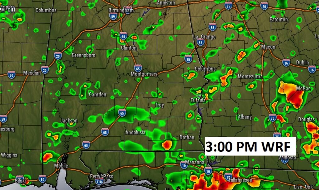
Future Radar. The WRF models shows scattered random storms this afternoon.
TROPICAL UPDATE: Yesterday was the statistical peak of the hurricane season.
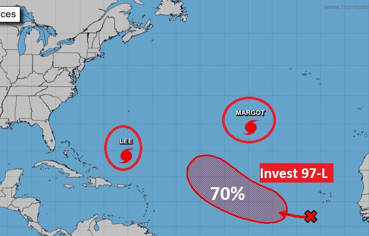
There are currently 3 features in the east Atlantic. Lee and Tropical Storm Margot. Plus, there’s Invest 97-L.
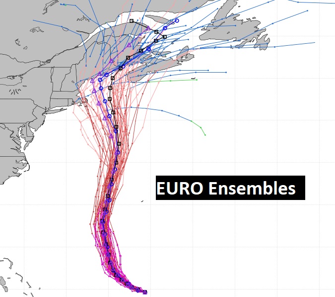
Hurricane Lee is a major Category 3 Hurricane with 115 mph winds. It has slowed down dramatically. It’s moving WNW at 7, expect to take a right hand turn to the north Look at the expected movement through Weekend. It will be taking a swing to the north. It’s exact impact on Bermuda and the eastern coast of the United States is still not completely known. Atlantic Canada could someday take a direct hit.
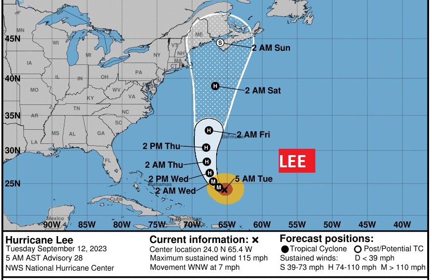
The direct danger for the eastern U.S. Coastline late next week has certainly not ended, as you can see. The Atlantic Canada and Bermuda is still in trouble.
I’m still here in Kansas City at the National Weather Association Conference. But, today is a travel day for me. I’ll have another update in the morning from Montgomery. Have a nice day.
–Rich