
Good Morning! Our great string of comfortable days and pleasantly cool nights continues. A good bit of sunshine today, mixed with some clouds. Still, tolerable humidity. Rain chance just about zero. I’ll say 10%, because of that broad circulation of that low off the SE coast. Besides that, expect a bone-dry and nice first weekend of Fall. Comfortable. Great Football Weather. A small chance of widely scattered storms returns Monday through Wednesday as a frontal system moves into the area. Here’s my brief forecast discussion.
TODAY: A Good bit of sunshine, mixed with some clouds. Still, tolerable humidity. High 86. Rain chance just about zero. I’ll say 10%, because of that broad circulation of that low off the SE coast. NE wind 6 to 12. Partly cloudy and comfortably cool tonight. Low 64.
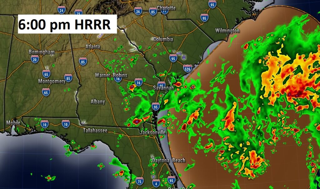
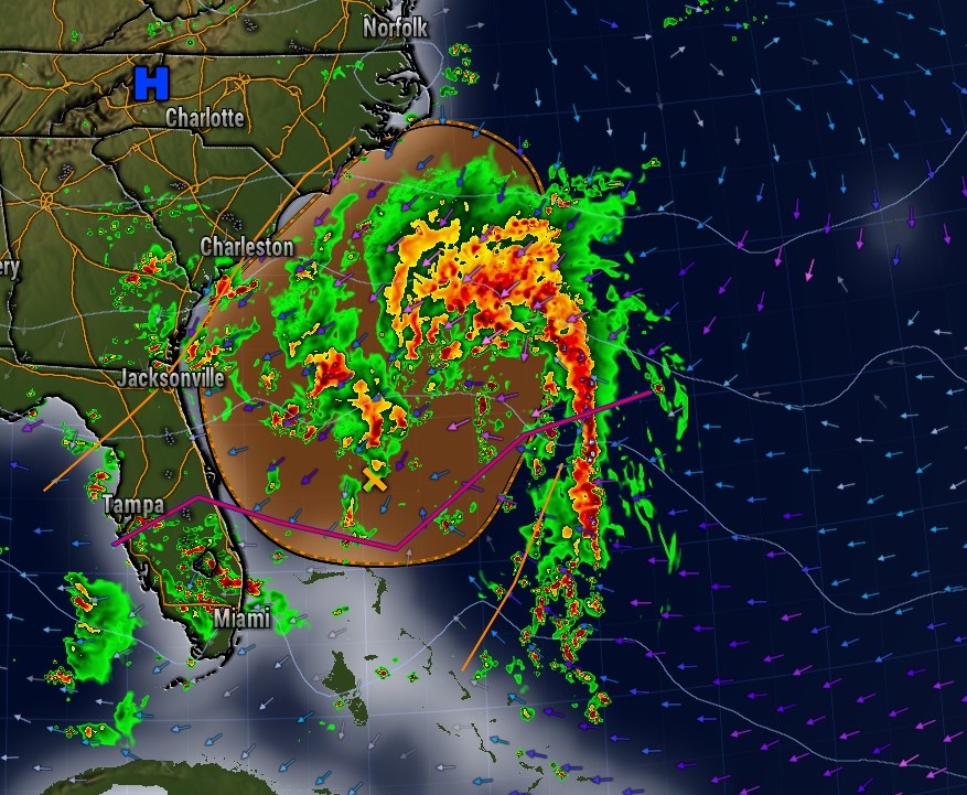
Here’s Future Radar at 6:00 PM. You see the rain around that Low Pressure Disturbance near the SE coast. Notice a couple of tiny blips on the radar in east/SE Alabama around the broad circulation. Rain chance: REMOTE.
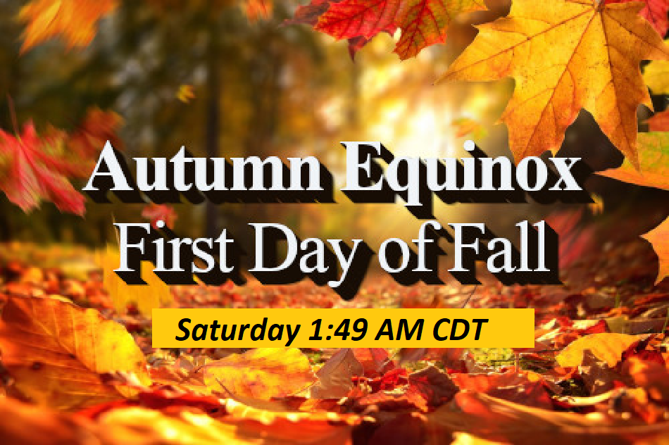
NEXT FEW DAYS: Our string of beautiful days continues. Mostly sunny through the weekend with highs in the upper 80’s and very tolerable humidity. Nights in the low 60’s. Dry and storm free. Tomorrow is the last official day of summer. Fall officially begins Saturday at 1:49 AM. The Autumnal Equinox. Small rain chance Monday , Monday night, Tuesday and into Wednesday.
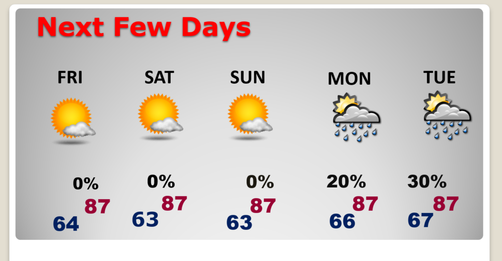
Early next week, a cool frontal system will approach. Small rain chance Monday , Monday night, Tuesday and into Wednesday.

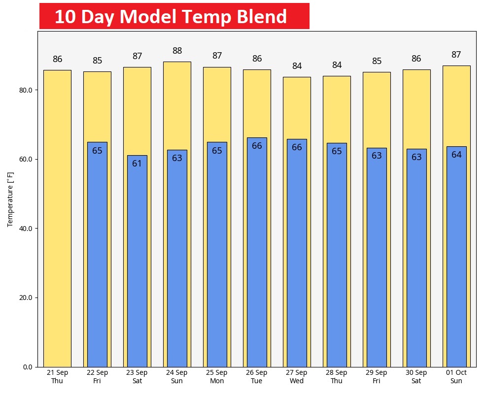
Could we be done with the 90’s? According to the 10 day model temp blend, we should stay in the 80’s daytime, 60;s at night. A delightful pattern for this part of the world.
AUTUMNAL EQUINOX SATURDAY: Friday is the last official day of summer. Fall begins in the wee hours of Saturday AM at 1:49 CDT. The Autumnal Equinox. South of the Equator it’s the first day of Spring.
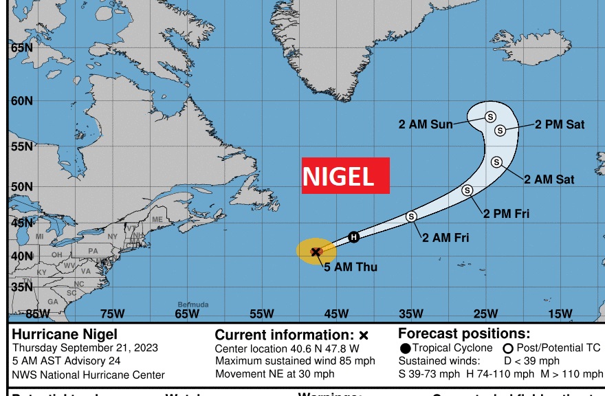
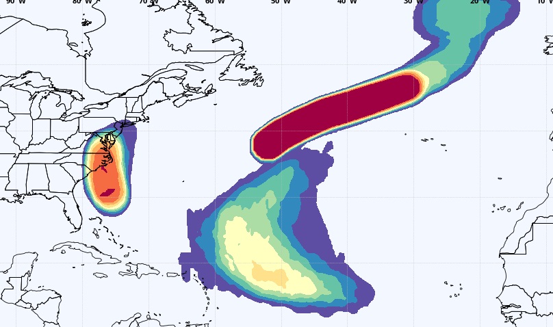
TROPICAL UPDATE: There are currently 3 features in the Atlantic, Including Hurricane Nigel. That Area to Watch off the SE US coast is worth noting. There’s also an Area to watch in the far east Atlantic. The next two available names are: Ophelia and Philippe. There are no tropical concerns in our part of the world.
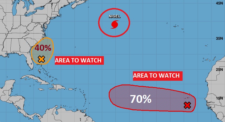
That area near the NE coast of Florida is making for a nasty day along the Florida coast and a potentially nasty weekend along the eastern US coastline as it moves northward. Right now its just a “regular” low pressure area. It could acquire some sub-tropical characteristics by tomorrow. 40% chance. But, it doesn’t matter. Wind, waves, winds, and strong thunderstorms will plague the US East coastal areas for a few days.
Hurricane Nigel is what’s called a “fish storm”. It will make the big curve into the Atlantic.
The EURO Tropical Storm Probability for the next 10 days keeps the Atlantic active. So far no Gulf concerns.
Thanks for reading this Blog this morning! Back to normal this morning. We are LIVE on the radio from 6 to 9 on NewsTalk 93.1. I’ll have another update for you in the morning. Have a nice day!
–Rich