
Good Morning! We’ve been enjoying an incredible string of nice days. This week, though, a series of disturbances will drift though the state. The risk of rain returns. We need the rain. Risk of scattered random showers & thunderstorms through Thursday. Highest rain chance of storms on Wednesday. Drier, comfortable air returns by Friday and Saturday. There’s an Area to Watch now in the southern Gulf. Nothing to lose sleep over right now. Here’s my brief forecast discussion.
TODAY: Partial Sunshine. Risk of scattered random showers & thunderstorms by this afternoon and this evening. High near 90. Not as cool tonight. Low 69.
A couple of Future Radar snapshots. The best chance of spotty showers and possibly storms will be closer to the evening hours and primarily from I-65 westward.
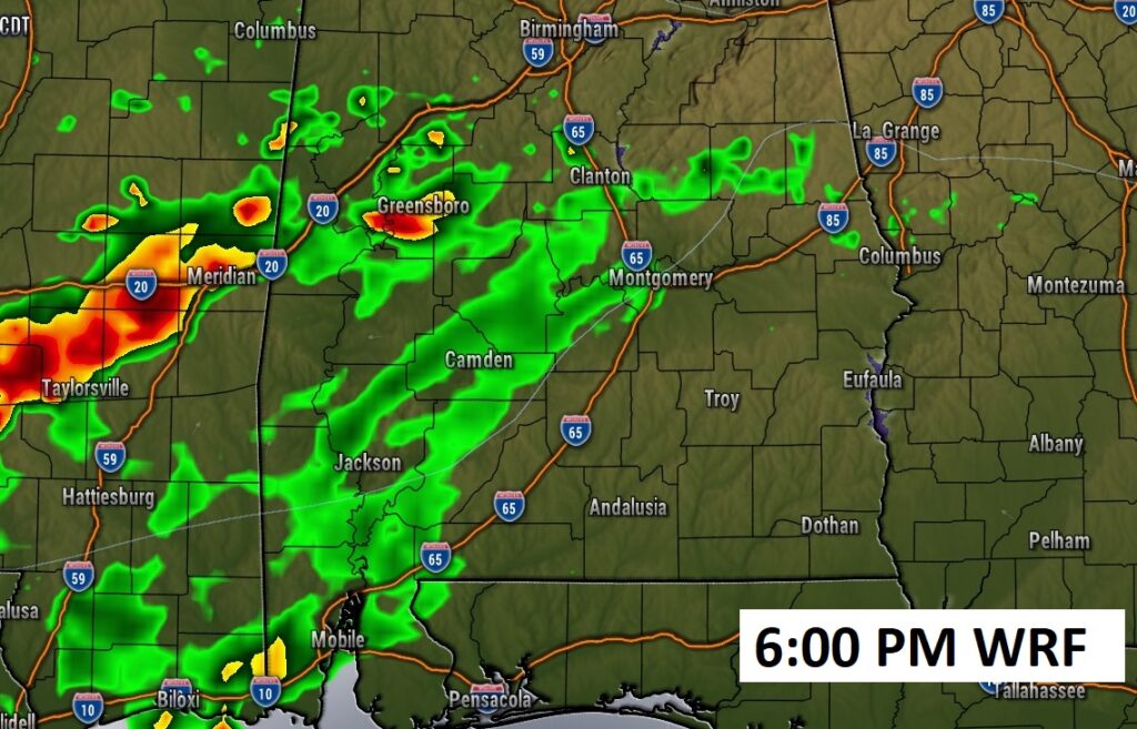
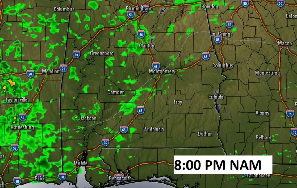
A frontal system parked over the Gulf south – with a series of eastward moving disturbances will be the driving force keeping the risk of showers and storms in our forecast for the next few days.

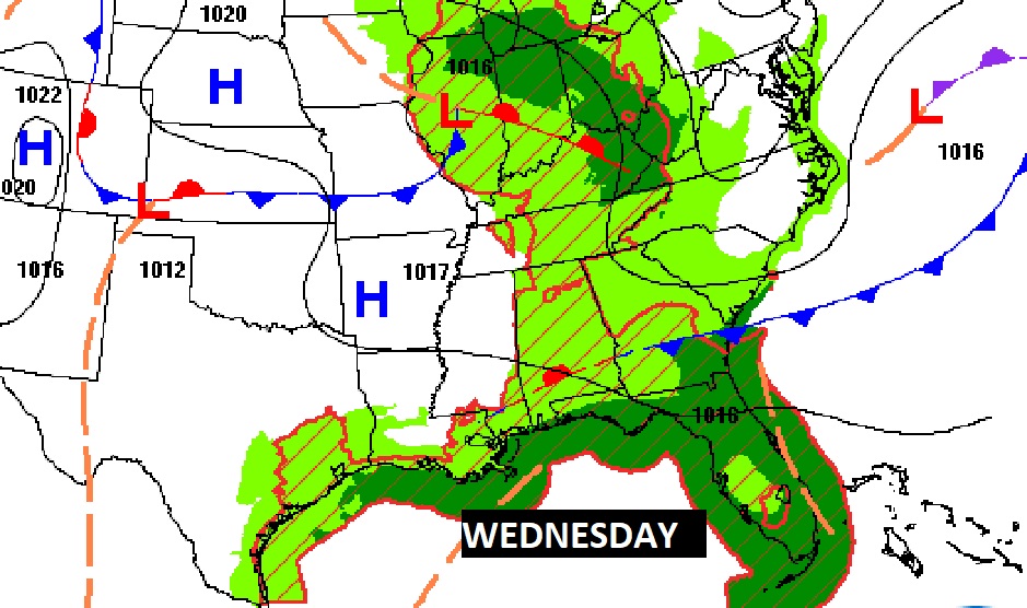
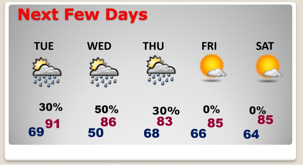
NEXT FEW DAYS: Risk of scattered random showers & thunderstorms through Thursday. Highest rain chance of storms on Wednesday. Drier, comfortable air returns by Friday and Saturday. Next weekend looks pretty nice.
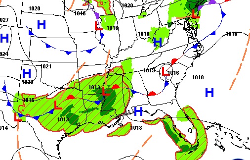
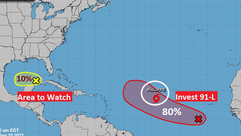
TROPICAL UPDATE: In the Atlantic there is 50 mph Tropical Storm Phillipe. A curving “fish storm”. Behind it, a Area to Watch. Someday it could become Rina. In the southern Gulf, there is an Area to Watch. A surface trough of low pressure is interacting with an upper low. Nothing to lose sleep over now, but we’ll watch it.
.
Thanks for reading this Blog this morning! This morning we are LIVE on the radio from 6 to 9 on NewsTalk 93.1. I’ll have another update for you in the morning. Have a nice day!
–Rich