
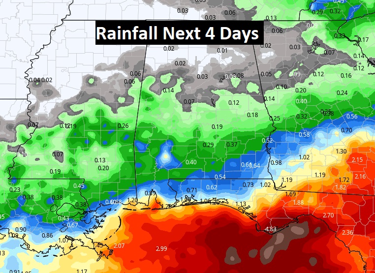
Good Morning! Fingers crossed on our rain chances over the next 2 days. We certainly need the rain. Much of south Alabama continues in a moderate to severe drought status. Yes, there will be more rain on the radar today and Wednesday, as a frontal system oscillates north and south. But the showers will be spotty. Some towns will get lucky, but, I’m afraid many towns will not get enough rain that matters this week. Wednesday and Thursday will be cooler. Friday and the weekend are looking great with come comfortable air in place. The Gulf of Mexico is quite active, but I don’t see any tropical concerns right away. Here’s my brief forecast discussion.
TODAY: Limited Sunshine. Risk of scattered random showers & thunderstorms by this afternoon and this evening. High 89. Mild tonight. Low 69.
A couple of Future Radar snapshots this afternoon. You can see why I am not too optimistic on the number of showers. Keep your expectations low.

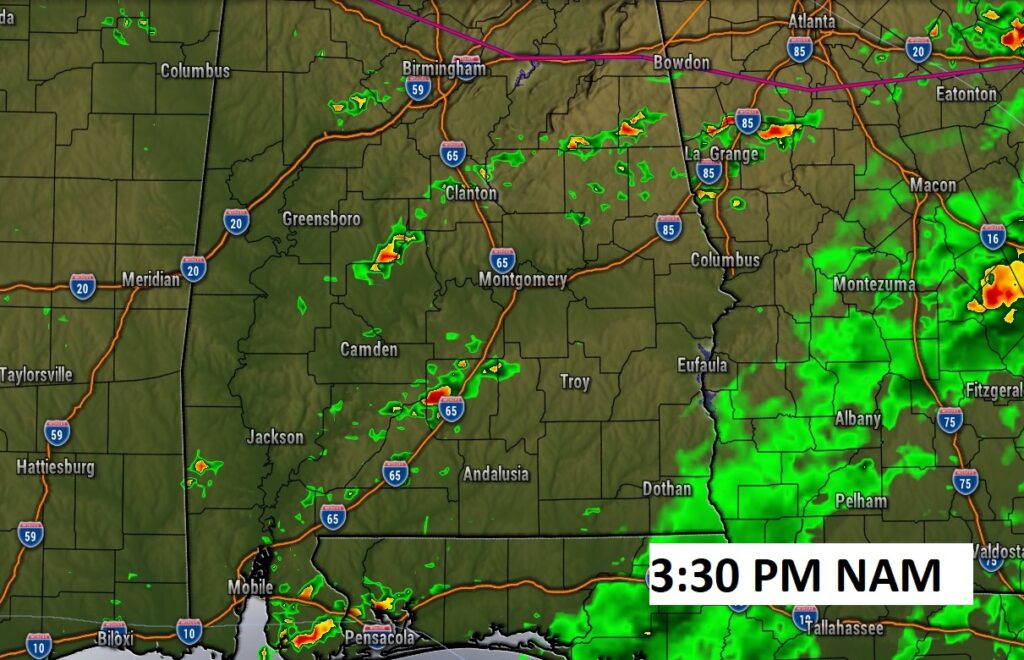
A frontal system parked over the state will continue to ocillate north and south through tomorrow.
DROUGHT MONITOR: 77% of Alabama is under some level of Drought. At least 25% of the state is in a moderate Drought level or higher. Parts of south and southwest Alabama are in a Severe or Extreme drought level.

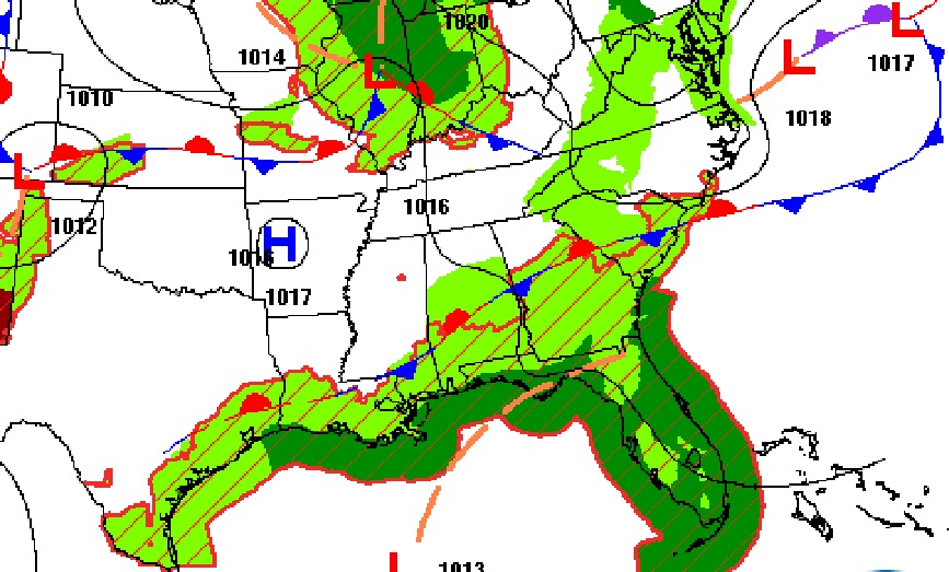
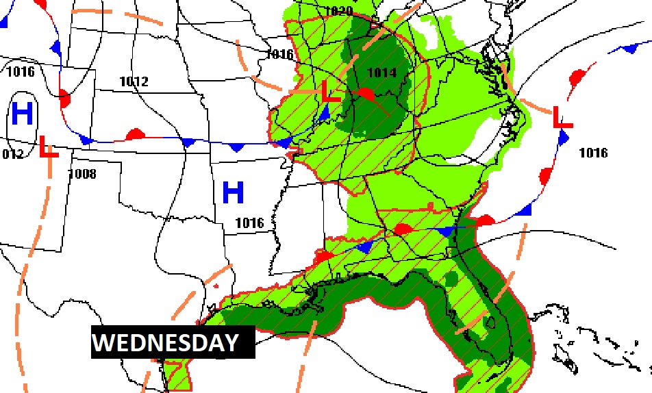
Yes, there will be more rain on the radar today and Wednesday, as a frontal system oscillates north and south. But the showers will be spotty. Some towns will get lucky, but, I’m afraid many towns will not get enough rain that matters this week. Meanwhile, where is the rain? Wow. Take a look for the Gulf coast. We’ll be watching the Gulf with great interest over the next few days. Still no signs of tropical development.
NEXT FEW DAYS: Risk of scattered random showers & thunderstorms through Wednesday. I’ve taken showers out of the Thursday forecast. I’ve taken the high temps. Down a few degrees on Wednesday & Thursday as cooler air from the east enters the eastern half of Alabama. Some really nice, comfortable air returns by Friday and Saturday. Next weekend looks pretty good right now. The Gulf of Mexico is quite active, but I don’t see any tropical concerns right away.

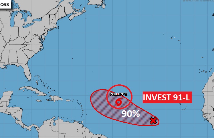
TROPICAL UPDATE: In the Atlantic there is 50 mph Tropical Storm Phillipe. A curving “fish storm”. There’s also Invest 91-L. This system has a 90% chance of development. Next name available is Rina. Neither of these systems are likely to affect the US. The Area to Watch in the Gulf is off the map for now.
.
Thanks for reading this Blog this morning! This morning we are LIVE on the radio from 6 to 9 on NewsTalk 93.1. I’ll have another update for you in the morning. Have a nice day!
–Rich