
Good Morning! Our extended warm & dry pattern continues. We need rain, but the prospects are not good. Sunshine will dominate daytime, with clear comfortable nights. We’re hopeful a Friday frontal system could bring us some spotty showers. But, it looks like the rain potential may fall apart right over us. Behind THAT front, expect to coolest air of the season, by far. Our low may be near 50 degrees by Sunday AM. No worries in the tropics right now. Get ready for the real-deal Fall air. Here’s my brief forecast discussion.
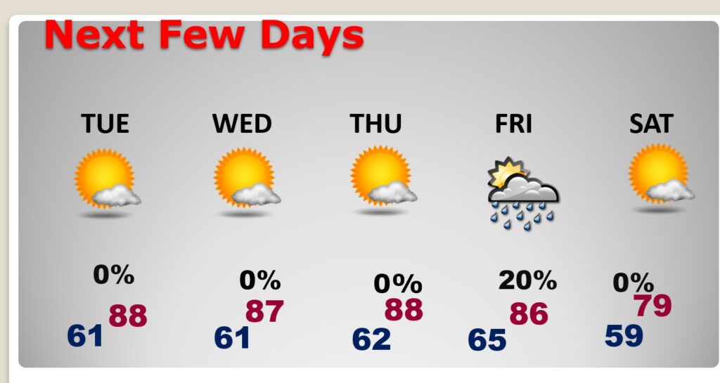
TODAY: Mostly sunny. Warm but, tolerable humidity. East breeze 5 to 10. High near 90. Mostly clear and cooler tonight. Low 61. Normals 85/61.
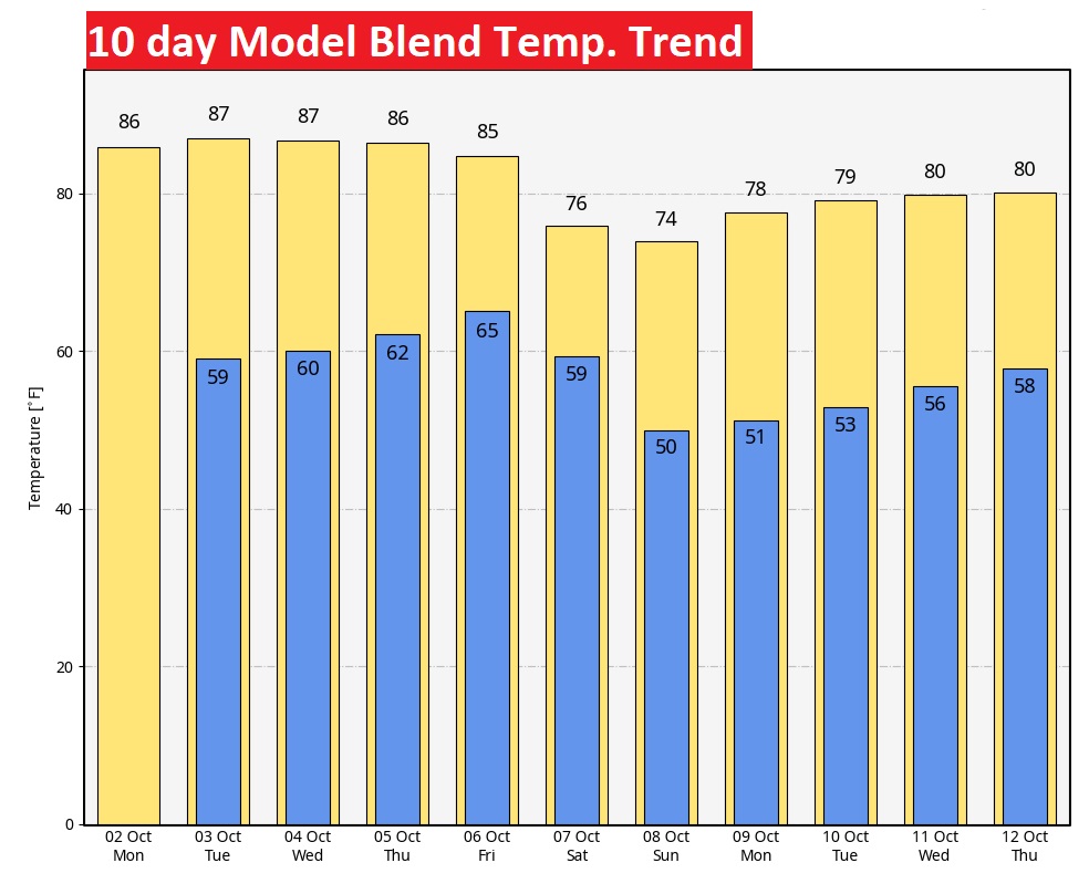
NEXT FEW DAYS: Our warm & dry pattern rolls on for several more days. Daily highs will be mainly in the upper 80’s. Low 60’s at night. Behind THAT front, expect to coolest air of the season, by far. Our low may be near 50 degrees by Sunday AM.
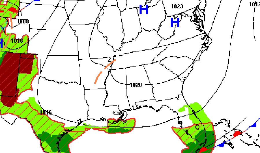
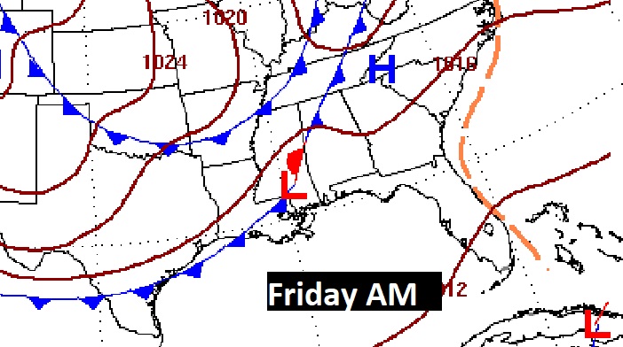
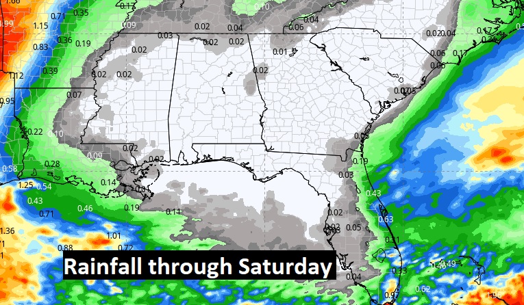
Will a late week front deliver some showers to Alabama? Looks like the rain potential may fall apart right over us. The rain prospects are not zero, but not great.
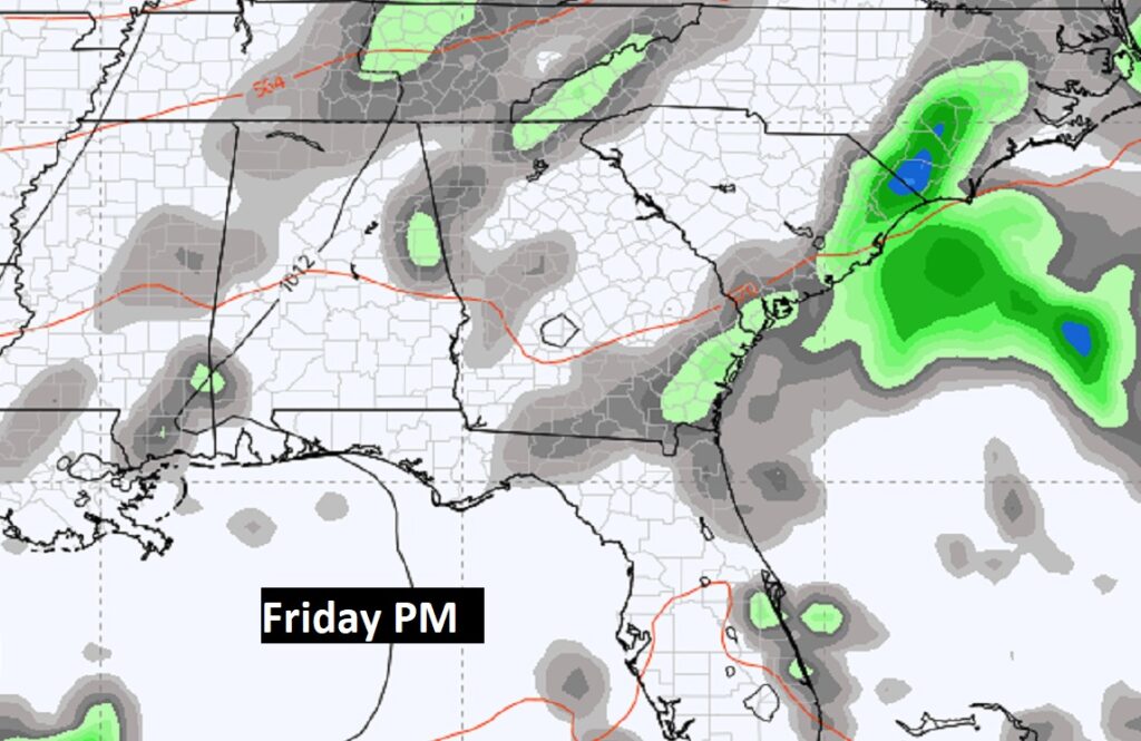
This is the Model Blend rainfall outlook through Saturday. Get out the garden hose.
Wow. That Friday cool front. Take a look at the weekend temperatures. Especially the overnight lows starting Saturday night. Get ready for the real-deal Fall air.
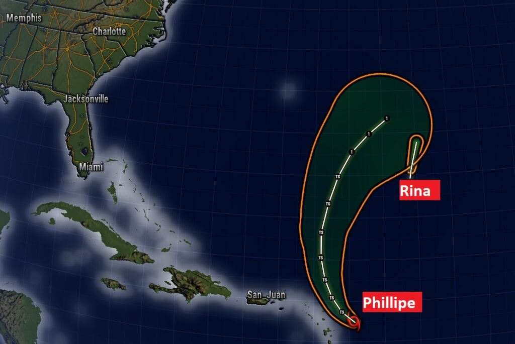
TROPICAL UPDATE: There are TWO weak systems in the Tropical Atlantic. Tropical Storm Pillipe and Post Tropical cyclone Rina. Both systems continue to struggle, and neither are expected to become a hurricane. And, neither should threaten any land areas.
.
Thanks for reading this Blog this morning! This morning we are LIVE on the radio from 6 to 9 on NewsTalk 93.1. I’ll have another update for you in the morning. Have a nice day!
–Rich