
Good Morning! Our warm & dry pattern rolls on through Thursday. A Cold Front approaches Friday. This front could bring some spotty showers to the state. The rainfall potential is not very good. Behind THAT front, expect to coolest air of the season, by far. Jacket weather nights are in our future. By Sunday and Monday morning we could be in the upper 40’s. It’ll be the first “Real Deal Fall Air” of the season so far. Here’s my brief forecast discussion.
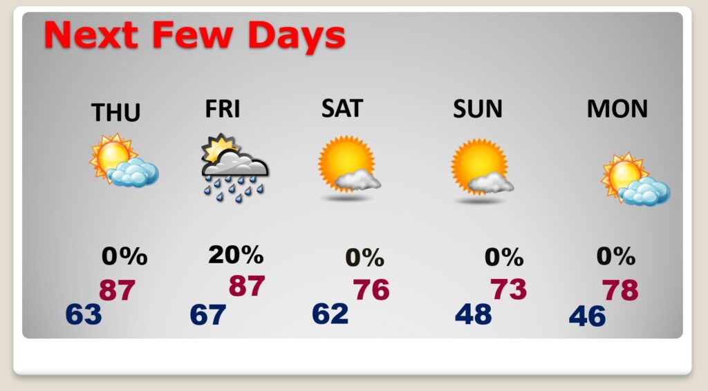
TODAY: Mostly sunny. Warm but, tolerable humidity. East breeze 5 to 10. High in the upper 80’s. Mostly clear and cool tonight. Low 63. Normals 85/60.
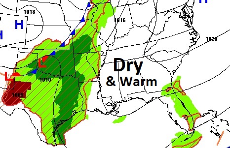
NEXT FEW DAYS: Our warm & dry pattern rolls on through Thursday. A Cold Front approaches Friday. This front could bring some spotty showers to the state. The rainfall potential is not very good. Behind THAT front, expect to coolest air of the season, by far. Jacket weather nights are in our future. By Sunday and Monday morning we could be in the upper 40’s. Big change on the way…
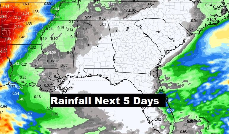
Cold Front approaches Friday. This front could bring some spotty showers to the state. Rain chances are not great, but not zero.
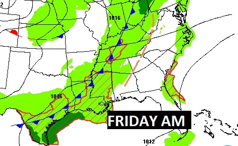
Rainfall with the front will be spotty at best.
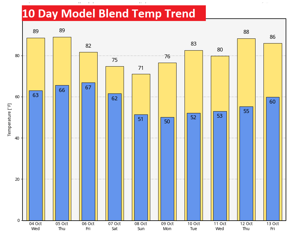
The Ten Day Model Temperature Blend looks pretty exciting. Look at those weekend highs and lows. Upper 40’s by dawn Sunday and Monday.
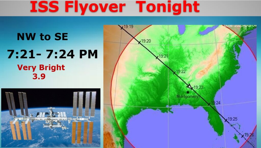
SPACE STATION FLYOVER TONIGHT: There is a particularly good ISS Flyover early this evening, very bright and straight overhead. Look in the northwest sky at 7:21. It will head southeast and fly straight overhead. 3.9 magnitude is about as bright as any flyover. Weather will be perfect. Enjoy! It never gets old. #alwx
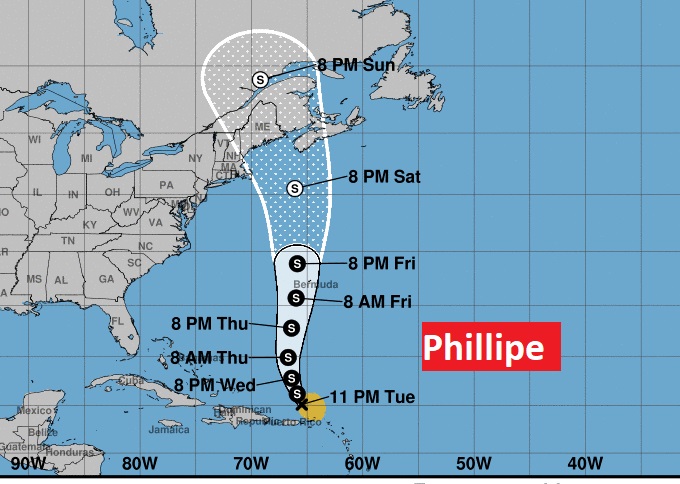
TROPICAL UPDATE: The only Tropical feature on the map right now is 45 mph Tropical Storm Phillipe. Phillipe could possibly interact with the New England coast by Sunday as a tropical depression.
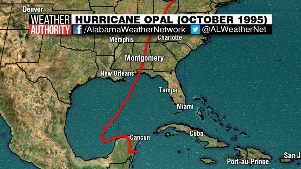
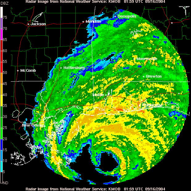
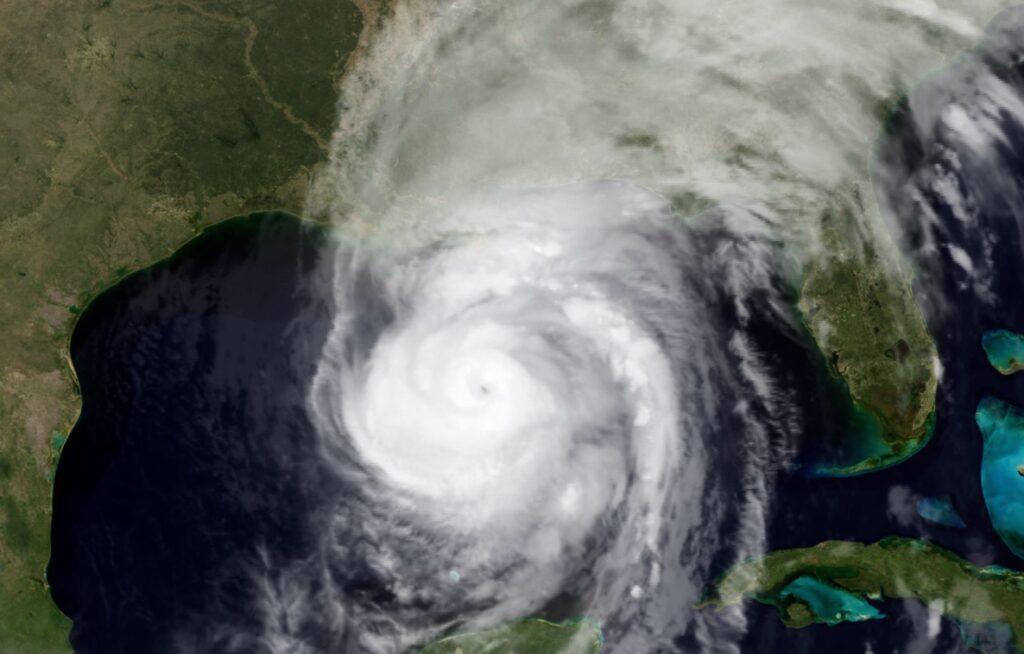
HURRICANE OPAL ANNIVERSARY: On this day in 1995, powerful Cat. 3 Hurricane Opal came ashore near Destin in the afternoon and then quickly moved northward through the heart of Alabama. It was still a full fledge hurricane over Montgomery at 10PM, with wind gusts to 90+ mph at MGM and Maxwell AFB. There were widespread power outages lasting several days. Thousands of trees came down.


Thanks for reading this Blog this morning! This morning we are LIVE on the radio from 6 to 9 on NewsTalk 93.1. I’ll have another update for you in the morning. Have a nice day!
–Rich