
Good Morning! Temperatures around the Southeast US continue well below normal. Yesterday, we didn’t make it out of the 60’s, with a stiff NW breeze. Today we’ll tack on a couple of degrees. Not as breezy. Nice weather continues at least through Wednesday, with middle 70’s. Clouds increase Thursday. But, showers and storms should hold off until the late night/overnight hours Thursday night through mid-day Friday as a Cold Front approaches. A secondary cool front arrives Friday night. Behind the front, it looks like we’re in for another nice weekend. Here’s my forecast discussion.
TODAY: Partial sunshine in the morning.Otherwise, a good bit of sunshine. Not as cool. Hi 71. NW wind at 5-10 mph. Mostly clear, chilly tonight. Low 46.
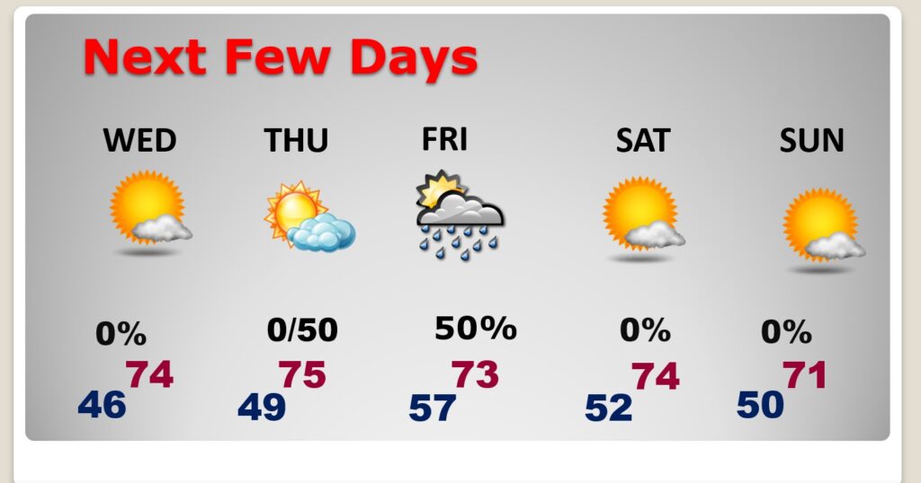
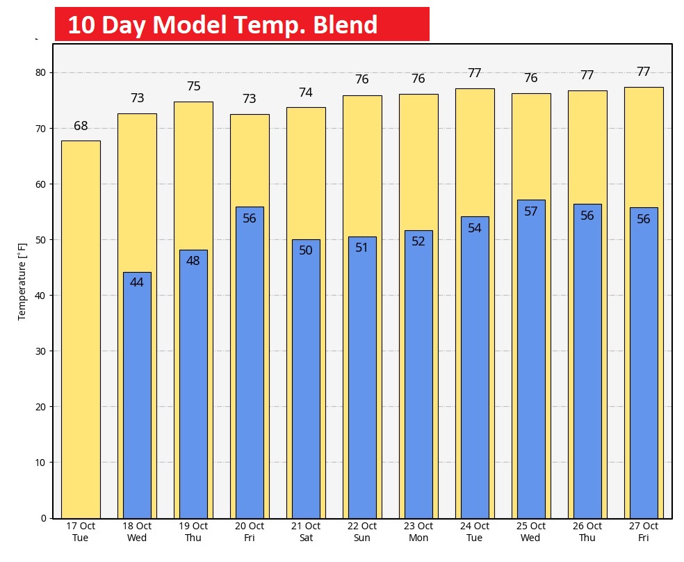
NEXT FEW DAYS: Normal high is 81, low 55. We’ll be below normal for several days. Expect comfortable mid 70’s Wednesday & Thursday. Looks like the next rain chance will arrive by late Thursday night through mid-day Friday. Showers and perhaps a few thunderstorms. A secondary cool front arrives Friday night. Behind the front, it looks like we’re in for another nice weekend.
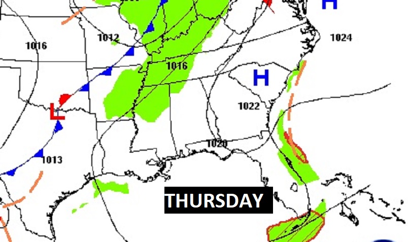
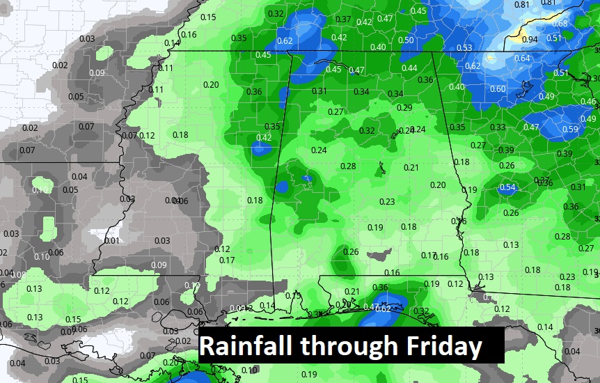
Thursday daytime looks dry, but the risk of showers and storms arrives overnight Thursday into Friday.
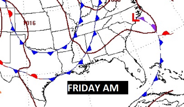
Here’s Friday morning at 7:00 AM on the Euro.
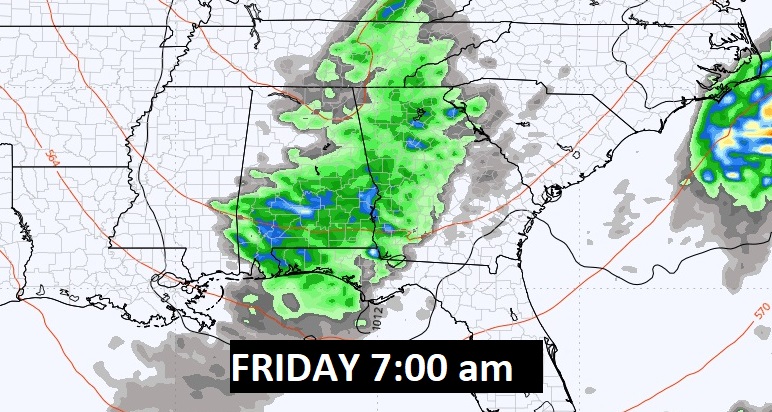
Rainfall amounts should average below a quarter of an inch in most places. No heavy rain this time.
Our prolonged cool spell continues, in that we’ll be nowhere near normal on temperatures for the next 10 days.
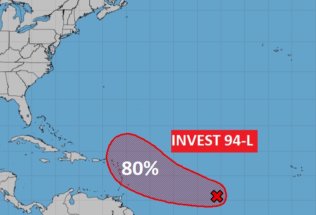
TROPICAL UPDATE: Invest 94-L will likely become a depression, and eventually Tammy, and could threaten the Islands in a few days. The rest of the tropics are quiet.
Thanks for reading this Blog this morning! This morning we are LIVE on the radio from 6 to 9 on NewsTalk 93.1. I’ll have another update for you in the morning. Have a nice day!
–Rich