
Good Morning! Yesterday was nice. Today will be text-book perfect. After a cool start, we’ll tease the mid 70’s, with plenty of sunshine. Changes are on the way, but not right away. Thursday will be very comfortable. Mid 70’s again. Clouds will increase as a front approaches, but it should be dry for your evening plans. Showers and perhaps a few storms arrive in the overnight hours and into Friday morning ahead of a cold front. Rainfall amounts will be light. Behind the front, we have a great weekend of weather ahead, followed by another extended string of dry, storm-free October days. Here’s my forecast discussion.
TODAY: Expect a lot of sunshine today. Comfortable Hi 74. NE wind at 5-10 mph. Mostly clear, chilly tonight. Low 50.
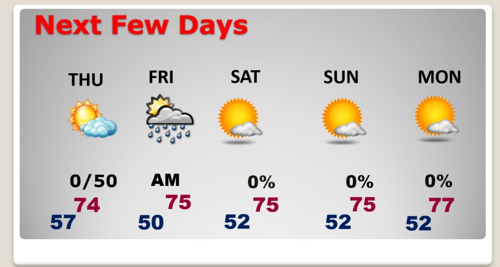
NEXT FEW DAYS: Normal high is 80, low 54. Thursday will be very comfortable. Mid 70’s again. Clouds will increase as a front approaches, but it should be dry for your evening plans. Showers and perhaps a few storms arrive in the overnight hours and into Friday morning ahead of a cold front. Rainfall amounts will be light. Behind the front, we have a great weekend of weather ahead, followed by another extended string of dry, storm-free October days.
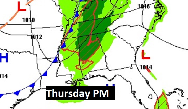
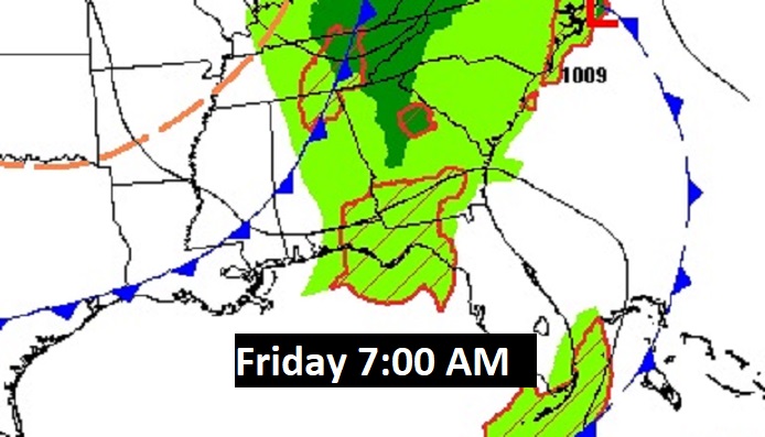
Thursday daytime looks dry, but the risk of showers and storms arrives overnight Thursday into Friday.
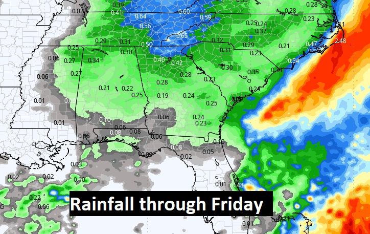
Here’s Friday morning at 4:00 AM on the Euro.
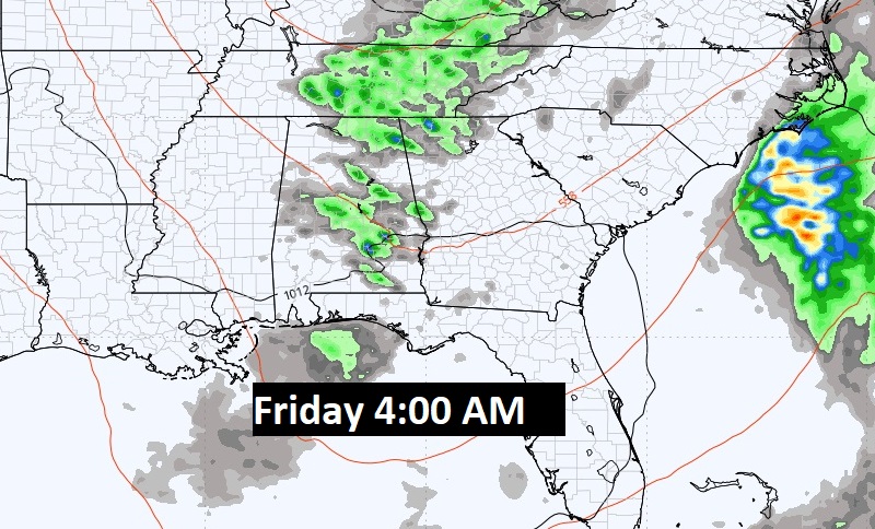
Rainfall amounts should average below a quarter of an inch in most places. No heavy rain this time, and no severe weather.
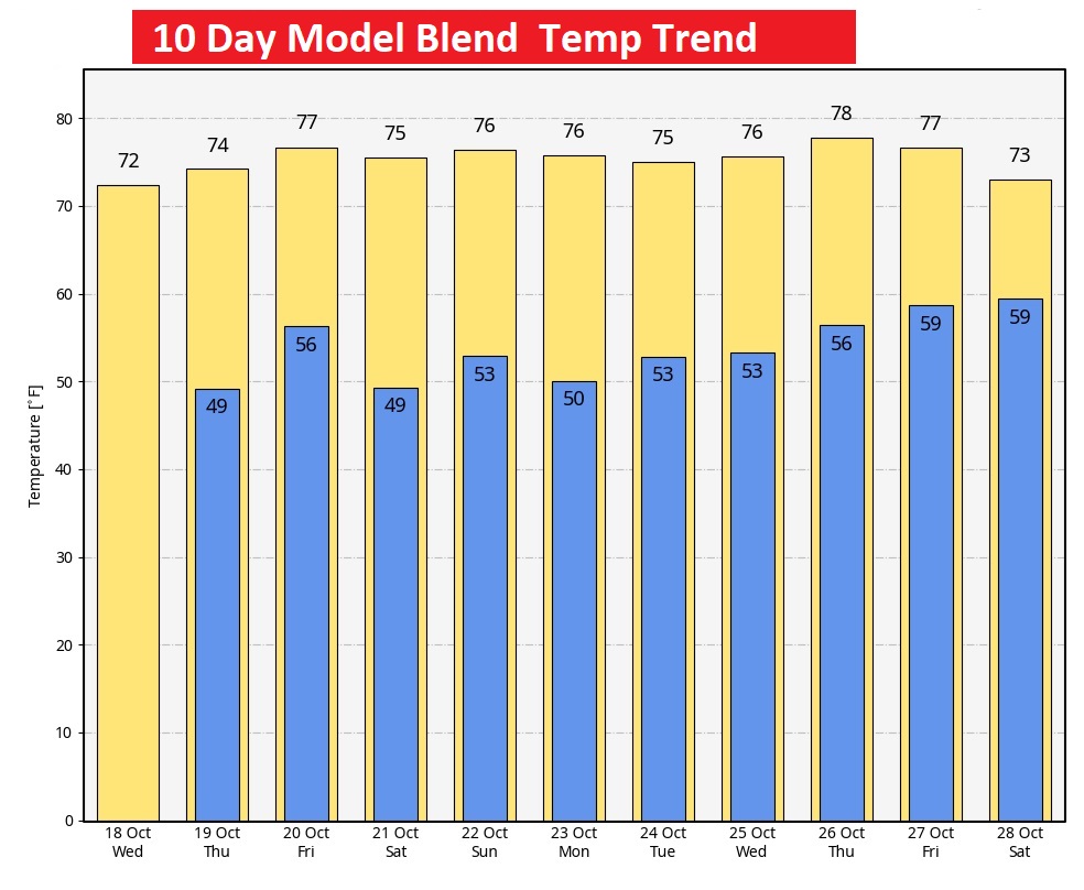
Here’s the ten-day model blend temperature trend.
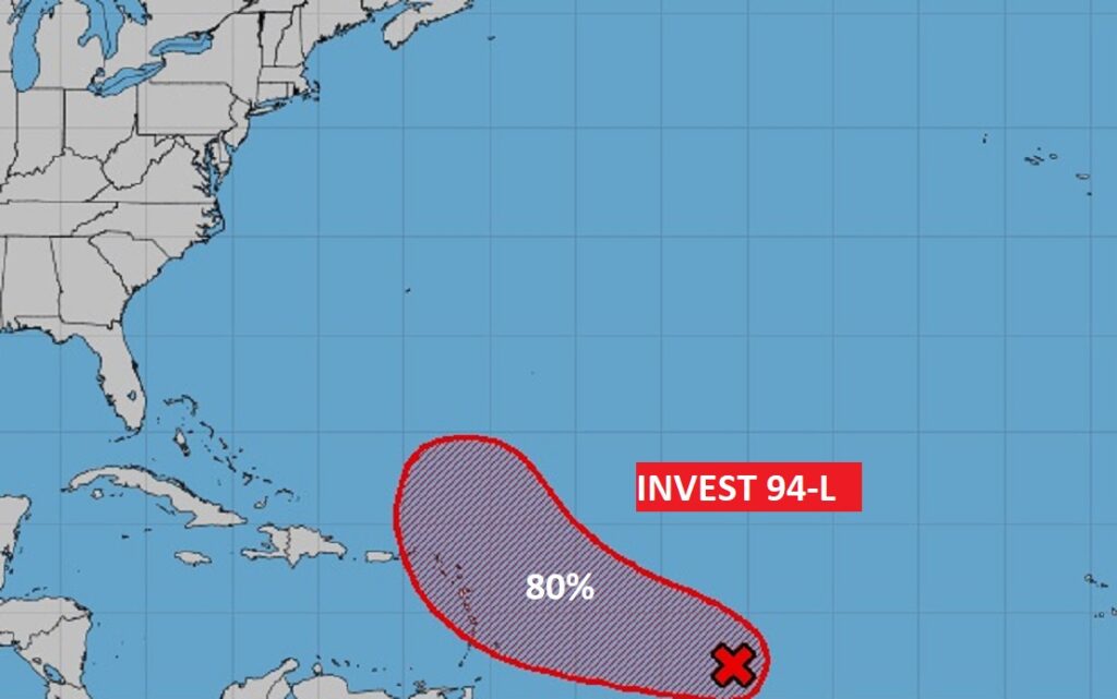
TROPICAL UPDATE: Invest 94-L will likely become a depression, and eventually Tammy, and could threaten the Islands in a few days. The rest of the tropics are quiet.
Thanks for reading this Blog this morning! This morning we are LIVE on the radio from 6 to 9 on NewsTalk 93.1. I’ll have another update for you in the morning. Have a nice day!
–Rich