
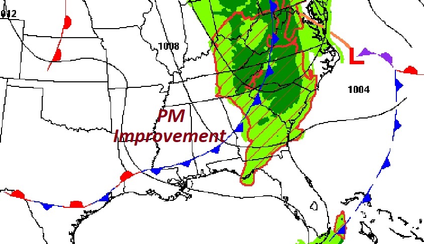
Good Morning! A frontal system crossing through the state early this morning will clear the state by early afternoon. Pre-dawn, there are a few showers ahead of the front but not many. Clouds this morning, give way to gradual clearing by mid-day and this afternoon. Get ready for a beautiful late October weekend, with abundant sunshine and comfortable days and cool nights. We need rain, but it looks we will see another long, extended string of dry days. Here’s my forecast discussion.
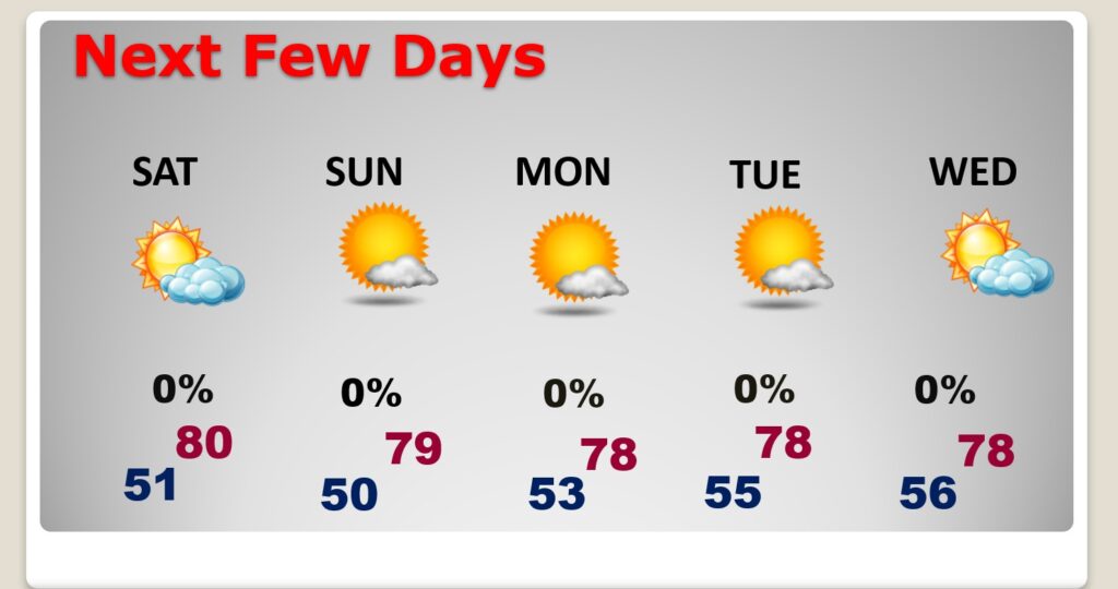
TODAY: Cloudy this morning. Risk of showers exits the state very early. Gradual clearing by mid-day. Improvement this afternoon. Very comfortable. High near 80. Breezy today. West wind at 5 to 15 gusting as high as 25 mph. Mainly clear and cooler tonight. Jacket weather. Low 51,
Here’s the map at 1:00 PM. The front will exit the state this afternoon.
NEXT FEW DAYS: Normal high is 79, low 53. Expect a beautiful late October weekend. Abundant sunshine. Comfortable. Near 80 Saturday. Upper 70’s Sunday and early next week. We need rain, but it looks we will see another long, extended string of dry days.
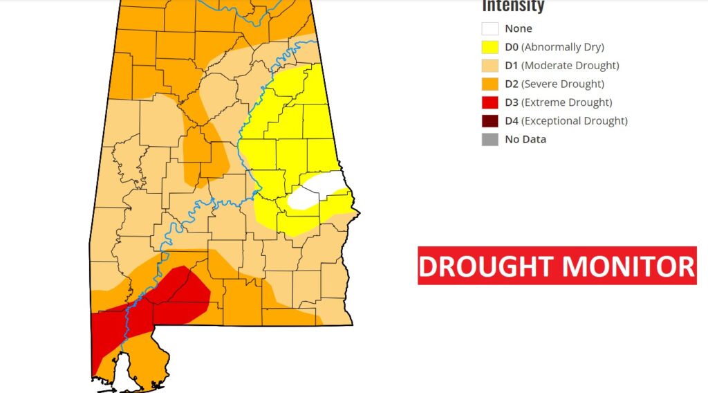
DRUGHT MONITOR: Last week’s 3+ inches of rain helped a bit in east central Alabama especially. Still though, on the new Drought Monitor map out today, 84% of Alabama is in at least a moderate drought. 44% of our state is in a severe or extreme drought, especially across the southwest half of Alabama.
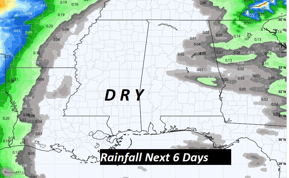
The next 6 days looks as dry as a bone.
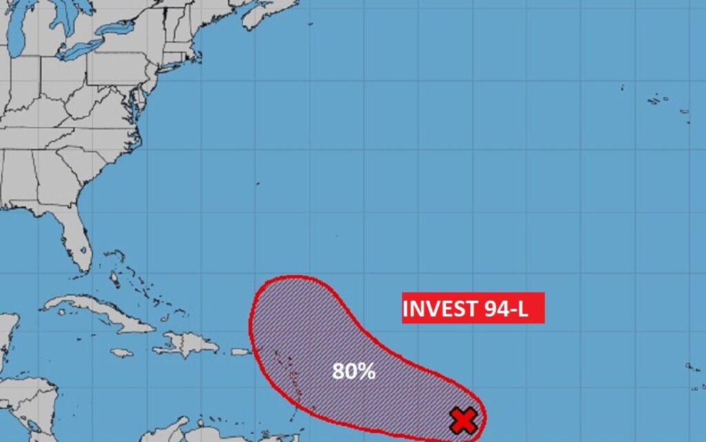
TROPICAL UPDATE: Tammy, with winds of 60 mph, is expected to become a hurricane. Tammy could bring hurricane conditions to the Leeward islands on Saturday, before turning northward into the open Atlantic.

There is a new Area to Watch in the SW Caribbean. The eastern Pacific remains active.
Thanks for reading this Blog this morning! This morning we are LIVE on the radio from 6 to 9 on NewsTalk 93.1. I’ll have another update for you in the morning. Have a nice day!
–Rich