
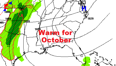
Good Morning! We’re nowhere close to record highs, but we continue quite warm for late October. And, the 80+ degree highs are in the cards for the next 5-6 days at least. (Normal Hi/lo 78/51) Meanwhile, as the drought continues to expand, we’re stuck in an extended dry pattern, with upper level high pressure in control. There’s no rain in the forecast through the upcoming weekend. Some of the models are hinting at a chance of showers early next week, but even that is in question. Here’s my brief forecast discussion.
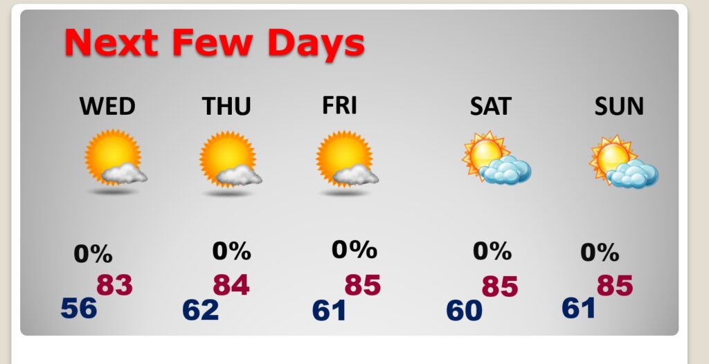
TODAY: Mostly sunny. Comfortable. High near 82. East wind 5 to 10. Partly cloudy tonight. Low 55.
NEXT FEW DAYS: Expect a beautiful late October weather to continue. Comfortable. The rain prospects through at least the upcoming weekend continues dismal. We should be above normal for several days. Each day will be 80 or above. Lows at night will be in the low 60’s Thursday through Sunday.
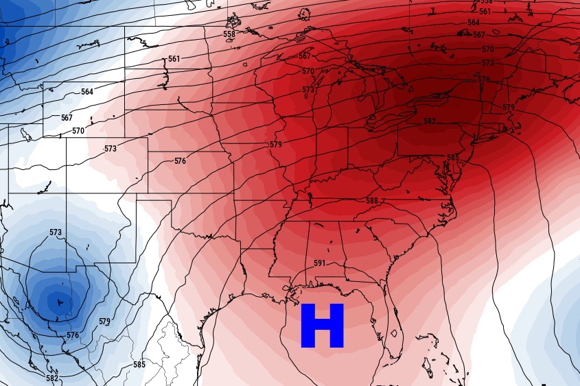
An upper Ridge of High Pressure is in firm control. It will continue to keep us warm. But, unfortunately dry.
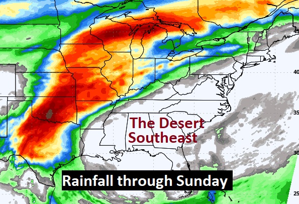
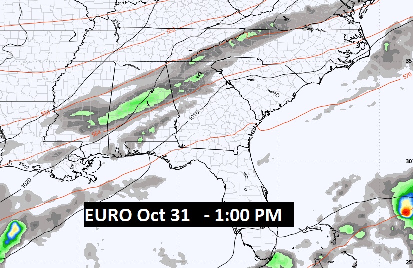
This map is quite frustrating. While parts of the Nation’s mid-section will see 3 to 5+ inches of rain through Sunday. The Desert Southeast will remain dry as a bone, as our drought continues to expand.
Perhaps a few showers on Halloween? Maybe….
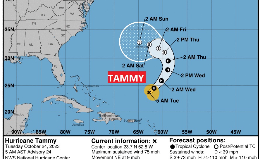
. TROPICAL UPDATE: Minimal Hurricane Tammy continues moving northeast in the Atlantic. The future track continues to show a bend to the west over the coming days.
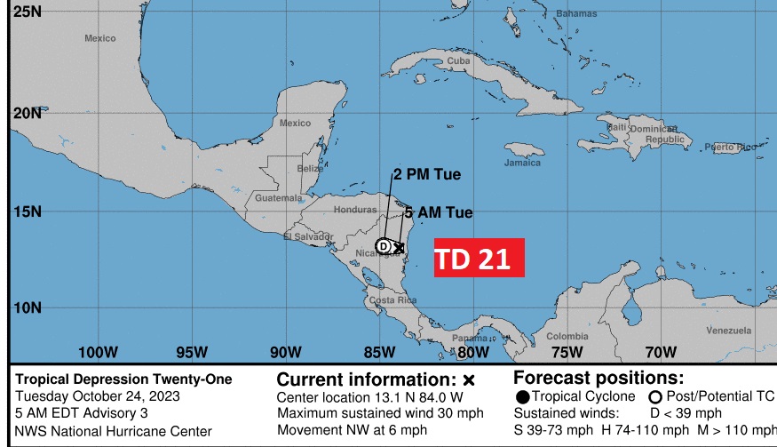
Tropical Depression 21 has already gone ashore in Central America. Adios.
Thanks for reading this Blog this morning! This morning we are LIVE on the radio from 6 to 9 on NewsTalk 93.1. I’ll have another update for you in the morning. Have a nice day!
–Rich