
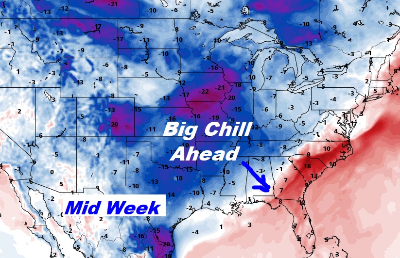
Good Morning! Our unusually warm late October weather continues through the weekend. Thursday & Friday we made it to 85. And mid 80’s appear likely today through Monday. But get ready for a BIG change. A Cold Front will sweep through the state Monday. A secondary Cold Front arrives Tuesday night. The chance of a shower or two on Halloween is not zero, but it’s rather small. Maybe 20% Behind it, Wednesday will be the coldest air of the season so far. We could possibly reach the mid 30’s by Thursday morning.
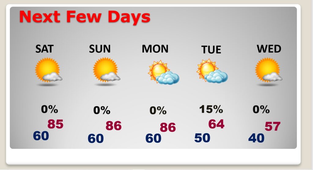
TODAY (Saturday): Mostly sunny. Comfortable. High near 85. SE wind 5 to 10 mph. Mainly clear tonight. Low 61.
(Normal high 76 – Low 50)
SUNDAY: More sun. Still Warm. High near 85. East wind 5 to 10 mph. Partly cloudy Sunday night. Low 61.
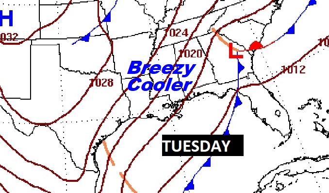
NEXT FEW DAYS: A Cold Front will sweep through the state Monday. A secondary Cold Front arrives Tuesday night. The chance of a shower or two on Halloween is not zero, but it’s rather small. Maybe 20% Behind it, Wednesday will be the coldest air of the season so far. We could possibly reach the mid 30’s by Thursday morning.
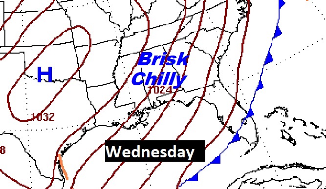
Here’s the 10 day temperature guidance. Get ready for a big change. Wednesday is the first day of November. It will be a rather brisk day, Breezy, Highs only in the 50’s. Low Wed. Night /Thursday AM in the mid 30’s. This will be the coldest air of the season so far.

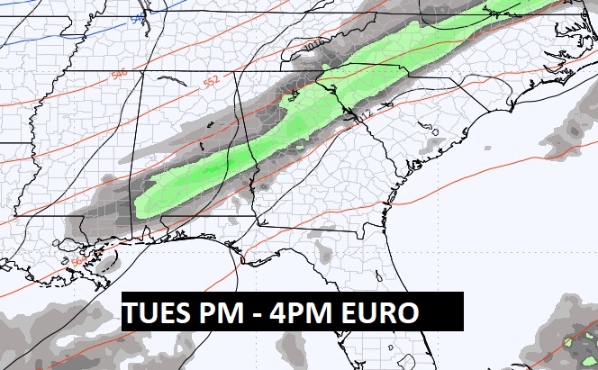
Here’s the expected rainfall outlook through Tuesday. The chance of a shower or two on Halloween is not zero, but it’s rather small.

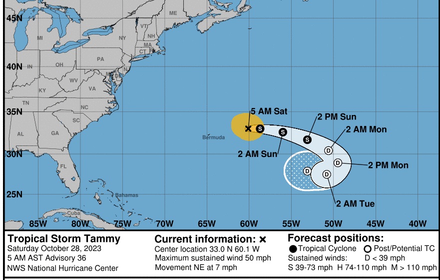
TROPICAL UPDATE: The Ghost of Tammy has resurfaced. The latest NHC guidance has Tammy bending eastward, then southeastward.
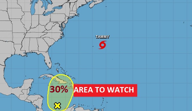
There is an Area to Watch in the Caribbean . It has a broad area of low pressure moving northward. 30% chance of development in the next few days.
Thanks for reading this Blog this morning! I’ll have another update for you in the morning. Have a nice weekend!
–Rich