
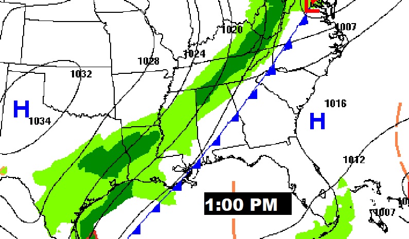
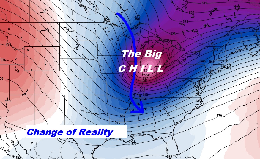
Good Morning! Get ready for a reality check. Today will be the last warm day. We’re in for a change of wardrobe. The Big Chill is approaching. The first of two cold front will swing through the state today. It will turn much cooler tonight. The chance of an isolated shower or two on is not zero, but it’s rather remote, primarily tonight and Tuesday AM. Halloween will be breezy and about 20° cooler than today. A secondary Cold Front arrives Tuesday night. We could possibly reach the mid 30’s by Wednesday morning. Wednesday will be the coldest day of the season so far. Wednesday’s high will be in the 50’s with brisk winds. We will be close to the freeze mark for the first time this year on Thursday morning. On Saturday and Sunday we are back to the mid 70’s. Here’s my brief forecast discussion.
TODAY: Mostly sunny. Still warm. High 80-82. By late morning, winds shift around to the NW at 10 to 16 and gusty. I’ll mention a small 20% chance of a shower overnight tonight, in the wee hours of the morning. Breezy & colder. Low 51.
(Normal high 76 – Low 49)
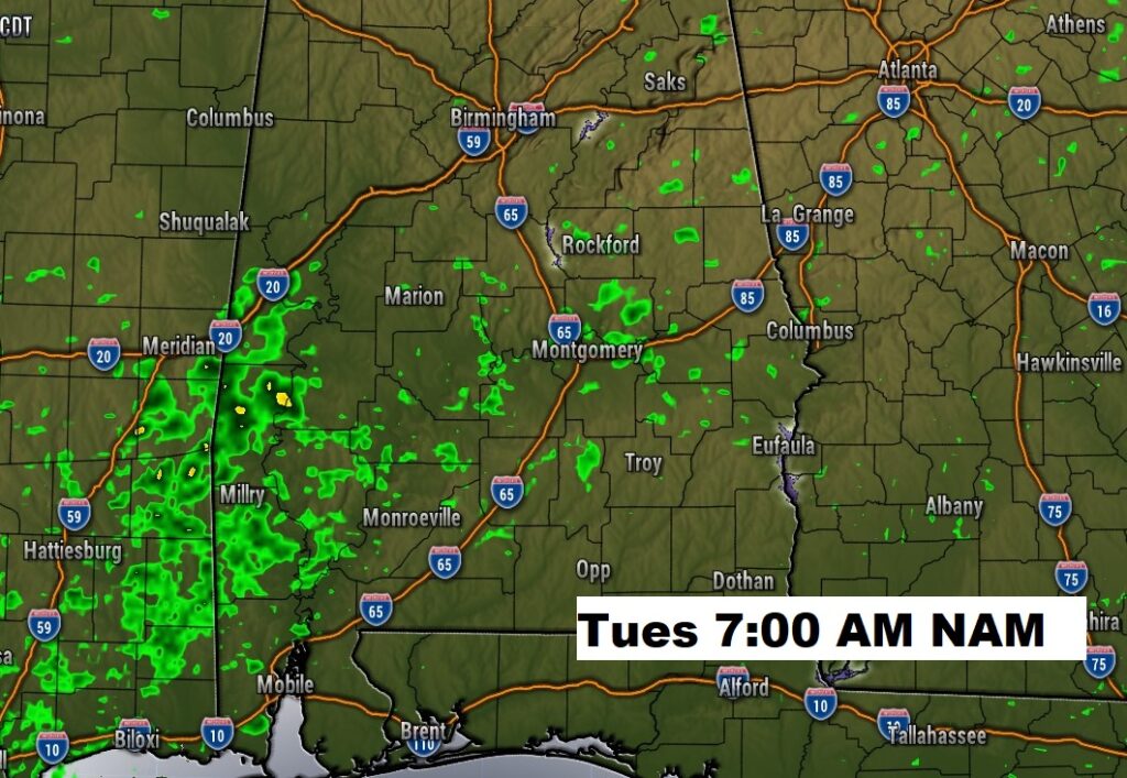
Showers are not completely out of the question, just don’t bet the farm. Here’s the NAM model Tomorrow morning at 7AM.
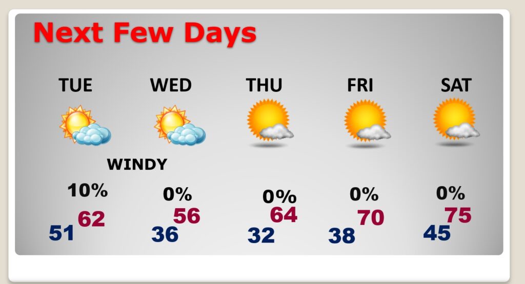
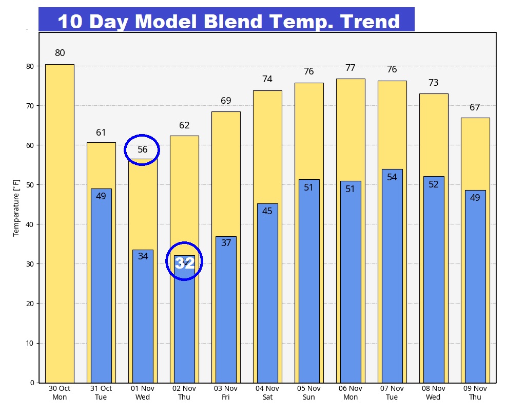
NEXT FEW DAYS: A secondary Cold Front arrives Tuesday night. The chance of a shower or two on is not zero, primarily tonight, but it’s rather remote, primarily tonight. Wednesday will be the coldest day of the season so far. We could possibly reach the mid 30’s by Wednesday morning. Wednesday’s high will be in the 50’s with brisk winds. We will be close to the freeze mark for the first time this year on Thursday morning. On Friday and Saturday we are back to the mid 70’s. A FIRE WATCH is in effect starting Tuesday afternoon and again Wednesday. We’re in a drought, humidity will be low and it will be windy.
Are you ready for an early freeze? Appears quite likely for many towns by Thursday morning. Fortunately, temperatures will moderate by next weekend. The Big Chill, this time, won’t last too long.
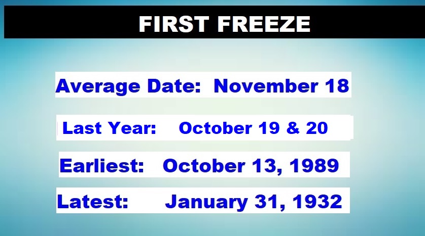
COLD FACTS: Just in case you were wondering. Here’s some Cold Facts on the First Freeze. Average First Freeze is 11/18. Last year: we had an extremely early freeze with 32 on October 19, and 29 on October 20th. By the way, average first frost is November 8th.
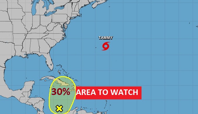
TROPICAL UPDATE: Two areas of concern in our general part of the world. Invest 96-L. And an Area to Watch in the Caribbean. A tropical Depression could form in the west Caribbean later this week. 40% chance of development.
Thanks for reading this Blog this morning! This morning we are LIVE on the radio from 6 to 9 on NewsTalk 93.1. I’ll have another update for you in the morning. Have a nice day!
–Rich