
Good Morning! The first freeze of the season is now behind us. Yesterday’s 28 degrees in Montgomery tied the record from 1954. Get ready for a big temperature recovery. Today we should make it to at least 70. The Normal High is 74. The warming trend continues this weekend. By Sunday we’ll be in the upper 70’s. Most of next week will be dry and warm. The drought continues to expand. No rain is expected through Thursday. Perhaps a small chance next Friday. Here’s my brief forecast discussion.
TODAY: Sunshine. Not as cool. High 71. East wind at 6 to 12 mph. Clear tonight. Not quite as cold. Low near 40.
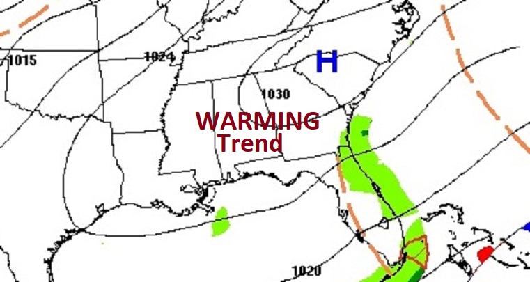
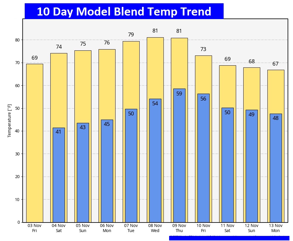
NEXT FEW DAYS: The Normal High is 74. The warming trend continues this weekend. Mid 70’s Saturday. By Sunday we’ll be in the upper 70’s. Most of next week will be dry and warm.
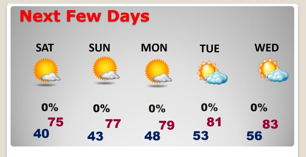
No more freezing temperatures for the next 10 days.
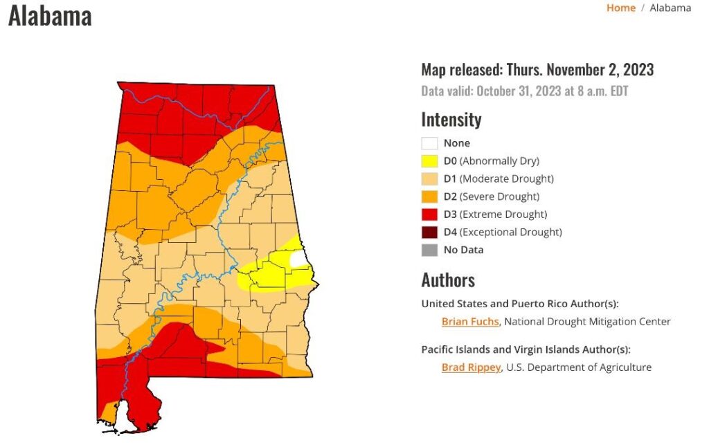
DROUGHT MONITOR: The new Drought Monitor map looks ugly. Now 58.4% of the state is in a Severe or Extreme drought. And, 99.6% of the state is in some level of Drought. Only a small sliver of Lee county is not included. No raindrops expected in the next 7 days.
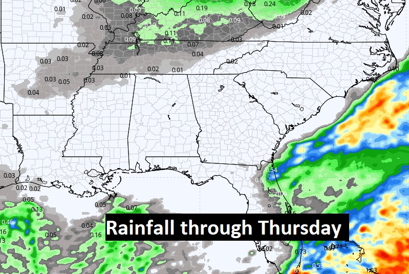
Here’s the expected rainfall through Thursday. NONE.
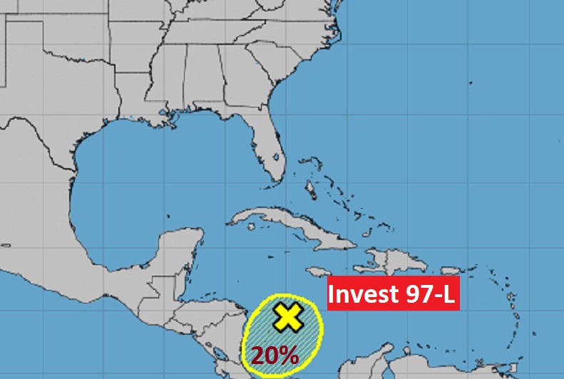
TROPICAL UPDATE: Invest 97-L, is running out of time for possible development in the Caribbean. The is a low 20% chance a tropical development .
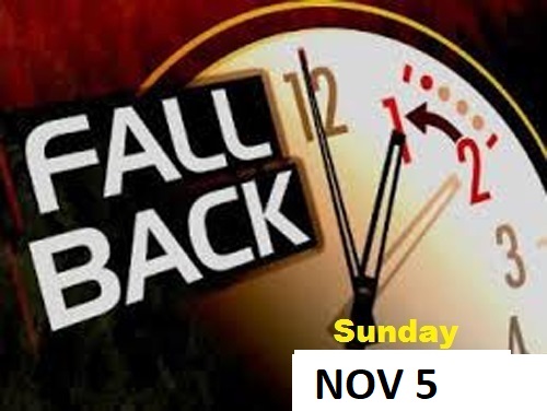
FALL BACK THIS WEEKEND: This is the weekend we Fall Back to CST. Happens officially late Saturday night, early Sunday AM at 2AM. Set your clocks back one hour. On Sunday, sunrise will be at 6:05 and Sunset at 4:51 PM.
Thanks for reading this Blog this morning! This morning we are LIVE on the radio from 6 to 9 on NewsTalk 93.1. I’ll have another update for you in the morning. Have a nice day!
–Rich