
Good Morning! A Gulf of Mexico storm system is bringing in much needed rain. Small chance much of the day, today. Rain has been steady in the overnight hours. Periods of rain continue likely today & tonight. There could be some leftover showers Thursday, before we dry out Friday. I’ll mention the chance of isolated showers late Friday and Friday night, as a cool front slips into the state. Cool sunshine will eventually return this weekend. Thanksgiving week could start out wet and stormy on Monday. But so far, the holiday looks pretty nice. Here’s my brief forecast discussion.
TODAY: Periods of rain likely today and tonight. Windy and cool. East winds 15-20 gusting to 30 mph. High 58. Low tonight 54.
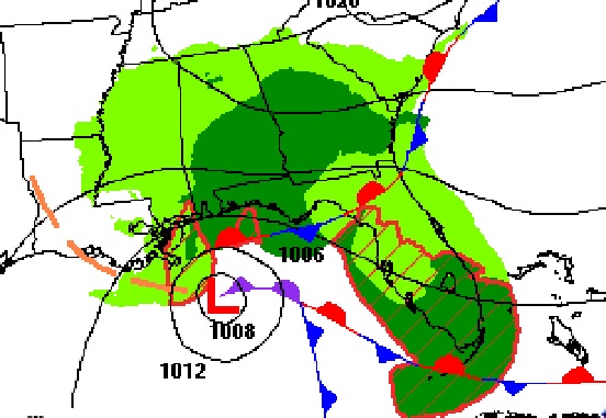
Gulf of Mexico low pressure is responsible for our wet forecast.
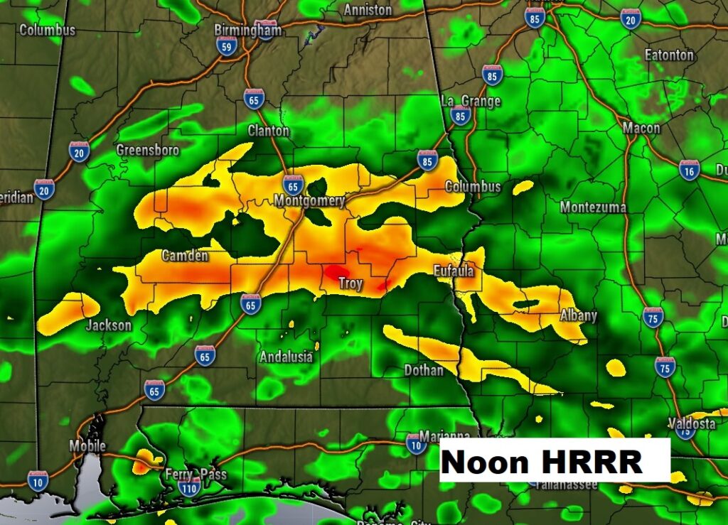
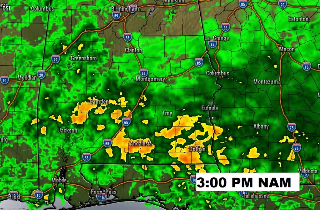
Future radar needs no explanation. It’ll be wet today and tonight. We need every drop.
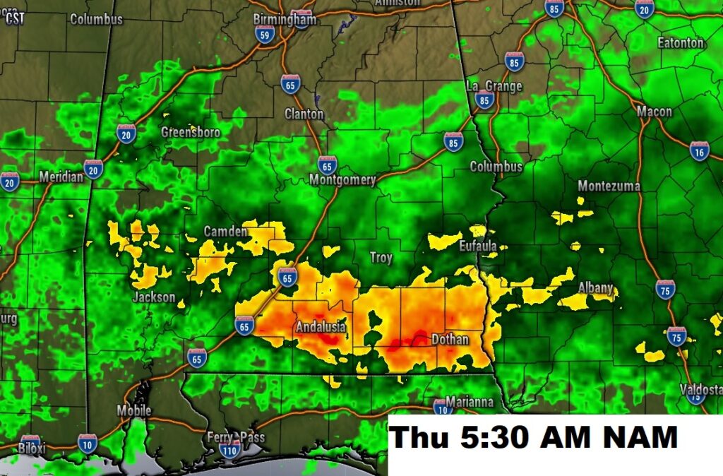
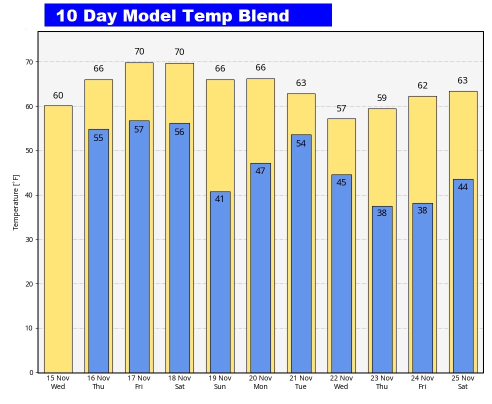
NEXT FEW DAYS: There could be some leftover showers Thursday. I’ll mention the chance of isolated showers late Friday and Friday night, as a cool front slips into the state. High 71. Saturday starts off cloudy and becomes mostly sunny. Mostly sunny Sunday. High in the upper 60’s.
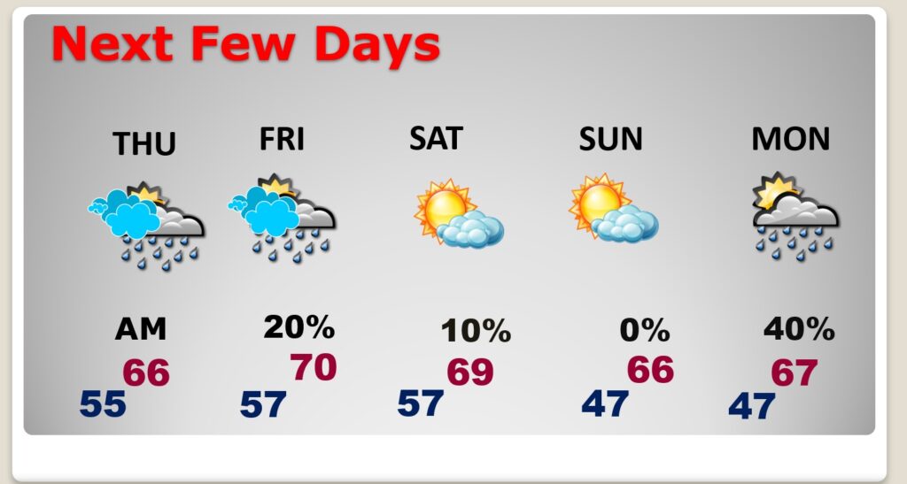
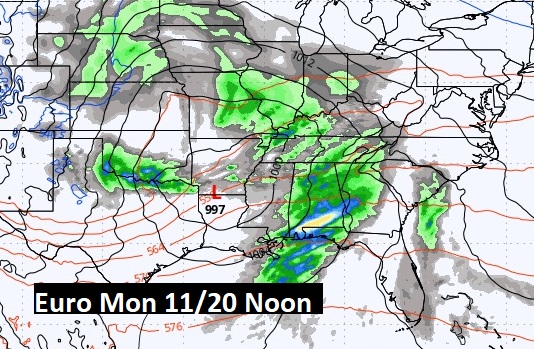
THANKSGIVING WEEK: Thanksgiving week could start out wet and stormy on Monday.
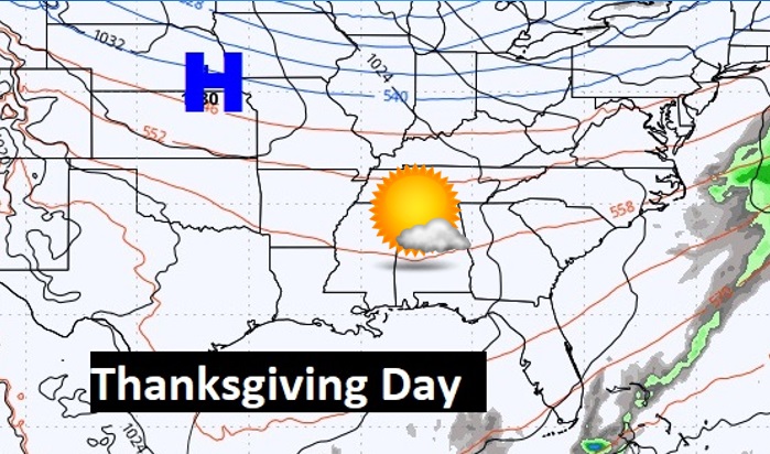
But so far, the holiday looks pretty nice. I’ve got us Mostly sunny with highs in the mid 60’s. There could be another storm system in that weekend after Thanksgiving.
I do not see any arctic air in the next 10 days.
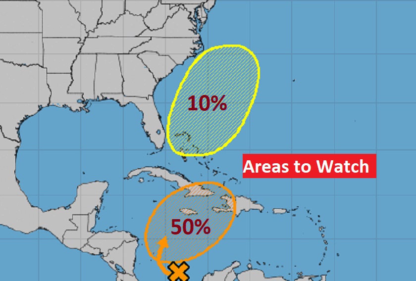
TROPICAL: That Area to Watch in the SW Caribbean will continue to develop. A tropical Depression could form in the next day or two.
Meanwhile, low pressure is developing off the SE US coastline. It is very unlikely this system will become tropical. But it could become an east coast Nor’Easter with gale winds.
Thanks for reading this Blog this morning! This morning we are LIVE on the radio from 6 to 9 on NewsTalk 93.1. I’ll have another update for you in the morning. Have a nice day!
–Rich