
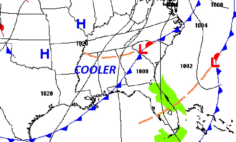
Good Morning! A Cold front moved through the state overnight. The air behind the front is cooler but certainly not cold. There could be some cloudiness early today, but there will be lots of sunshine on this Saturday. Tonight will be quite chilly. Sunday will be a nice day. Sunshine and seasonably cool. The next storm system will affect the state in the Monday Night into Tuesday as Thanksgiving week begins. Showers and thunderstorms. A small Severe Weather threat is possible with this storm system. Rainfall looks very beneficial. Thanksgiving looks cool but sunny. Thanksgiving morning will be near 40 degrees. Late week looks pretty nice.
TODAY: Clouds early will give way to a Mostly Sunny day. Yesterday’s high was 74. Today’s high 70-73. Northwest wind 6 to 12 mph. Clear and chilly tonight. Low 41.
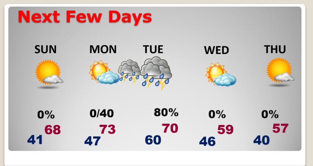
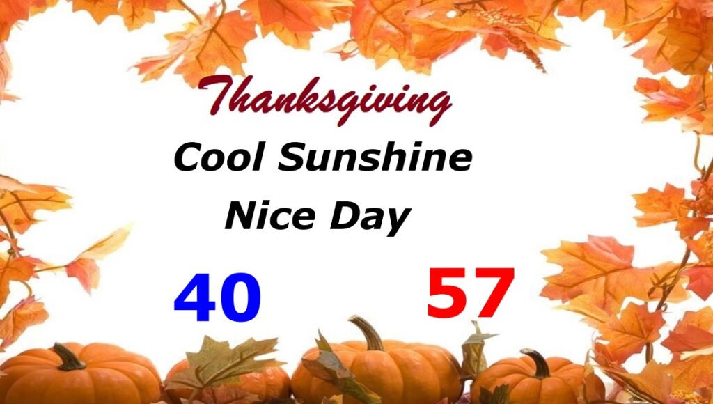
NEXT FEW DAYS: Sunday will be a nice day. Sunshine and seasonably cool. The next storm system will affect the state in the Monday Night into Tuesday as Thanksgiving week begins. Showers and thunderstorms. A small Severe Weather threat is possible with this storm system. Rainfall looks very beneficial. Thanksgiving looks cool but sunny. Thanksgiving morning will be near 40 degrees. Late week looks pretty nice.
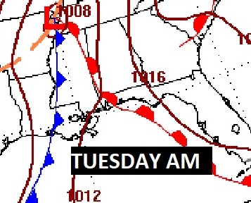
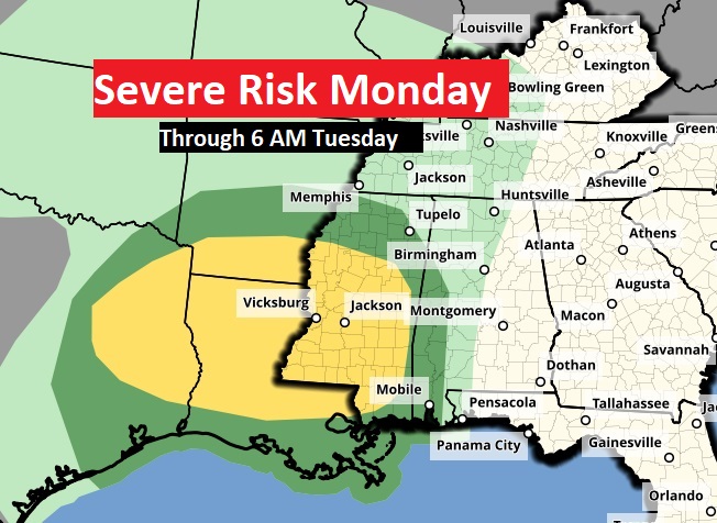
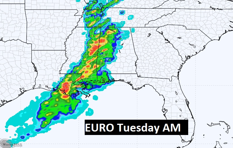
THANKSGIVING WEEK Storm System: The next storm system will start to affect the state in the overnight hours Monday night. For most of us the main action will be Tuesday. It could get stormy quite early. Here’s the set-up Tuesday morning at 6AM.
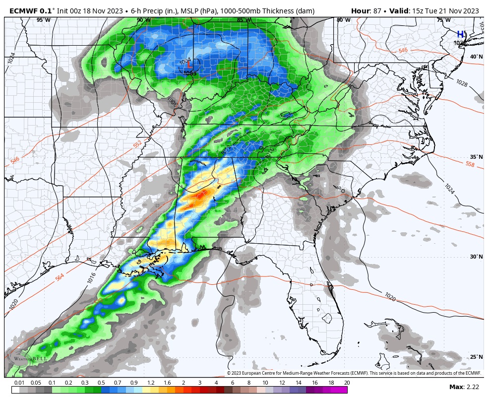
The Storm Prediction Center has outlooked a level 2 Severe Weather Risk for states west of us on Monday, and even a Marginal Severe risk into west Alabama by Tuesday morning at 6AM. Although the Severe Risk for most of us has appeared to diminish, the risk is not Zero. We’ll continue to watch this system carefully. We are in the Severe Weather Season as you know.
THANKSGIVING FORECAST: Thanksgiving looks cool but sunny. Thanksgiving morning will be near 40 degrees. We will not make it out of the 50’s for a high. Back to the lower 40’s Thursday night.

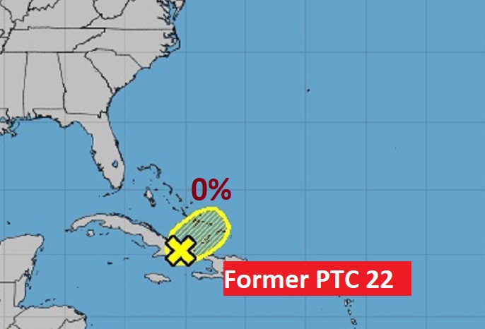
TROPICAL: The threat fromPotential Tropical Cyclone 22 has ended. Conditions are no longer favorable for Tropical Cyclone Development
Thanks for reading this Blog this morning! I’ll have another update for you on Monday morning. Have a great weekend!
–Rich