
Good Morning! Early this morning, we are tracking some strong storms moving through the state. This is out ahead of an approaching Cold front. The window for potential severe weather will continue through the morning and into the early afternoon. Damaging wind gusts are the main threat. But, some brief tornadoes can’t be ruled out. Much cooler air will follow for Wednesday and Thanksgiving. Showers will return to the forecast Thursday night and Friday. So far, Iron Bowl Saturday looks nice. Here’s my brief forecast discussion.
TODAY: WIND ADVISORY this morning. Showers and thunderstorms. Severe weather threat. Breezy. South wind 15-20 gusting to 30 mph. High 71. Widely scattered evening showers are possible. Low tonight 51.
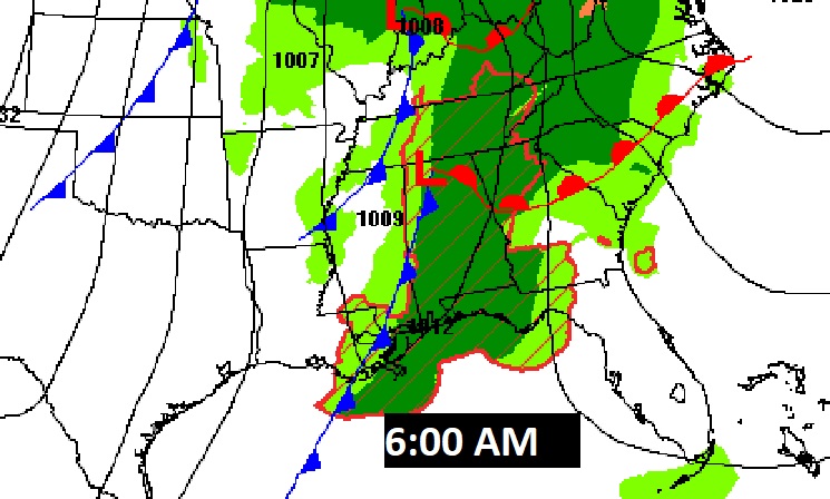
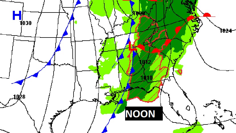
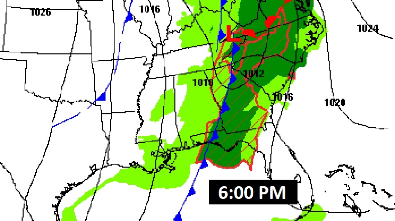
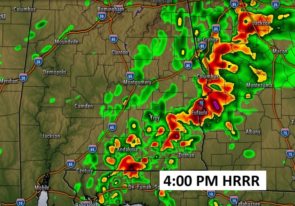
The main front moves from East Mississippi at Dawn to near Dothan by 6:00 PM
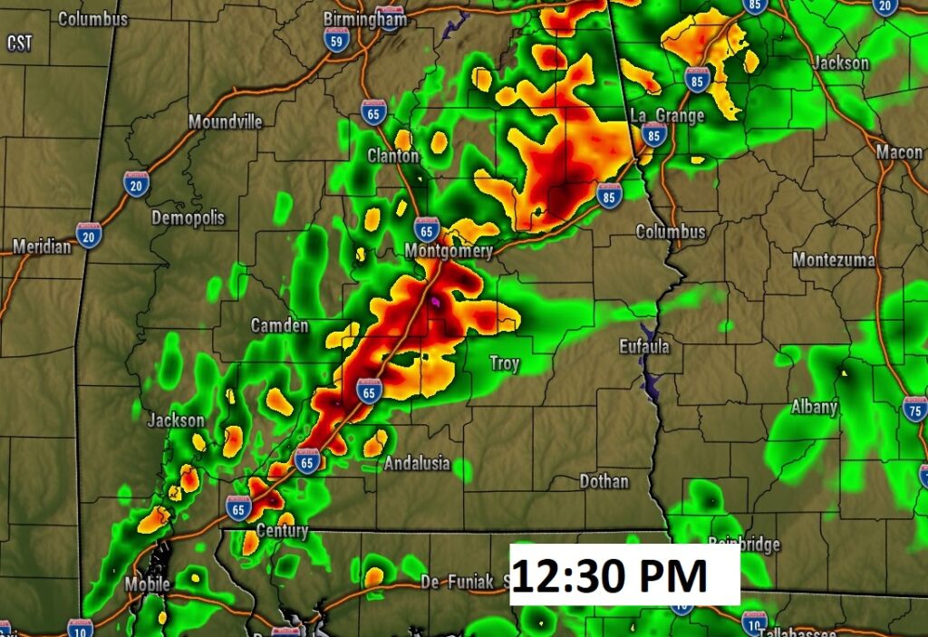
Future hi-res Radar. West Alabama storms in the morning reach the I-65 corridor by about lunchtime and into SE Alabama by late afternoon.
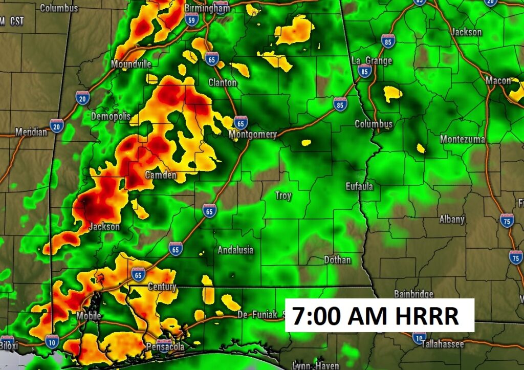
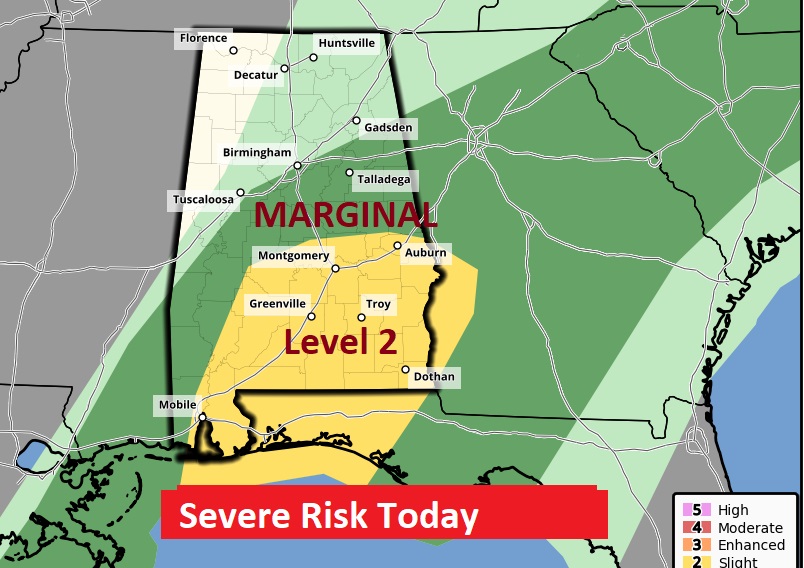
Most of us in central and South Alabama are in z Level 2 Severe Risk. There will be warnings. Risk of scattered damaging wind gusts 60+ mph. A few brief tornadoes are possible.
NEXT FEW DAYS: Much cooler air moves in behind the storm system. Coldest morning – Thursday morning. Low near 40. Thanksgiving will be mostly cloudy and cool. Showers will return to the forecast Thursday night and Friday. So far, Iron Bowl Saturday looks nice. Another small chance of rain returns Sunday night.
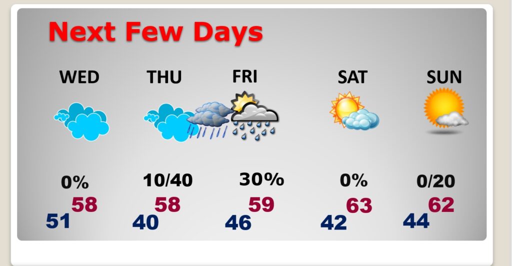
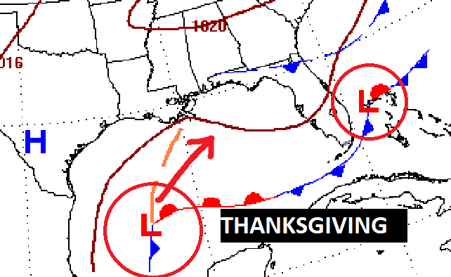
On Thanksgiving, a developing low in the Gulf moves northeast, reaching near the coast Friday morning. Increasing chance of rain Thursday night into Friday.

Thanks for reading this Blog this morning! This morning we are LIVE on the radio from 6 to 9 on NewsTalk 93.1. I’ll have another update for you in the morning. Have a nice day!
–Rich