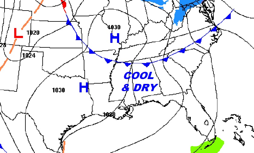
Good Morning! It’s a cool but dry forecast for now. We’ll start off near freezing this morning, and end up in the 50’s later. Tonight will be the coldest night. We should reach the upper 20’s by Dawn Wednesday. Dry weather continues though Thursday. But, looking ahead, there’s lots of rain in our future late week and over the weekend. It sure looks like a “soaker”. Rain and storms become likely by Thursday night and Friday. Then, Part Two over the weekend, could even be wetter. Total rainfall Thursday night through Sunday could be excessive. Unfortunately, this weekend features a lot of Christmas tree lightnings and parades. Here’s my brief forecast discussion.
.
TODAY: Cool & Dry. Clouds early give way to sunshine by about mid-morning. Hi 56. NW wind 6 to 12 mph. Clear and cold tonight. Low 28.
NEXT FEW DAYS: Wednesday will feature a lots of sunshine. Thursday will be dry and not quite as cool. Rain and storms become likely by Thursday night and Friday. Right on the heals of that storm system will be a weekend storm system that will keep us very wet at times. We’ll be near or above 70 by Friday. Normal hi/lo 67/41.
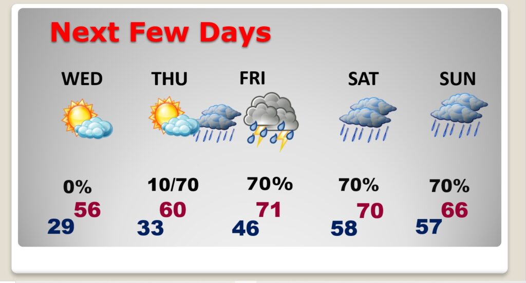
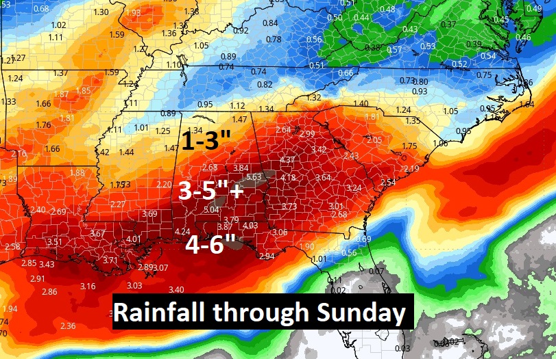
Total rainfall Thursday night through Sunday could be excessive.
Here’s the 10 day model temp trend. Coldest morning will be today Wednesday. Temperatures will moderate by late week.

Thanks for reading this Blog this morning! This morning we are LIVE on the radio from 6 to 9 on NewsTalk 93.1. I’ll have another update for you in the morning. Have a nice day!
–Rich
CHASE enjoying the warm fire this morning!