
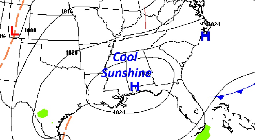
Good Morning! It’s a cold Wednesday morning. Most towns will end up well into the 20’s at dawn. Expect more cool sunshine today with highs in the mid to upper 50’s. That’s about 10 degrees too cool for this time of year. We’ll be near the freeze mark again tomorrow morning. Enjoy the dry weather through Thursday. There’s lots of rain in our future. Rain and storms become likely by Thursday night and Friday. Some storms could be Severe on Friday. That’s just part one of a two part storm system. There’s more rain ahead for Saturday and Sunday. Total rainfall, through Sunday, could be significant. Be flexible with your weekend outdoor plans. Here’s my brief forecast discussion.
TODAY: Cool sunshine & dry. High 57. North wind 5 to 10 mph. Partly cloudy, Cold tonight. Low 33.
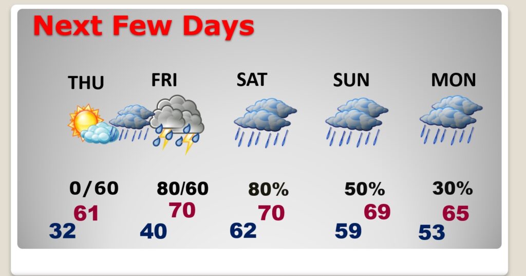
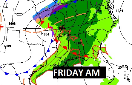
NEXT FEW DAYS: Thursday will be dry and not quite as cool. Rain and storms become likely by Thursday night and Friday. Right on the heals of that storm system will be a weekend storm system that will keep us very wet at times. We’ll be near or above 70 by Friday, Saturday and Sunday. Normal hi/lo 66/41.
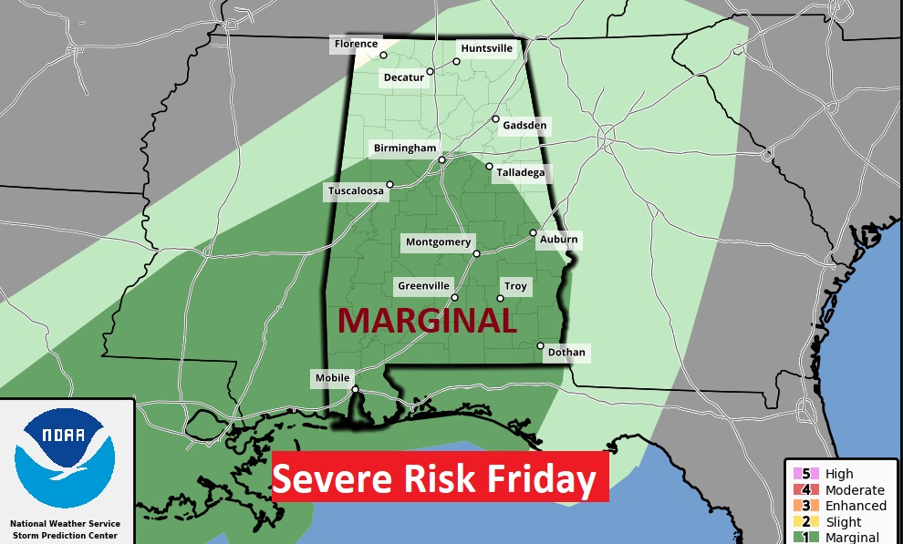
Strong to possibly Severe Storms Friday. Marginal Severe Risk.
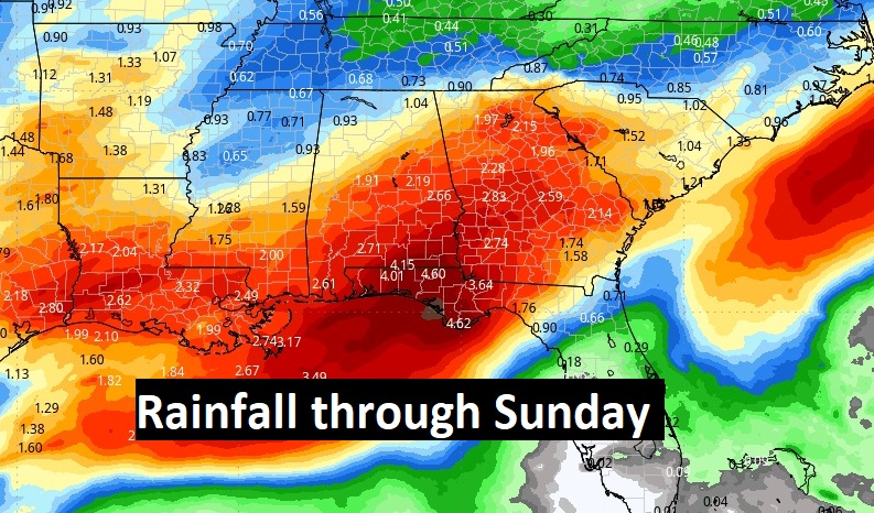
Total rainfall Thursday night through Sunday could be rather significant in spots, especially across the southern half of Alabama.
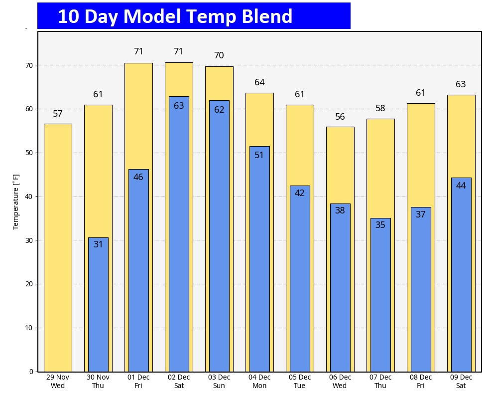
Here’s the 10 day model temp trend. The warmest days will be Friday, Saturday and Sunday, but they will also be the wettest days.
Thanks for reading this Blog this morning! This morning we are LIVE on the radio from 6 to 9 on NewsTalk 93.1. I’ll have another update for you in the morning. Have a nice day!
–Rich