
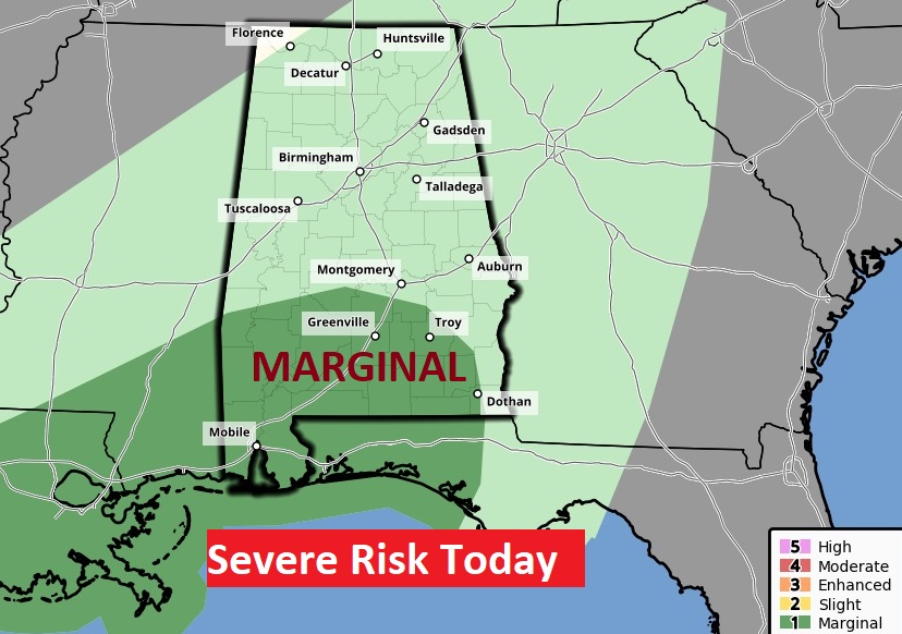
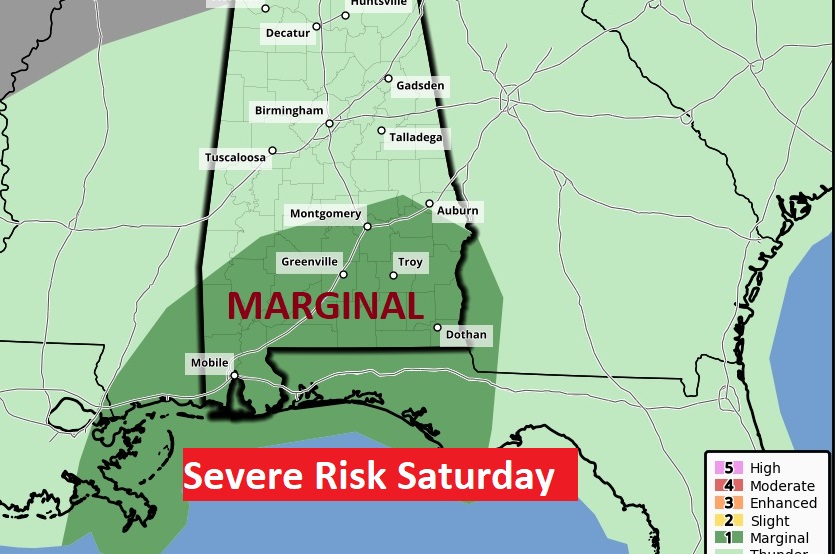
Good Morning! Welcome to December. The new month will begin with a 2 part storm system which will dominate the weekend forecast with some drenching rain and storms. Parts of our state are in a Marginal Severe Risk today and again Saturday with part two. Showers will start to taper off by Sunday afternoon. Monday and most of next week looks dry.
Here’s my brief forecast discussion.
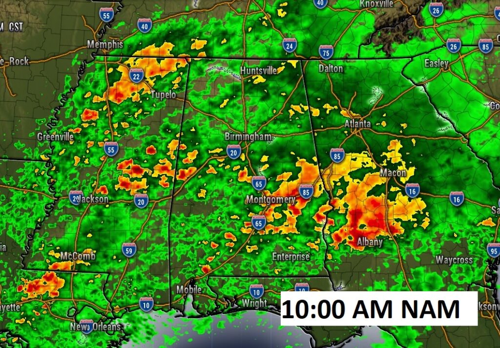
TODAY: Showers and thunderstorms likely today and tonight. Hi 71. SE winds 5-15 gusting to 20 mph. Low tonight 63.
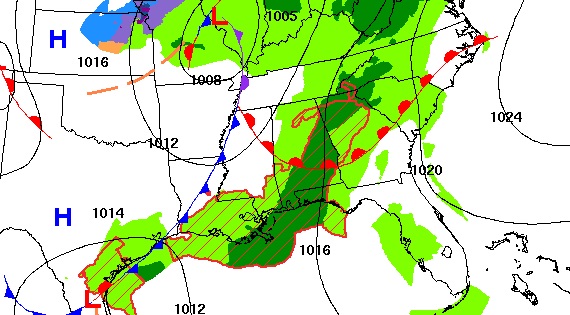
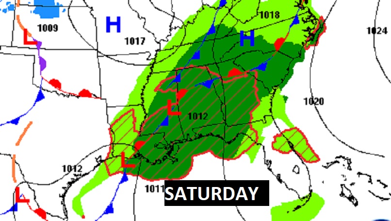
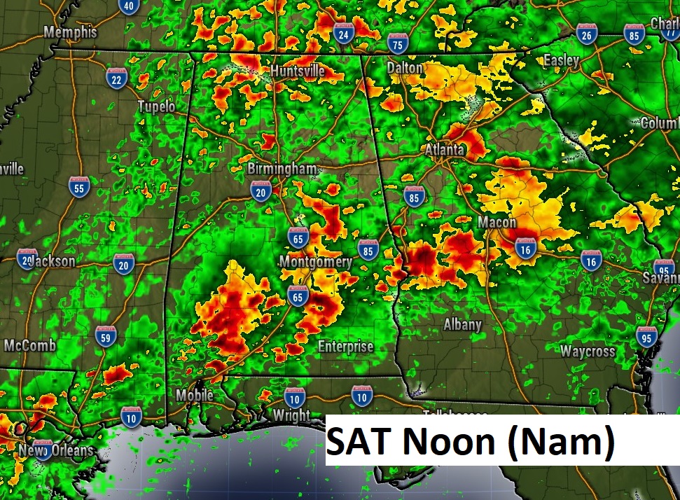
Two-part storm system. Part 1 today, Part 2 approaches tomorrow.
Severe weather risk mostly for south Alabama today. Slightly broader Marginal Risk on Saturday, extending into central Alabama.
I selected two Future Radar snapshots…one from today and one from tomorrow. You clearly see…it’s going to rain.
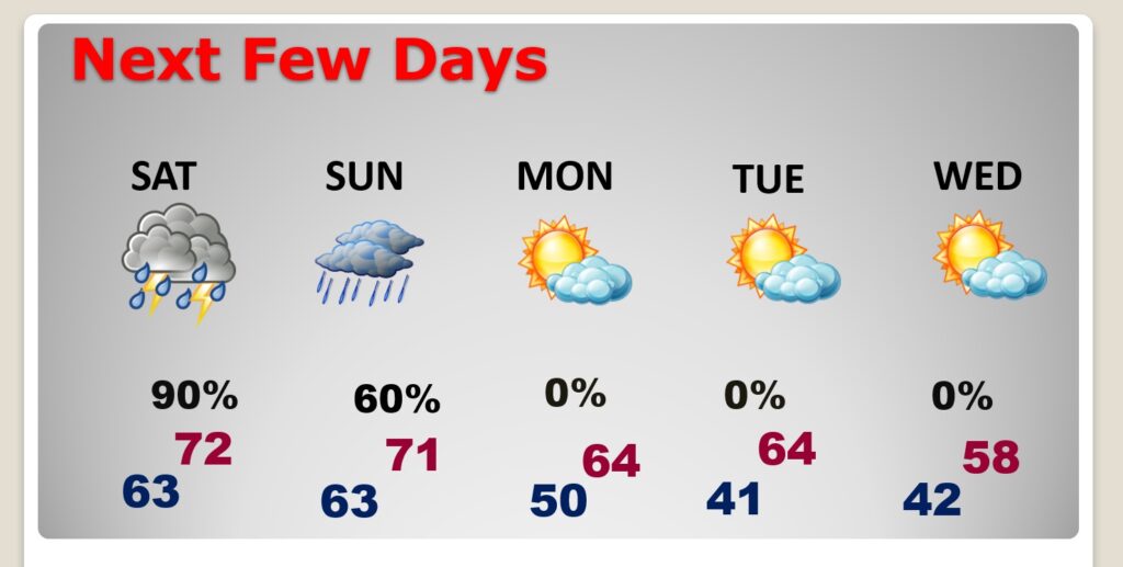
NEXT FEW DAYS: Very wet through Saturday and Saturday night. Some leftover scattered showers first half of the day Sunday. Showers will start to taper off by Sunday afternoon. Monday and most of next week looks dry.
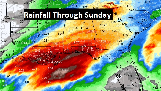
Total rainfall tonight through Sunday could be rather significant in spots, especially across the southern half of Alabama. Total rainfall could average 3 to 4.5” in spots.
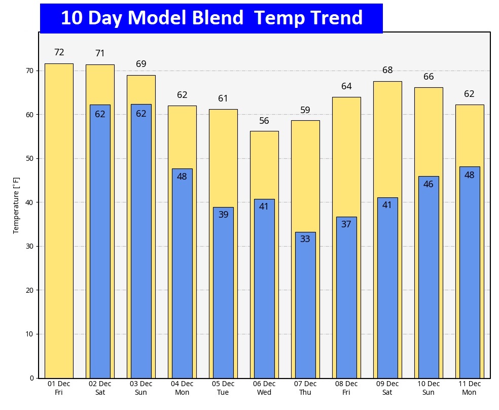
Here’s the 10 day model temp trend. I don’t see anything unusually cold in the next 10 days.
Thanks for reading this Blog this morning! This morning we are LIVE on the radio from 6 to 9 on NewsTalk 93.1. I’ll have another update for you in the morning. Have a nice day!
–Rich