
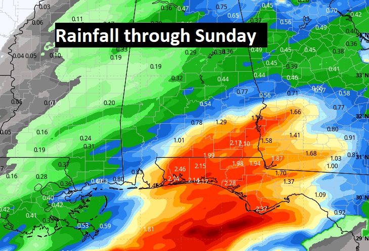
Good Morning! We continue with our wet weekend forecast, but there a few new wrinkles. It appears that the extent of the heaviest rainfall will be displaced southward. Most of the excessive rainfall totals will generally be south of Troy. Much of central Alabama will see rainfall totals under an inch. There could be some thunderstorms, but now the severe weather threat covers mainly south and southeast Alabama. The risk of showers should end early Sunday AM, with improvement later in the day. Most of the week ahead looks dry. We’ll be near the freeze mark by Thursday morning.
TODAY: Periods of Showers and maybe a few thunderstorms today and tonight. Hi 71. SE winds 5-15 gusting to 20 mph. Low tonight 63.
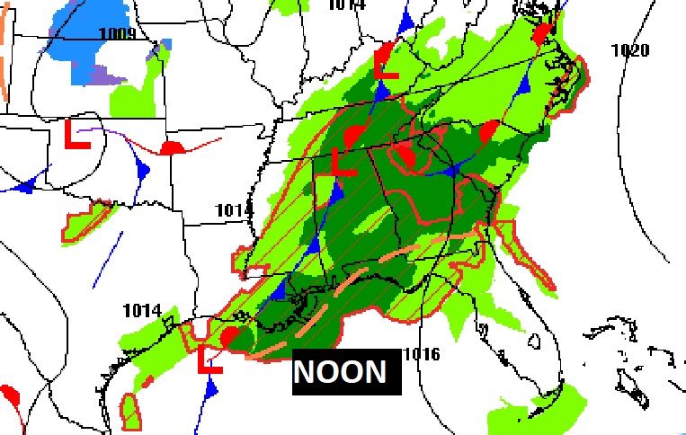
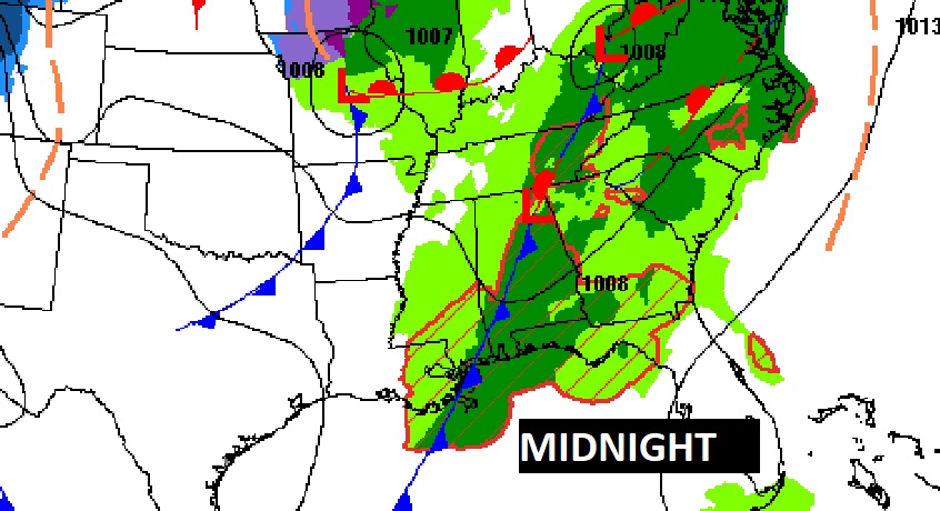
Here’s the set up at Midnight and Noon. Periodic but widespread rain has caused the postponements of numerous events.
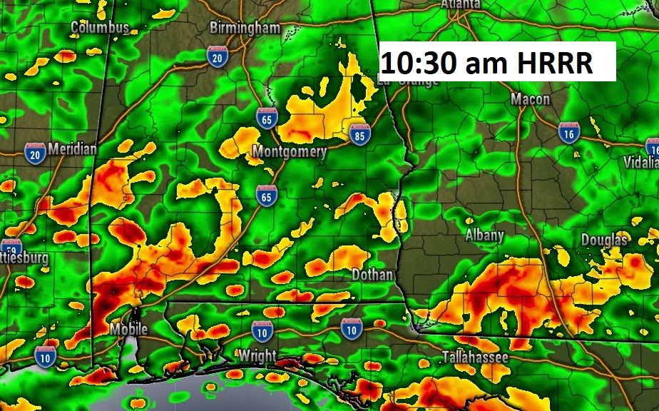
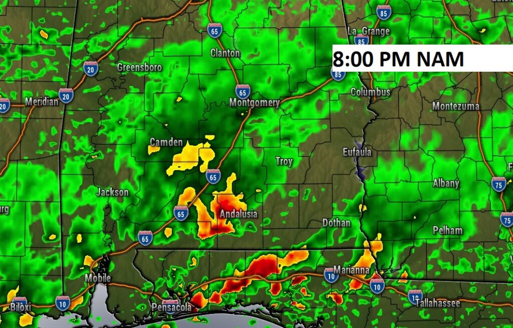
Here’s some Future Radar snapshots. It’s going to be a very wet day across Alabama and surrounding states.
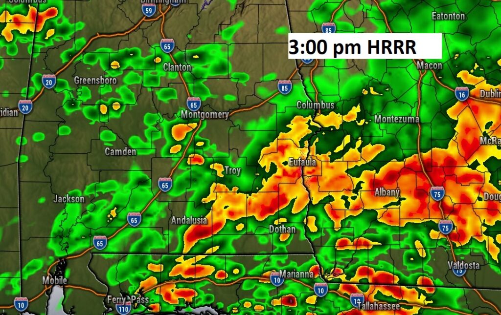
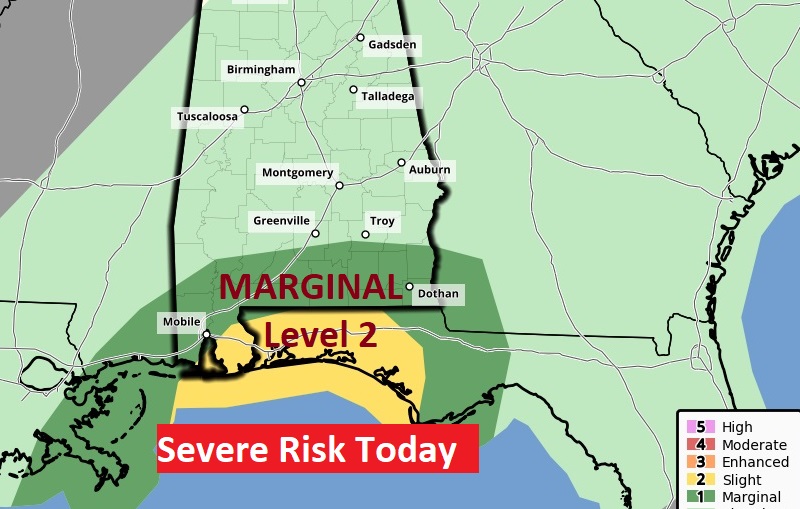
Severe weather risk mostly for southeast Alabama today, generally south of Troy. Damaging wind gusts are the main threat. A brief tornado can’t be ruled out.
It appears that the extent of the heaviest rainfall will be displaced southward. Most of the excessive rainfall totals will generally be south of Troy. Much of central Alabama will see rainfall totals under an inch. Parts of southeast Alabama could see 3”+.
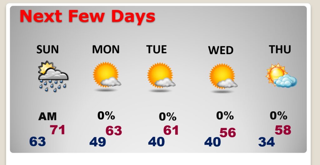
NEXT FEW DAYS: . Some leftover scattered showers are possible early Sunday AM. Expect improvement by afternoon. Monday and most of next week looks dry. A cold front will bring in some chilly air by Wednesday. We’ll be close to a freeze by Thursday AM.
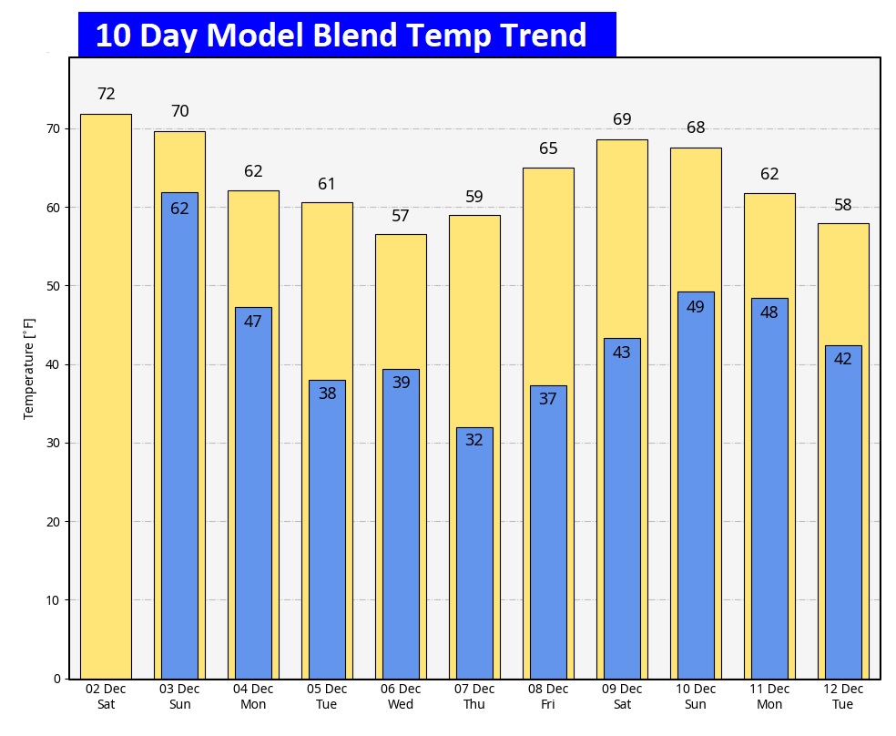
Here’s the 10 day model temp trend. Expect some chilly air by Wednesday. We’ll be close to a freeze by Thursday AM. Otherwise, no red flags in the next 10 days.
Thanks for reading this Blog this morning! The next Blog update will be on Monday morning. Try to have a nice weekend.
–Rich