
Good Morning! There’s lot of good news in this week’s forecast. After a wet and gloomy weekend, brighter days are on the menu. It’s looks like we are storm-free and dry through Friday. Some cooler air is on the way. The 2nd of two cool fronts arrives Tuesday PM. Wednesday will be chilly. We’ll be near the freeze mark on Thursday morning. And, I think we are dry through at least Friday. Will the weather cooperate for rescheduled Christmas events on Saturday? It all depends on timing of the next storm system. Right now we’ll mention the risk of scattered showers. Better rain chance Saturday night. Here’s my brief forecast discussion.
TODAY: Widespread patchy dense morning fog. Otherwise, it’s a good Monday forecast. Mostly sunny. High 65. Southwest wind 5 to 15 mph. Partly cloudy, chilly tonight. Low 39.
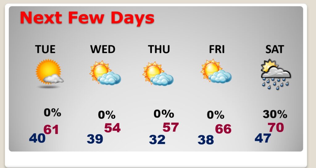
NEXT FEW DAYS: Cooler air flows in by Tuesday evening. Wednesday will be chilly. We’ll be close to a freeze by Thursday AM. We’re dry through Friday at least. What about Saturday? Will it be dry. It all depends on the timing of the next storm system. Right now we’ll mention the risk of scattered showers. Better rain chance Saturday night.
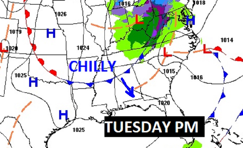
First of two cold fronts arrives today. The second front, with colder air arrives by Tuesday evening.

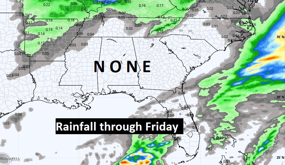
Dry as a bone through Friday.
Here’s the 10 day model temp trend.

Thanks for reading this Blog this morning! This morning we are LIVE on the radio from 6 to 9 on NewsTalk 93.1. I’ll have another update for you in the morning. Have a nice day!
–Rich