
Good Morning! Some cooler air is on the way. The 2nd of two cool fronts arrives this evening. Wednesday will be chilly. We’ll be close to the freeze mark on Thursday morning. And, I think we are dry through at least Friday. Some cooler air is on the way. The next cool front arrives this evening. Wednesday will be breezy & chilly. We’ll be near the freeze mark on Thursday morning. We should stay storm-free and dry through Friday. The next storm system will start to affect the area daytime Saturday. Scattered showers and thunderstorms become likely by Saturday night. Too early to say if this will be a severe weather situation. But, ‘tis the season. Here’s my brief forecast discussion.
TODAY: Abundant sunshine. High 62. West wind 6 to 12 mph. Clear and Chilly tonight. Low 39.
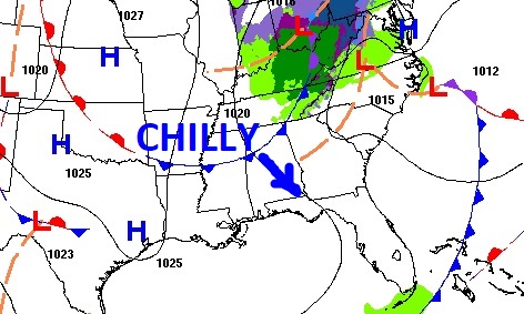
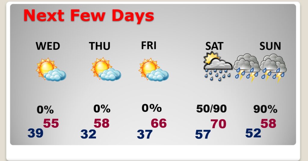
NEXT FEW DAYS: Wednesday will be breezy and chilly. We’ll be close to a freeze by Thursday AM. We’re dry through Friday. Friday is a nice day. High 66. at least. The next storm system will start to affect the area daytime Saturday. Scattered showers and thunderstorms become likely by Saturday night.
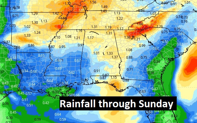
Here’s the expected rainfall through Saturday. Dry as a bone through Friday.
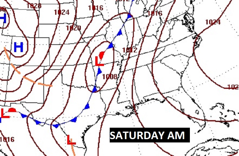
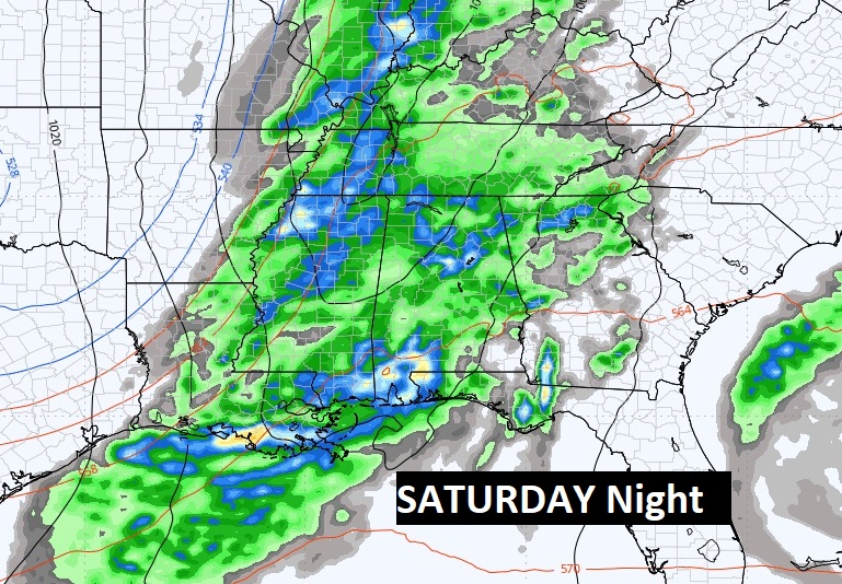
Potent storm system and frontal system brings showers and thunderstorms back to the state Saturday.
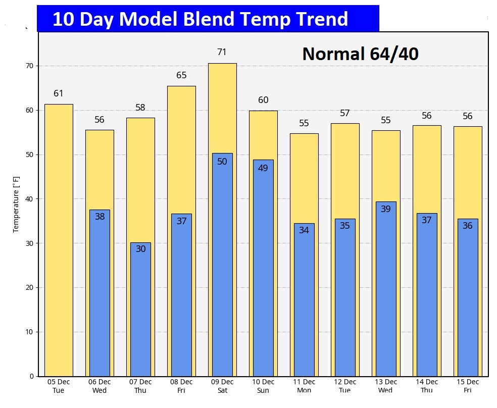
Here’s the 10 day model temp trend. I don’t see anything shocking at this point.
Thanks for reading this Blog this morning! This morning we are LIVE on the radio from 6 to 9 on NewsTalk 93.1. I’ll have another update for you in the morning. Have a nice day!
–Rich