
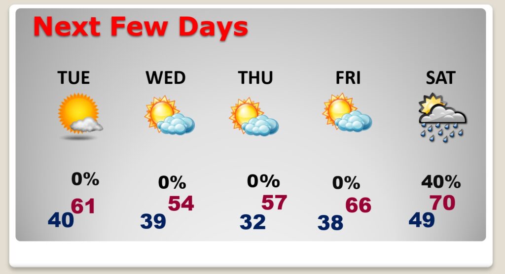
Good Morning! Much cooler air has overspread the area. Today will be rather brisk. Sunshine, but breezy and rather chilly with highs only reaching the mid 50’s. We’ll be close to the freeze mark on by Dawn tomorrow. Temperatures will start to moderate Friday, and still dry. Scattered showers and thunderstorms arrive Saturday afternoon, and become likely by Saturday night. The cool front passes out of the area before lunchtime Sunday, ending the rain threat. Here’s my brief forecast discussion.
TODAY: A brisk day. Cool sunshine. High in the mid 50’s. North wind at 10 to 20 mph. Clear and cold tonight. Low 31.
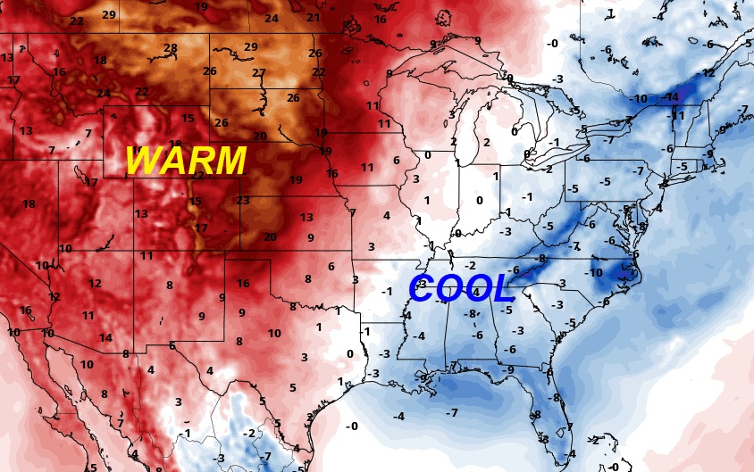
MUCH of the country is WAY above normal except here in the Southeast and the east.
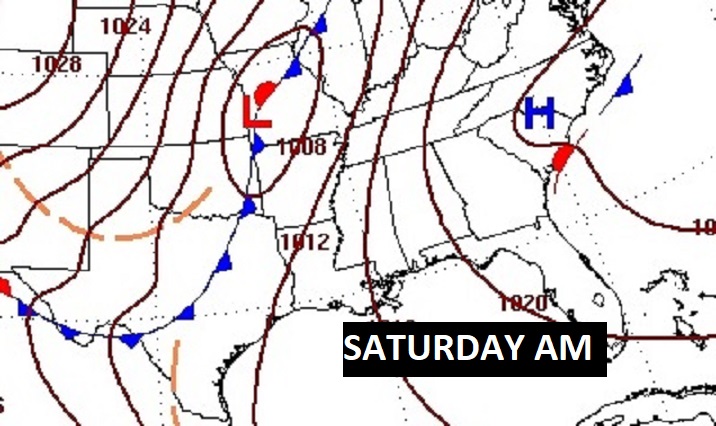
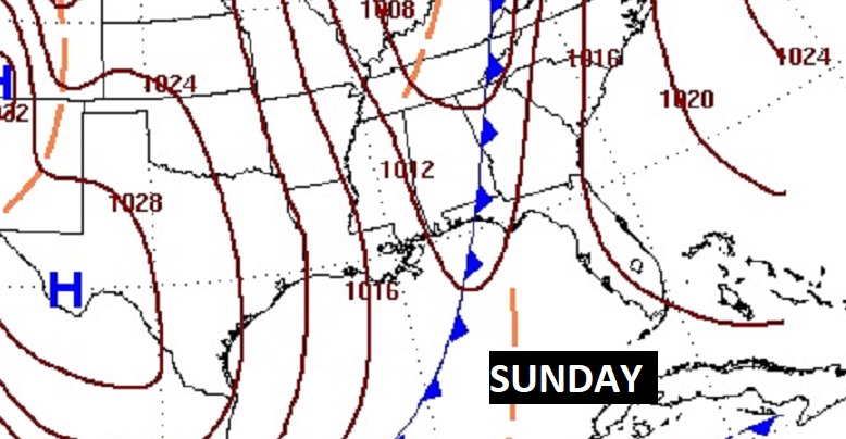
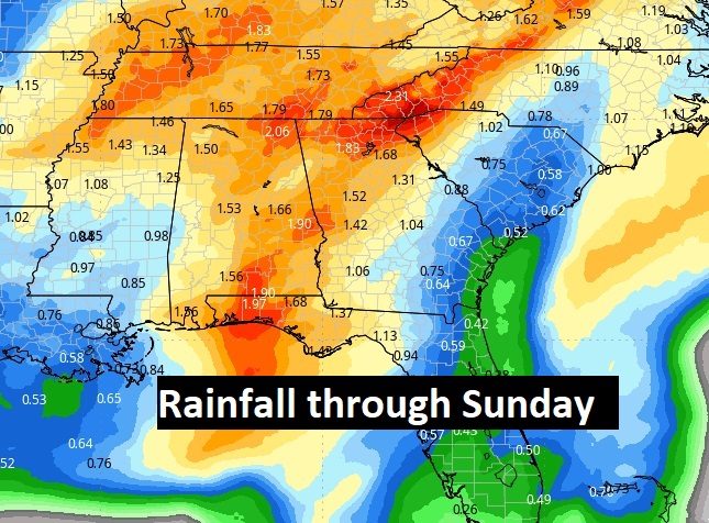
NEXT FEW DAYS: Thursday will be cool & dry. Temperatures will start to moderate Friday, and still dry. Scattered showers and thunderstorms arrive Saturday afternoon, and become likely by Saturday night. The cool front passes out of the area before lunchtime Sunday, ending the rain threat.
Here’s the expected rainfall through Sunday.
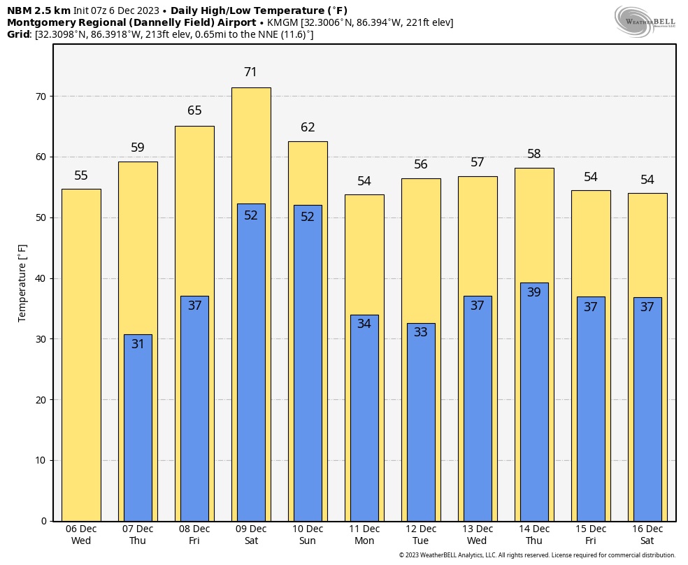
Here’s the 10 day model temp trend. Looks like another cool-down by the middle of next week.
Thanks for reading this Blog this morning! This morning we are LIVE on the radio from 6 to 9 on NewsTalk 93.1. I’ll have another update for you in the morning. Have a nice day!
–Rich