
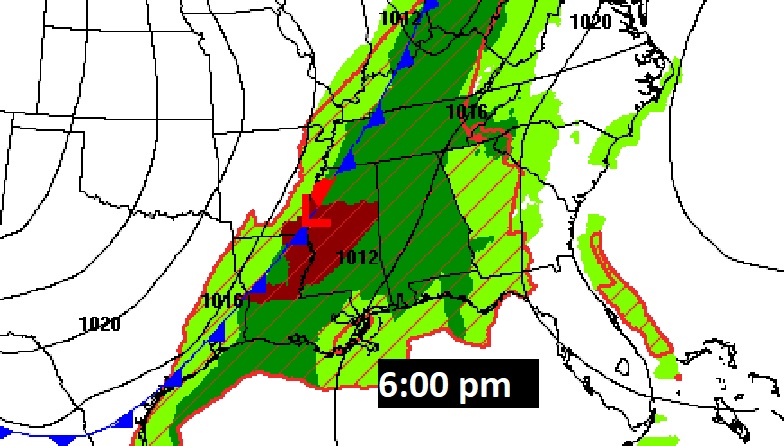
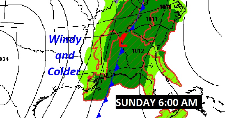
Good Morning! A Cold Front is approaching the state. Early this morning showers are already on the prowl. The risk of scattered showers and thunderstorms will continue today and this evening. But, the main event will be late tonight, in the overnight hours, as a “squall line” of strong storms crosses the state. Some storms could be severe. Most of us are in a Marginal Severe Risk. Behind the main line, the risk of showers will continue until mid to late morning until the frontal passage. The rest of Sunday will be windy and colder with falling temperatures. Expect a freeze Sunday night. Monday will be a raw, brisk day. Could be a total of three freezing mornings. But, next week looks primarily storm-free and dry. Here’s the progress of the fronts this evening and again Sunday morning.
TODAY: Mostly cloudy and mild for December. High 75. Random scattered showers and thunderstorms will be around from time to time. South winds 6 to 12.
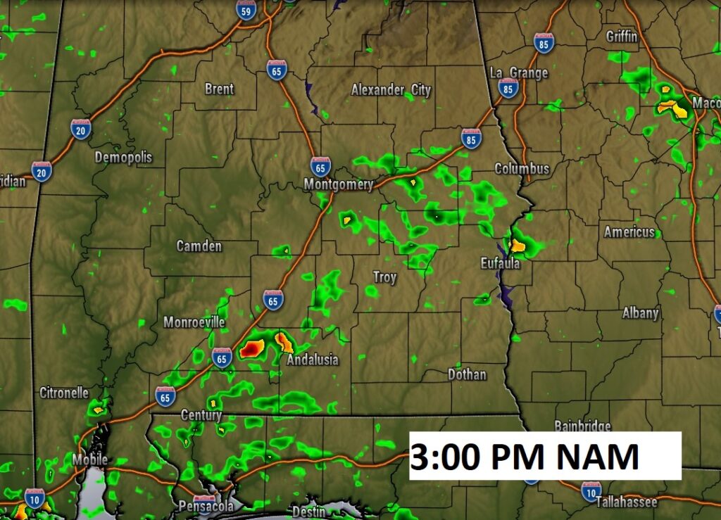
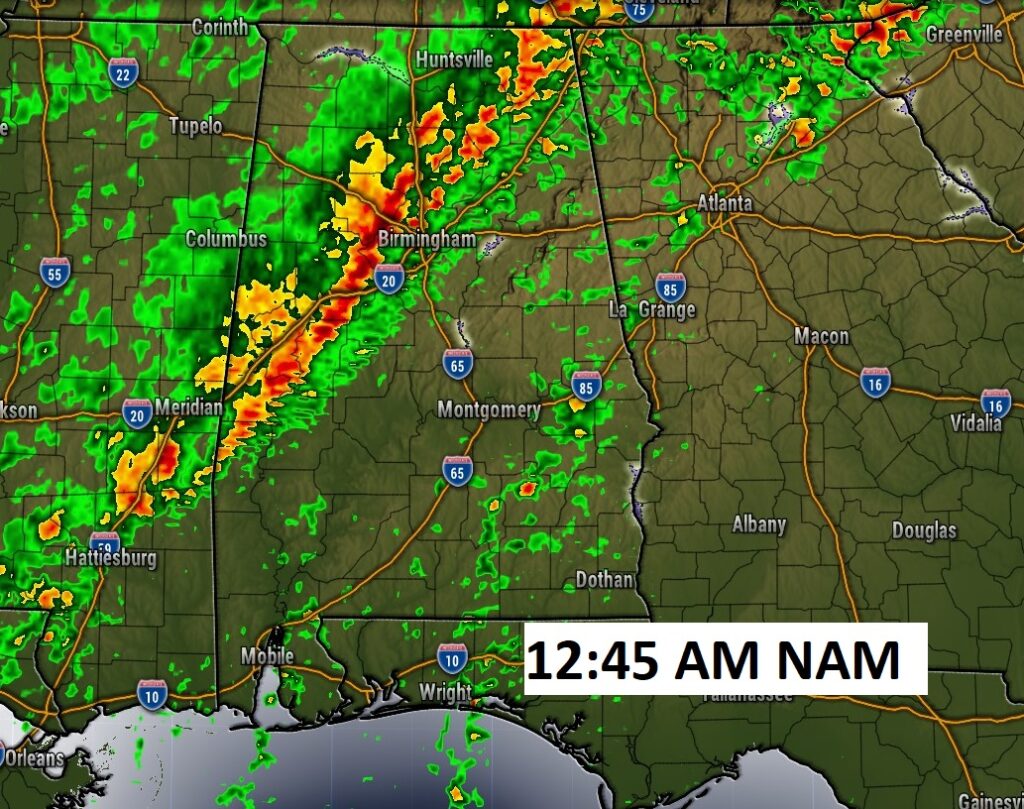
Here’s a Future radar snapshot at mid-afternoon.
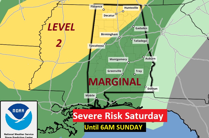
TONIGHT: Showers and storms are still possible in the evening. But, the main event will be late tonight, in the overnight hours, as a “squall line” of strong storms crosses the state. Some storms could be severe. Most of us are in a Marginal Severe Risk.
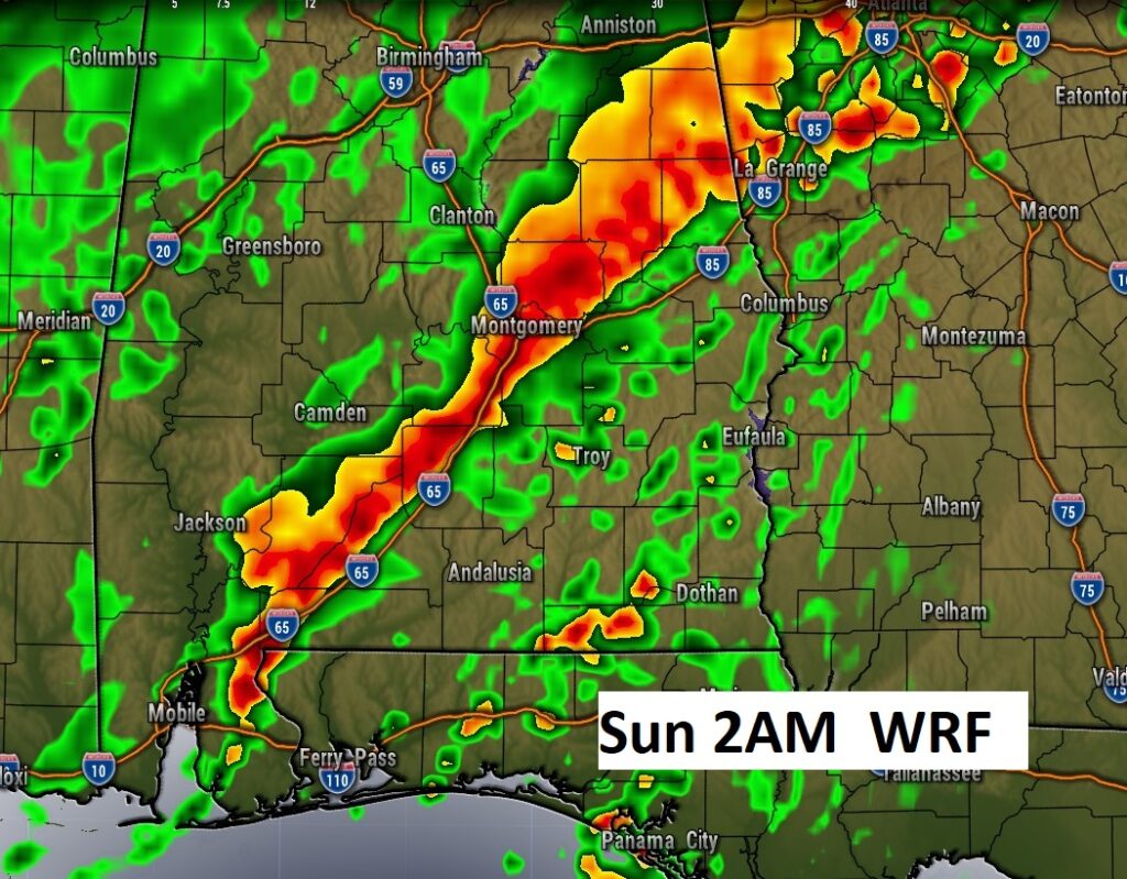
Here’s some Future Radar snapshots in the overnight hours.
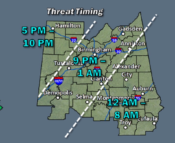
This map will give you a general idea on potential severe weather timing.
SUNDAY: But, the main event will be late tonight, in the overnight hours, as a “squall line” of strong storms crosses the state. Some storms could be severe. Most of us are in a Marginal Severe Risk. Behind the main line, the risk of showers will continue until mid to late morning until the frontal passage. The rest of Sunday will be windy and colder with falling temperatures. Temps in the low to mid 60’s morning falling to the upper 40’s by late afternoon. Strong NW winds at 15 to 25 mph.
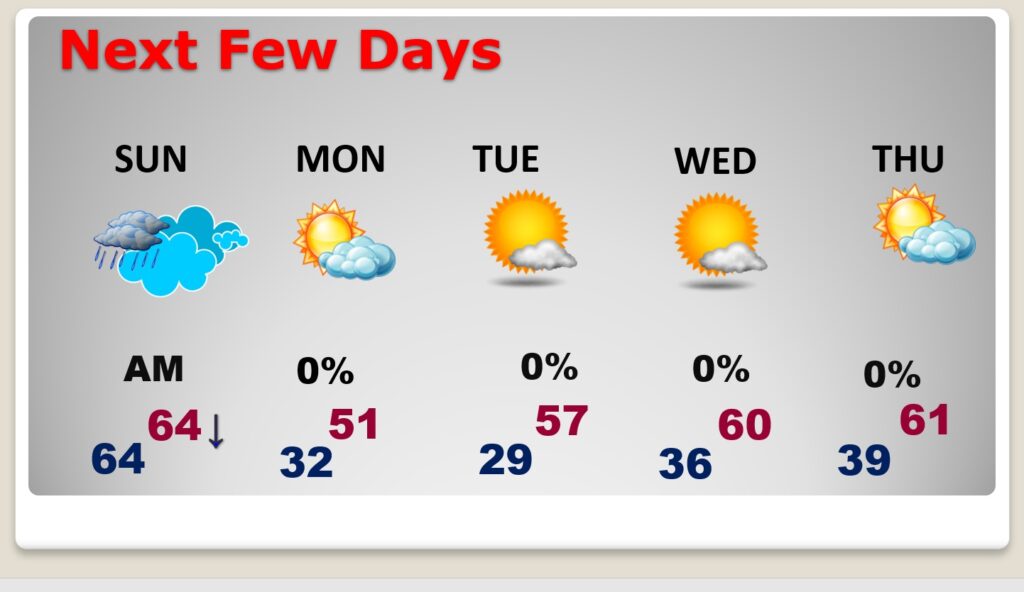
NEXT FEW DAYS: Monday will be a raw, brisk day. Could be a total of three freezing mornings. But, next week looks primarily storm-free and dry.
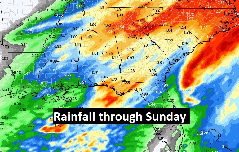
Here’s the expected rainfall through Sunday. Locally heavy rainfall in spots.
Here’s a look at the 10 day model temperature blend.

Thanks for reading this Blog this morning! I’ll have severe weather updates overnight as needed.
–Rich