
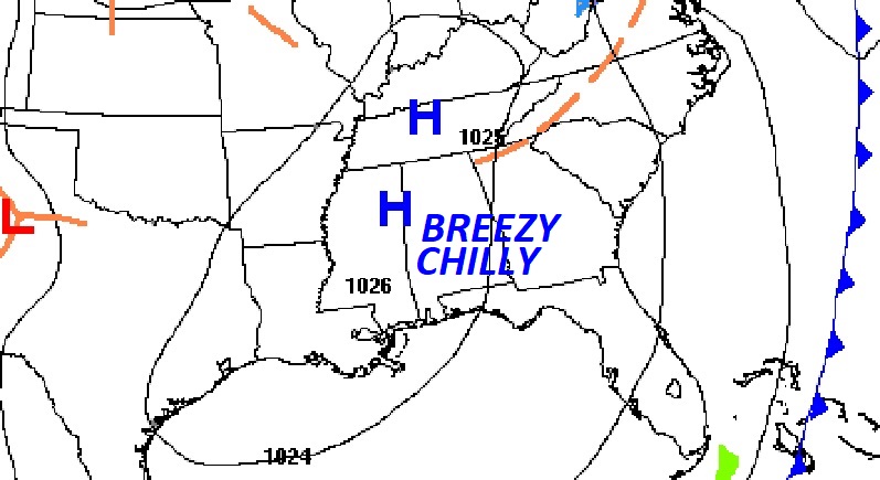
Good Morning! Colder air is in place, following the weekend storm system that brought up to three dozen tornadoes to the South. Here in Alabama it looks like there may be a total of 6 tornado tracks in Alabama including two in Jefferson county. (looks like two EF-1s in Jefferson) On a cold Monday morning, we have a very chilly on tap. We’ll be near or below freezing tonight and Tuesday night. But, the week ahead looks quiet. We’ll be dry through Friday. A Gulf storm system will brush by the area Friday night/Saturday, which will bring a risk of showers in our forecast, but noting severe. Here’s my brief forecast discussion.
TODAY: Sunshine, breezy and cold. High 52. North wind 11 to 16 mph. Clear and cold tonight. Low near 30.
High pressure is in control. Sunshine is back.
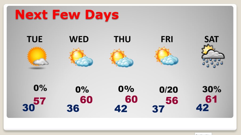
NEXT FEW DAYS: Expect a couple of near or below freezing mornings Tuesday and Wednesday. Below normal are in the cards for the week ahead. Sunshine will dominate Tuesday through Friday. But, the week ahead looks quiet. We’ll be dry through Friday. A Gulf storm system will brush by the area Friday night/Saturday, which will bring a risk of showers in our forecast.
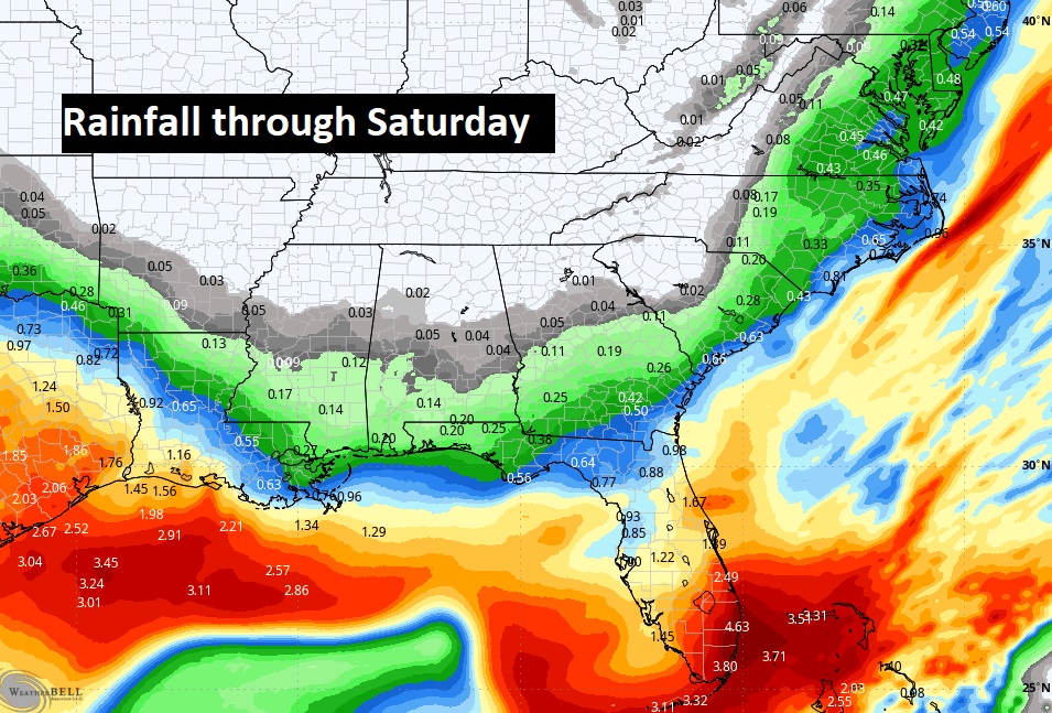
Most of the rain associated with that weekend Gulf Storm System will stay south.

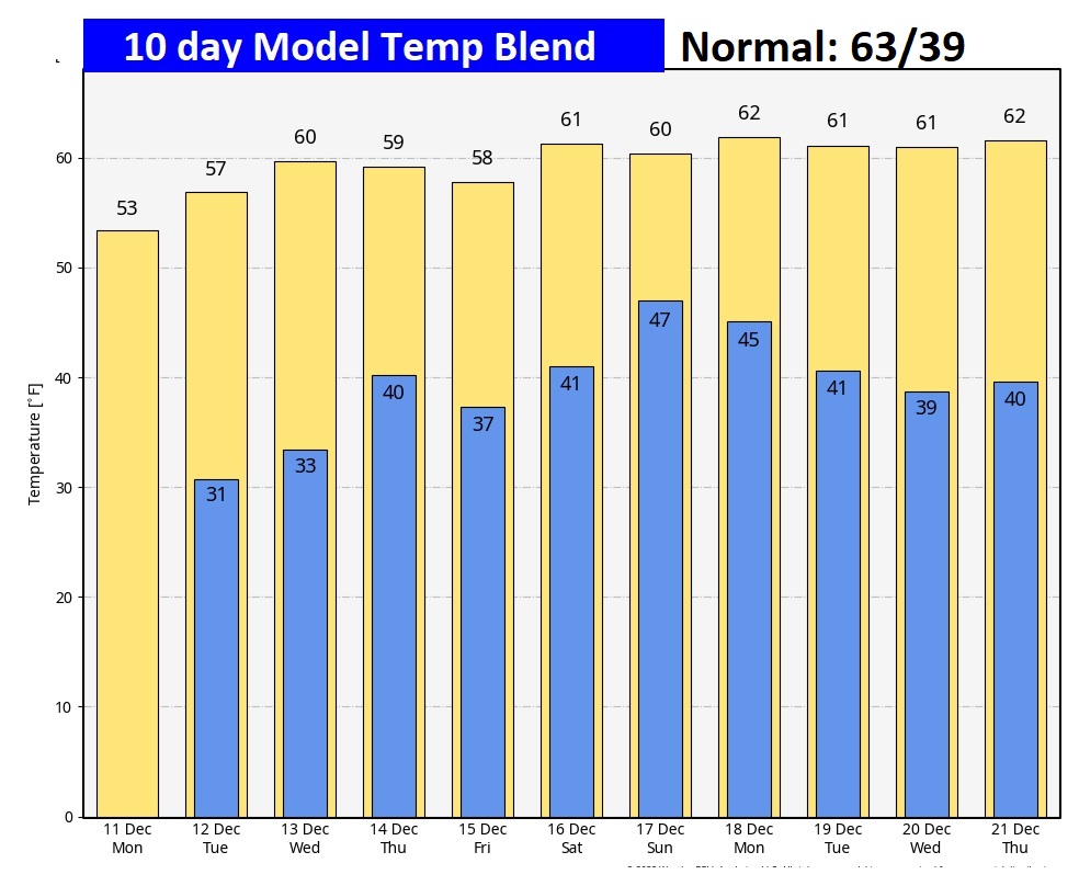
Here’s the 10 Day Model Temp Blend. Temperatures will generally be below normal this week. I don’t see any Arctic air in this forecast that takes us up to December 21st.
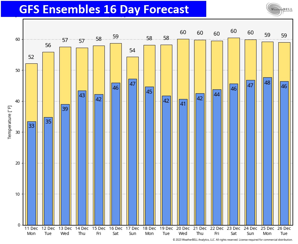
Gosh, I hesitate to show you this GFS 16 Day Ensemble model outlook, because it could radically change, down the road. But here’s the current outlook through Christmas.
Thanks for reading this Blog this morning! This morning we are LIVE on the radio from 6 to 9 on NewsTalk 93.1. I’ll have another update for you in the morning. Have a nice day!
–Rich